Norumbega Conservation Trail
Distance:
1.5 Miles / 2.4 kmType:
LoopDifficulty:
EasyTime to Hike:
~45 minutesFeatures:
Surface Type:
Semi-PavedLoading...
Loading...
The Norumbega Conservation Trail at Norumbega Park or Norumbega Conservation Area in Newton, Massachusetts is an easy 1.5-mile trail that passes through the entire park and features a relaxing view along the Charles River.
The trail is accessible from Woodbine St right off Commonwealth Avenue. The park is made up of just over 13 acres of woods and fields along the Charles River. There are several well maintained trails around the park including some older paved trails.
The park features beautiful views of the Charles River, woodland, fields and trails. There are several park benches around the place to sit. Trails are easily walked or biked!
Pets: This is a dog friendly park. Dogs must be leashed and their waste carried out.
Biking: Biking is allowed.
-
Parking
42.34743, -71.255868 -
Main Trailhead
42.34743, -71.255868 -
Old Stairway through the woods
42.347432, -71.256799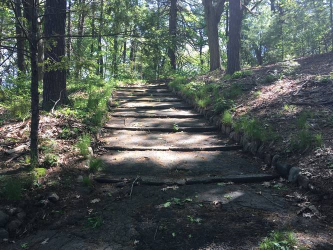
-
Charles River
42.349209, -71.258339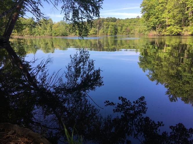
-
Woodbine St Entrance
42.347331, -71.255746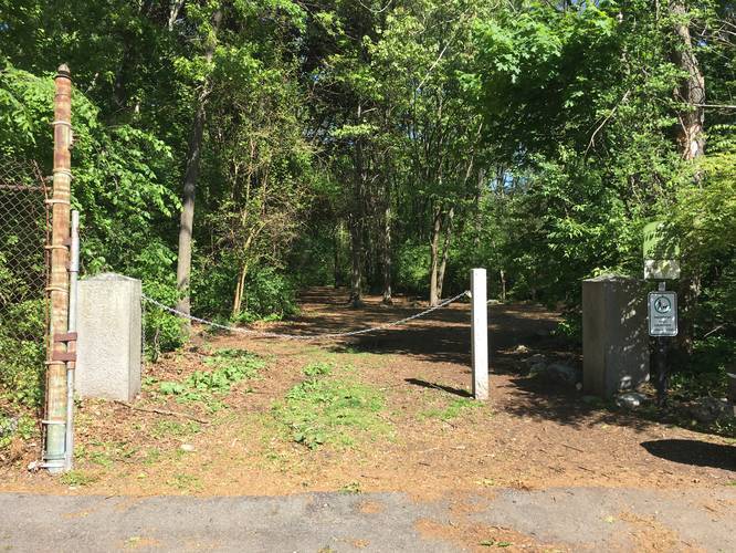
Hazards
Seasons
All
1 Trip Report


Helpful Links
Find Hiking Trails Near Me:


Before you leave...
MyHikes is an indie web platform aimed to make exploring public trails easier for everyone. The site has no investors and is owned and operated by one person, Dave Miller (Founder & Admin). As the Founder, main contributor, and doer-of-all-things for MyHikes, I share my trips with over-detailed write-ups for fun on a volunteer basis and I believe that public trail information should be available to everyone.
It takes a lot of time 🕦, money 💰, and effort (including espresso shots ☕) to run MyHikes, including hiking , mapping , writing , and publishing new trails with high-quality content... along with building new features, moderating, site maintainance, and app development for iOS and Android . I simply ask that if you find MyHikes' trail guides helpful to please consider becoming a Supporter to help keep the site, iOS, and Android apps available to everyone.
Supporters unlock website and in-app perks with a one-time payment of $25 (you renew) 😎👍. Or you can simply make a Donation of your choice without a MyHikes user account. Otherwise, telling your friends about MyHikes is the next-best thing - both quick and free 🎉
Thanks for visiting MyHikes and have a great hike!️

Dave Miller
MyHikes Founder & Admin

