Noanet Peak
Distance:
4.1 Miles / 6.6 kmType:
Out-and-BackDifficulty:
ModerateTime to Hike:
2 hours, ~5 minutesFeatures:
Surface Type:
DirtLoading...
Loading...
This 4.1 mile out-and-back/loop combo hike out to Noanet Peak in the Noanet Woodlands outside of Boston, Massachusetts is a great way to see the city skyline from the middle of the woods. This hike brings you to the old mill site in the Noanet Woodlands and circles two ponds that feed the stream that the mill sat on. After circling the ponds, the trail shoots up to Noanet Peak where you get a skyline view of Boston. If you skip the ponds, it's about 1.5 miles to get to Noanet Peak.
Fishing in the ponds is allowed by permit-only and Noanet Woodlands has about 17 miles of trails in total. The trails are not well marked, but there are signs to navigate to the old mill site and peak.
-
Parking
42.247822, -71.269177 -
Main Trailhead
42.24793, -71.269169 -
View of Boston from Noanet Peak
42.23533, -71.26563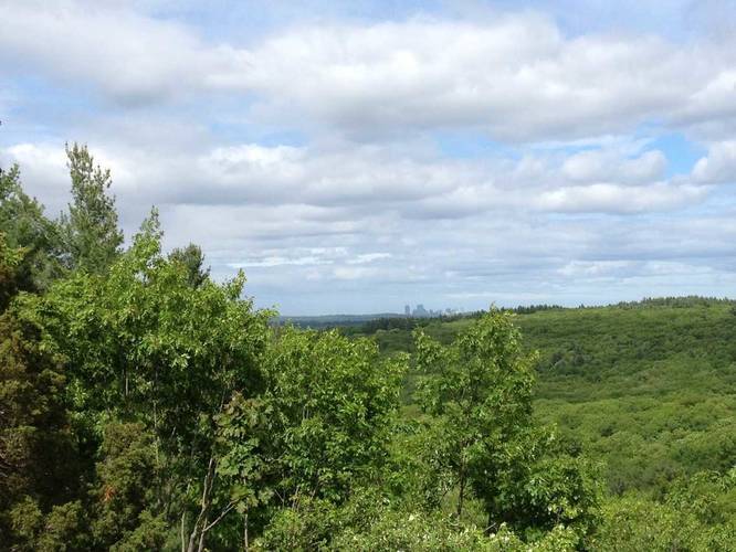
Hazards
Seasons
All
2 Trip Reports


Helpful Links
Find Hiking Trails Near Me:


Before you leave...
MyHikes is an indie web platform aimed to make exploring public trails easier for everyone. The site has no investors and is owned and operated by one person, Dave Miller (Founder & Admin). As the Founder, main contributor, and doer-of-all-things for MyHikes, I share my trips with over-detailed write-ups for fun on a volunteer basis and I believe that public trail information should be available to everyone.
It takes a lot of time 🕦, money 💰, and effort (including espresso shots ☕) to run MyHikes, including hiking , mapping , writing , and publishing new trails with high-quality content... along with building new features, moderating, site maintainance, and app development for iOS and Android . I simply ask that if you find MyHikes' trail guides helpful to please consider becoming a Supporter to help keep the site, iOS, and Android apps available to everyone.
Supporters unlock website and in-app perks with a one-time payment of $25 (you renew) 😎👍. Or you can simply make a Donation of your choice without a MyHikes user account. Otherwise, telling your friends about MyHikes is the next-best thing - both quick and free 🎉
Thanks for visiting MyHikes and have a great hike!️

Dave Miller
MyHikes Founder & Admin

