Loading...

Distance:
2.7 Miles / 4.3 km
Type:
Out-and-Back
Difficulty:
Moderate
Time to Hike:
1 hour, ~21 minutes
Features:
Surface Type:
Dirt
Park:
Mount Holyoke Range State Park
Town:
Amherst, Massachusetts
Directions:
42.305059, -72.528429
Added:
July 17, 2017
Updated:
April 02, 2019
Loading...
Loading...
488 '

Total Change
928 '

Ascent
1,015 '

Descent

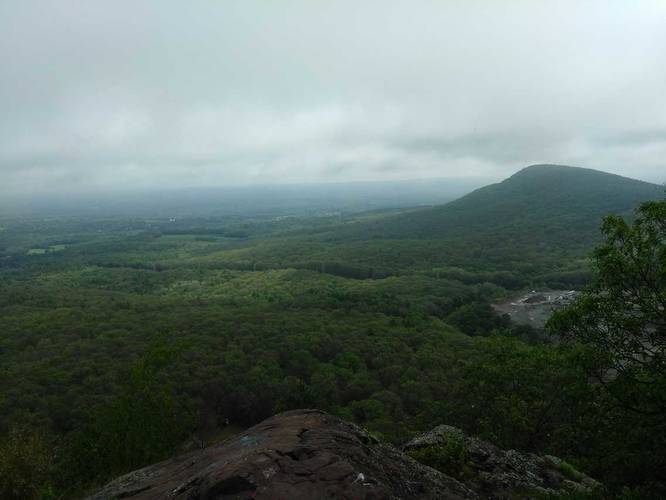
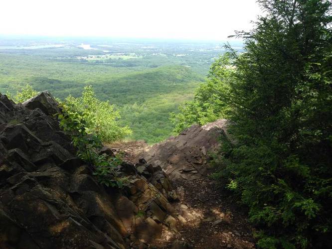
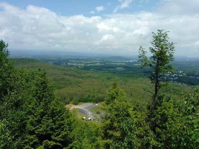
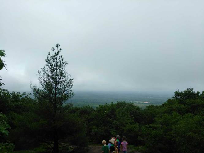
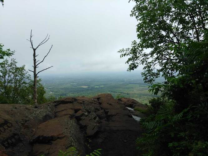
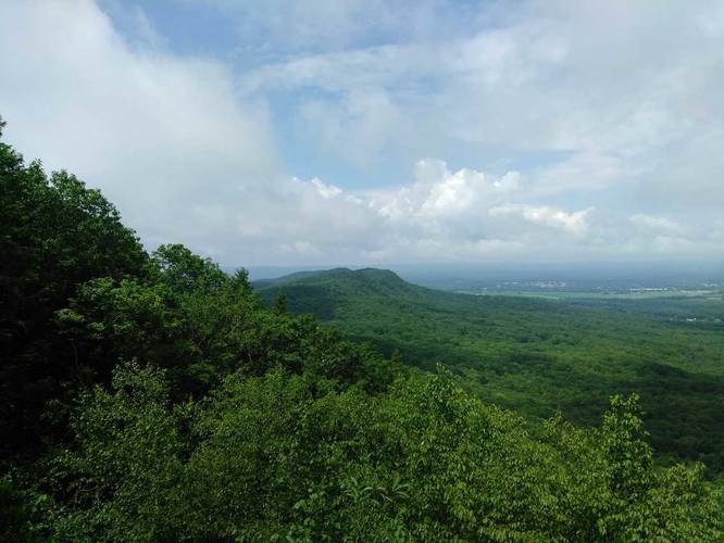
The Mount Hitchcock Trail on the Holyoke Range near Amherst Massachusetts, is a moderate to difficult 2.7 mile out-and-back hike from the Notch Visitor Center up to Mount Hitchcock and back.

Park at the Notch Visitors Center. Follow the M & M trail across the street and up Bare Mountain, there are several lookouts on the way up and at the top. From there continue on down the backside of Bare Mountain.

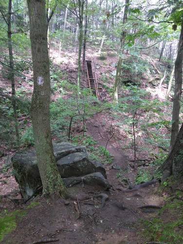
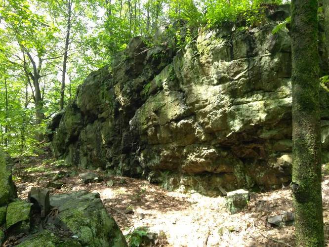
The trail is very up and down. There is a small section with a staircase that has a sign that the trail is closed but it is only for the staircase and appears to be outdated. 

Explore 206 trails near Amherst, MA
  1. Parking

    42.305059, -72.528429
  2. Main Trailhead

    42.305401, -72.528664
  3. Vista point

    42.303679, -72.531137
    Vista point
  4. Just before steep stair climb

    42.304396, -72.538963
    Just before steep stair climb
  5. Vista point

    42.305711, -72.545776
    Vista point
  6. Vista point

    42.30416, -72.533253
    Vista point
  7. Vista point

    42.303446, -72.53141
    Vista point
  8. Vista point

    42.303441, -72.531427
    Vista point
  9. Large rock outcropping

    42.305548, -72.545099
    Large rock outcropping
  10. Vista point

    42.305754, -72.545824
    Vista point
Explore other routes for this Trail guide, added by the MyHikes' community via Trip Reports. To add your own hike as a Community Route for this Trail guide, leave a Trip Report with an attached GPX file.

Hazards

Ticks - Lyme Disease More Info (CDC)

Season

Spring

Photo Albums

3 Trip Reports

No Star-Ratings
Write-up by:
Tocra user profile picture
2.7 miles / 4.3 km
Trail added
July 17, 2017
Hiked on
July 17, 2017
Updated on
April 02, 2019
3.0 miles / 4.8 km
July 16, 2020
2.7 miles / 4.3 km
December 04, 2018
Hiking

Weather Forecast

In Amherst, MA

Explore Hiking Trails

New Hikes

Bates Ferry Trail and General Greene Tree
2.7 Miles
4.3 km
Easy
Out-and-Back
Upper Rattler Run Falls
1.9 Miles
3.1 km
Hard
Out-and-Back
Sandford Lake Trail
1.3 Miles
2.1 km
Easy
Out-and-Back
Larry's Creek Trail
3.6 Miles
5.8 km
Moderate
Out-and-Back

Before you leave...

MyHikes is an indie web platform aimed to make exploring public trails easier for everyone. The site has no investors and is owned and operated by one person, Dave Miller (Founder & Admin). As the Founder, main contributor, and doer-of-all-things for MyHikes, I share my trips with over-detailed write-ups for fun on a volunteer basis and I believe that public trail information should be available to everyone.

It takes a lot of time 🕦, money 💰, and effort (including espresso shots ☕) to run MyHikes, including hiking , mapping , writing , and publishing new trails with high-quality content... along with building new features, moderating, site maintainance, and app development for iOS and Android . I simply ask that if you find MyHikes' trail guides helpful to please consider becoming a Supporter to help keep the site, iOS, and Android apps available to everyone.

Supporters unlock website and in-app perks with a one-time payment of $25 (you renew) 😎👍. Or you can simply make a Donation of your choice without a MyHikes user account. Otherwise, telling your friends about MyHikes is the next-best thing - both quick and free 🎉

Thanks for visiting MyHikes and have a great hike!️

Admin user profile picture

Dave Miller
MyHikes Founder & Admin