Mount Saint Helena
Distance:
10.3 Miles / 16.6 kmType:
Out-and-BackDifficulty:
ModerateTime to Hike:
5 hours, ~9 minutesFeatures:
Surface Type:
DirtLoading...
Loading...
This is a hike to the highest peak (4339 ft) in Sonoma County, though it’s only about 1500 ft or so away from the Napa County line. This trail follows a gently graded fire road, so in cool weather it’s fairly easy despite the distance. The hike is 10.2 miles roundtrip, with an elevation gain for around 2300 ft. Parking is free on the side of the road.
For more details and directions, check out the Norcalhiker blog post for this trip.
Hazards
Season
Summer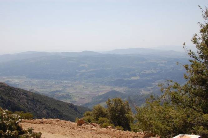
1 Trip Report


Helpful Links
Find Hiking Trails Near Me:


Before you leave...
MyHikes is an indie web platform aimed to make exploring public trails easier for everyone. The site has no investors and is owned and operated by one person, Dave Miller (Founder & Admin). As the Founder, main contributor, and doer-of-all-things for MyHikes, I share my trips with over-detailed write-ups for fun on a volunteer basis and I believe that public trail information should be available to everyone.
It takes a lot of time 🕦, money 💰, and effort (including espresso shots ☕) to run MyHikes, including hiking , mapping , writing , and publishing new trails with high-quality content... along with building new features, moderating, site maintainance, and app development for iOS and Android . I simply ask that if you find MyHikes' trail guides helpful to please consider becoming a Supporter to help keep the site, iOS, and Android apps available to everyone.
Supporters unlock website and in-app perks with a one-time payment of $25 (you renew) 😎👍. Or you can simply make a Donation of your choice without a MyHikes user account. Otherwise, telling your friends about MyHikes is the next-best thing - both quick and free 🎉
Thanks for visiting MyHikes and have a great hike!️

Dave Miller
MyHikes Founder & Admin

