Mount Holyoke
Distance:
2.0 Miles / 3.2 kmType:
Out-and-BackDifficulty:
ModerateTime to Hike:
1 hourFeatures:
Surface Type:
DirtLoading...
Loading...
This hike leads from Hockanum Rd, up Taylor's Notch Trail and merges onto the Metacomet-Monadnock Trail before reaching the summit of Mount Holyoke.
The hike is moderate and is 2 miles out-and-back. This is one of the tallest mountains in the valley, but is mostly a moderate hike with about 750 feet of elevation change.
Biking and dogs are allowed, but plan to bring plenty of water as there aren't many water sources while climbing this mountain, unless in the early spring.
Hazards
Season
Spring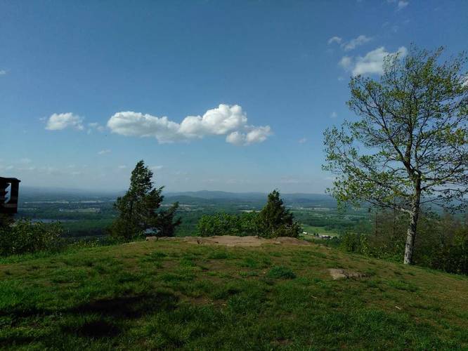
3 Trip Reports


Helpful Links
Find Hiking Trails Near Me:


Before you leave...
MyHikes is an indie web platform aimed to make exploring public trails easier for everyone. The site has no investors and is owned and operated by one person, Dave Miller (Founder & Admin). As the Founder, main contributor, and doer-of-all-things for MyHikes, I share my trips with over-detailed write-ups for fun on a volunteer basis and I believe that public trail information should be available to everyone.
It takes a lot of time 🕦, money 💰, and effort (including espresso shots ☕) to run MyHikes, including hiking , mapping , writing , and publishing new trails with high-quality content... along with building new features, moderating, site maintainance, and app development for iOS and Android . I simply ask that if you find MyHikes' trail guides helpful to please consider becoming a Supporter to help keep the site, iOS, and Android apps available to everyone.
Supporters unlock website and in-app perks with a one-time payment of $25 (you renew) 😎👍. Or you can simply make a Donation of your choice without a MyHikes user account. Otherwise, telling your friends about MyHikes is the next-best thing - both quick and free 🎉
Thanks for visiting MyHikes and have a great hike!️

Dave Miller
MyHikes Founder & Admin

