Slacker Trail
Distance:
0.6 Miles / 1.0 kmType:
One-WayDifficulty:
ModerateTime to Hike:
~18 minutesFeatures:
Surface Type:
DirtLoading...
Loading...
The Slacker Trail at the Marin Headlands in the Golden Gate National Recreation Area in Sausalito, California is a moderate 0.6 mile one-way trail that leads from the parking lot at the intersection of McCullough Road and Conzelman Road and leads over to the SCA Trail.
This trail starts off from the parking lot by crossing McCullough Road and quickly shoots uphill at a fairly steep grade. Despite this trail being moderate, the toughest part of the hike is the initial climb up to the ridge. Once you hit the top of the ridge, you'll find the trailhead for the Slacker Ridge Trail, which leads up to Slacker Hill with views of the bay area and San Francisco. Make sure to hit up the Slacker Ridge Trail before continuing along this one.
After hitting Slacker Hill, or if you plan to skip it, the trail flattens out before heading downhill toward the SCA Trail, but the grade isn't as steep as the initial climb from McCullough Road.
Coastal Trail: This is technically part of the Coastal Trail at Marin Headlands. To continue following the Coastal Trail from here, check out the SCA Trail, and the Julian Trail.
Hazards
Seasons
All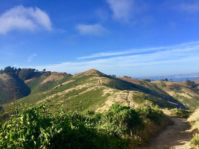
1 Trip Report


Helpful Links
Find Hiking Trails Near Me:


")

Before you leave...
MyHikes is an indie web platform aimed to make exploring public trails easier for everyone. The site has no investors and is owned and operated by one person, Dave Miller (Founder & Admin). As the Founder, main contributor, and doer-of-all-things for MyHikes, I share my trips with over-detailed write-ups for fun on a volunteer basis and I believe that public trail information should be available to everyone.
It takes a lot of time 🕦, money 💰, and effort (including espresso shots ☕) to run MyHikes, including hiking , mapping , writing , and publishing new trails with high-quality content... along with building new features, moderating, site maintainance, and app development for iOS and Android . I simply ask that if you find MyHikes' trail guides helpful to please consider becoming a Supporter to help keep the site, iOS, and Android apps available to everyone.
Supporters unlock website and in-app perks with a one-time payment of $25 (you renew) 😎👍. Or you can simply make a Donation of your choice without a MyHikes user account. Otherwise, telling your friends about MyHikes is the next-best thing - both quick and free 🎉
Thanks for visiting MyHikes and have a great hike!️

Dave Miller
MyHikes Founder & Admin

