Lyman Run Trail
Distance:
5.2 Miles / 8.4 kmType:
Out-and-BackDifficulty:
EasyTime to Hike:
2 hours, ~36 minutesFeatures:
Surface Type:
DirtLoading...
Loading...
The Lyman Run Trail at Lyman Run State Park in Galeton, Pennsylvania is an easy 5.2-mile out-and-back trail that features beautiful views of Lyman Run Reservoir and spans the entire length of the park.
This trail has three main sections and can be picked up from two main parking lots. This hike description follows the trail from east to west and follows yellow blazes.
The trail begins near the eastern-most parking lot at Lyman Run State Park and follows Rock Run for about 0.1-miles before the trail crosses Rock Run and follows Lyman Run for about a quarter mile. The first 0.3-miles of this trail runs through a beautiful coniferous forest before it meanders away from Lyman Run and heads through a mixed forest of pines and deciduous trees.
Shortly after hiking away from Lyman Run, the trail will take a 90-degree left-hand turn and head directly toward Lyman Run. The trail seemingly ends at the creek, but this is where hikers are supposed to wade through the creek to cross to the other side. The water is always running - unless there's a drought - so plan to wear waterproof boots, or plan to get your feet wet. The water depth is about 1-foot deep at this section of the creek and there are no rocks hikers can use to cross the creek easier.
Further on, beyond the creek crossing (continuing to hike west), the trail meanders along a deciduous forest among ferns before the trail reaches the ATV/Snowmobile Trail. Hike along the ATV trail, crossing the bridge, and then take a left-hand turn to continue following the yellow blazes.
Not far after the ATV bridge crossing, the trail will reach the flood basin behind the Lyman Run Reservoir dike - which gives the hiker an interesting view of the surrounding mountains, reservoir dike, and the human-made waterfall of water cascading down from the reservoir. The trail technically heads uphill, heading east, and then follows the road over to the reservoir dike (as shown in the trail map); however, hikers can choose to skip this portion and cross the wooden bridge over Lyman Run to head up the backside of the dike.
Regardless of how you hike over to the dike, views from the Lyman Run Reservoir dike are the best views this trail has to offer, but the hike is still not over as the trail continues at the very end of the dike, to the south.
Hike to the very southern end of the dike and look for a skinny trail that leads up the brush and into the woods. This is where the trail becomes a bit more boring as you hike through a thick forest along a trail littered with rocks and roots. The trail continues for about 1.5 to 2-miles one-way, from the dike, and eventually reaches the Susquehannock Trail System (STS).
This trail data does not reach the Susquehannock Trail System(STS) as we turned back after 1.4-miles in from the dike; however, hiking this far will bring hikers 5.2-miles out-and-back to this point. If you plan to hike all the way to the STS, plan for a 6 to 7 mile out-and-back hike.
Parking: If you plan to hike this trail in full, including the Lyman Run creek crossing, you should park at the parking coordinates provided. If you plan to hike just the reservoir and west, heading into the woods, or heading east into the woods, you can park here: 41.725311, -77.761036 - this is the main parking lot for the park, near the dike.
Pets: Dogs are allowed if leashed and their waste must be carried out by the hiker.
Hunters: Hunting is allowed near this trail, at Lyman Run State Park. Please be aware and wear blaze orange during hunting season.
Creek crossing: Please note that this trail has one creek crossing where no bridge is provided for hikers. This creek crossing can be found 0.4 to 0.5-miles in from the eastern parking lot. If you do not plan to hike this trail in its entirety, park at the main parking lot and skip the eastern-most section of this trail.
-
Parking
41.716683, -77.747191 -
Main Trailhead
41.71708, -77.747634 -
Creek crossing - the trail continues to the left of these boulders about 15 feet down the stream
41.720786, -77.751044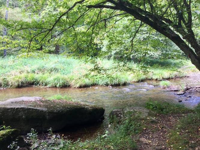
-
western side of Lyman Run creek crossing
41.720611, -77.751389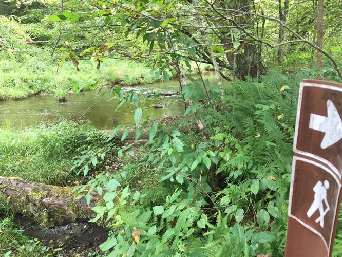
-
View of Lyman Run Reservoir and man-made waterfall
41.724394, -77.760567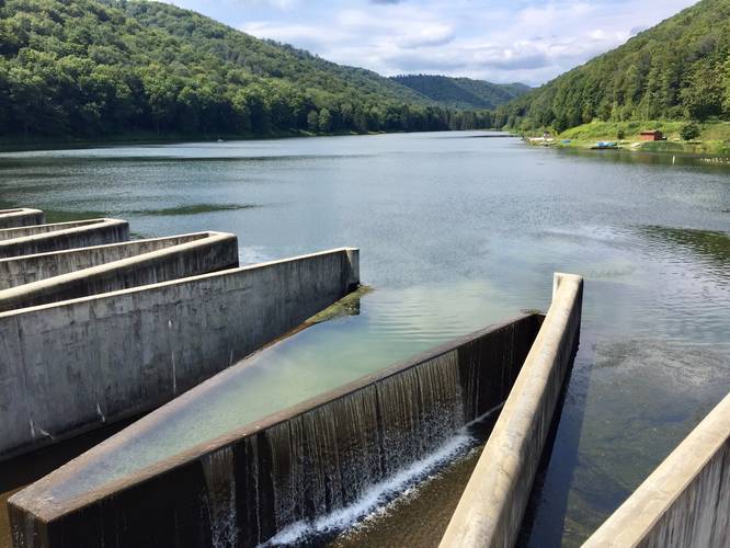
-
Western Lyman Run view
41.721019, -77.775178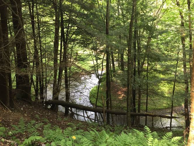
Hazards
Seasons
AllBlaze Color
2 Trip Reports


Before you leave...
MyHikes is an indie web platform aimed to make exploring public trails easier for everyone. The site has no investors and is owned and operated by one person, Dave Miller (Founder & Admin). As the Founder, main contributor, and doer-of-all-things for MyHikes, I share my trips with over-detailed write-ups for fun on a volunteer basis and I believe that public trail information should be available to everyone.
It takes a lot of time 🕦, money 💰, and effort (including espresso shots ☕) to run MyHikes, including hiking , mapping , writing , and publishing new trails with high-quality content... along with building new features, moderating, site maintainance, and app development for iOS and Android . I simply ask that if you find MyHikes' trail guides helpful to please consider becoming a Supporter to help keep the site, iOS, and Android apps available to everyone.
Supporters unlock website and in-app perks with a one-time payment of $25 (you renew) 😎👍. Or you can simply make a Donation of your choice without a MyHikes user account. Otherwise, telling your friends about MyHikes is the next-best thing - both quick and free 🎉
Thanks for visiting MyHikes and have a great hike!️

Dave Miller
MyHikes Founder & Admin

