Laurel Highlands Hiking Trail - Jesrey Hollow to Ohiopyle
Distance:
10.2 Miles / 16.4 kmType:
One-WayDifficulty:
StrenuousTime to Hike:
5 hours, ~6 minutesFeatures:
Surface Type:
DirtLoading...
Loading...
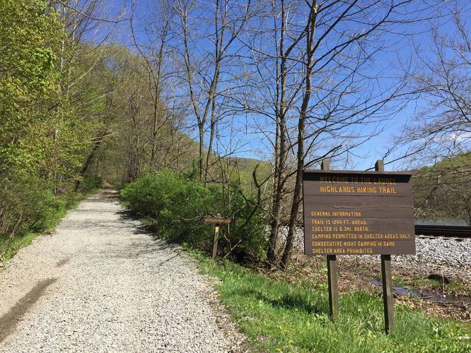
This section of the Laurel Highlands Hiking Trail in Confluence, Pennsylvania is a strenuous 10.2-mile one-way trail that runs from Jersey Hollow Rd over to the end of the trail in Ohiopyle State Park and State Game Lands 111.
This trail technically has two trailheads - one located along Jersey Hollow Rd in State Game Lands 111 and the other is located in Ohiopyle, here. While this trail is listed as being in Ohiopyle State Park, it's really split between State Game Lands 111 and Ohiopyle State Park. The eastern side is located in the State Game Lands and the western side is located in Ohiopyle State Park, so it's smart to wear blaze-orange when hiking this trail just in case there are hunters present.
While the entire Laurel Highlands Hiking Trail about 70-miles long, this 10.2-mile section can be completed in a single day and a perk of the hike is that there's a shuttle service that'll bring you directly to the eastern terminus.
The elevation profile of this section of the LHHT is strenuous, but the difficulty lies mostly in the downhill portions. If you plan to hike this trail from east to west, the hike will still be strenuous; however, the elevation gain is far greater than if you hike east to west.
Ohiopyle is where you get a shuttle to the eastern trailhead via Wilderness Voyageurs and hike back to
Ohiopyle, PA. Ohiopyle State Park has great facilities, lots of less difficult trails and waterfalls compared to this section of the LHHT.
Waterfalls: There are various small waterfalls during the rainy months along the trail, especially closer to Ohiopyle. Most of these waterfalls sit in the small creeks that run down the side of the mountains and eventually run into the Youghiogheny River.
Bouldering: Within the first mile or two of the trail, on the Ohiopyle end, is a very popular bouldering area with large rock formations.
Parking: Parking for the western trailhead in Ohiopyle, click here. If you plan to drive directly to the eastern terminus along Jersey Hollow Rd, go to the Get Directions section below.
-
Parking
39.892026, -79.375973 -
Main Trailhead
39.892196, -79.377645 -
Small waterfall trickling down the hillside
39.870544, -79.487197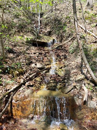
-
Very small waterfalls trickling down the creek
39.868483, -79.482667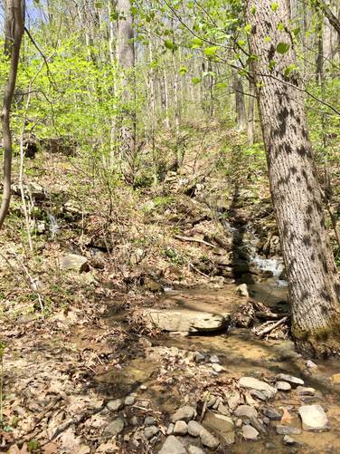
-
Small fantail waterfall about 3 feet tall
39.866722, -79.481042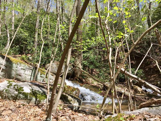
-
Large boulders for bouldering
39.866208, -79.480583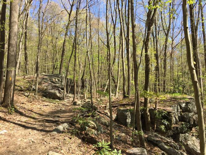
-
View Trail Map
Hiker: Admin (David Miller)Hiked on: April 27, 2019Distance: 1.6 miles / 2.6 km
Hazards
Seasons
Spring, Summer, FallBlaze Color
3 Trip Reports


Helpful Links
Find Hiking Trails Near Me:


")


Before you leave...
MyHikes is an indie web platform aimed to make exploring public trails easier for everyone. The site has no investors and is owned and operated by one person, Dave Miller (Founder & Admin). As the Founder, main contributor, and doer-of-all-things for MyHikes, I share my trips with over-detailed write-ups for fun on a volunteer basis and I believe that public trail information should be available to everyone.
It takes a lot of time 🕦, money 💰, and effort (including espresso shots ☕) to run MyHikes, including hiking , mapping , writing , and publishing new trails with high-quality content... along with building new features, moderating, site maintainance, and app development for iOS and Android . I simply ask that if you find MyHikes' trail guides helpful to please consider becoming a Supporter to help keep the site, iOS, and Android apps available to everyone.
Supporters unlock website and in-app perks with a one-time payment of $25 (you renew) 😎👍. Or you can simply make a Donation of your choice without a MyHikes user account. Otherwise, telling your friends about MyHikes is the next-best thing - both quick and free 🎉
Thanks for visiting MyHikes and have a great hike!️

Dave Miller
MyHikes Founder & Admin

