Latourell Falls Loop Trail
Distance:
2.5 Miles / 4.0 kmType:
LoopDifficulty:
ModerateTime to Hike:
1 hour, ~15 minutesFeatures:
Surface Type:
Semi-PavedLoading...
Loading...
The Latourell Falls Loop Trail at Guy W. Talbot State Park in Corbett, Oregon is a moderate 2.5 mile hike through the gorge of Latourell Falls and Upper Latourell Falls. Latourell Falls cascades down 249 feet and is the closest waterfall to Portland in the Columbia River Gorge. Latourell Falls is unique in that to its sides is a lichen covered columnar basalt formation that shines a bright yellow next to the falls. This loop trail brings you to Latourell Falls and Upper Latourell Falls before ending back at the parking lot.
Starting on the left side of the trail from the parking lot, the hike starts off on a paved trail that leads uphill to a lookout point of Latourell Falls. From there the trail becomes dirt and winds along the gorge and eventually to the side of the falls for a different viewpoint. After passing Latourell Falls, the trail becomes more rocky and winds along southward towards the Upper Latourell Falls.
Once you reach Upper Latourell Falls, you'll find a wooden footbridge that crosses the creek as well as a massive rock overhang that the falls cascade down from. In the late autumn and winter this bridge ices over, so watch your step. Upper Latourell Falls is two-tiered and the 1st tier is not as easy to see from below the falls, so to get pictures, look for the upper tier before heading down to the footbridge.
After passing Upper Latourell Falls, you'll start heading north again along the creek until you reach a lookout point of the Columbia River Gorge with a bench. Continue on the trail, heading downhill, until you reach the road. Once you reach the road, cross it and follow the trail downhill until it curves to the right - here the trail heads back to the base of Latourell Falls.
Once you reach the base of Latourell Falls, there's another wooden footbridge that leads across the creek. Again, this bridge will freeze over in the colder months, so watch your step. Follow the paved trail back up to parking to complete the 2.5 mile loop.
-
Parking
45.538843, -122.218172 -
Main Trailhead
45.538656, -122.21782 -
Upper Latourell Falls
45.530758, -122.220805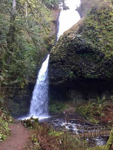
-
Vista of the Columbia River
45.537822, -122.220108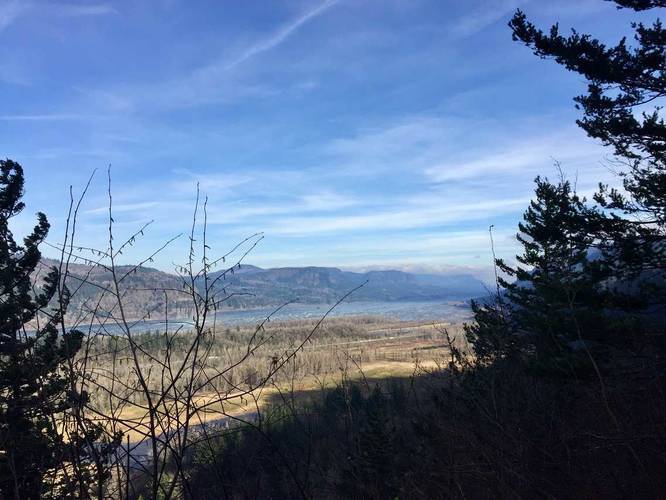
-
Vista of the Columbia River
45.537822, -122.220117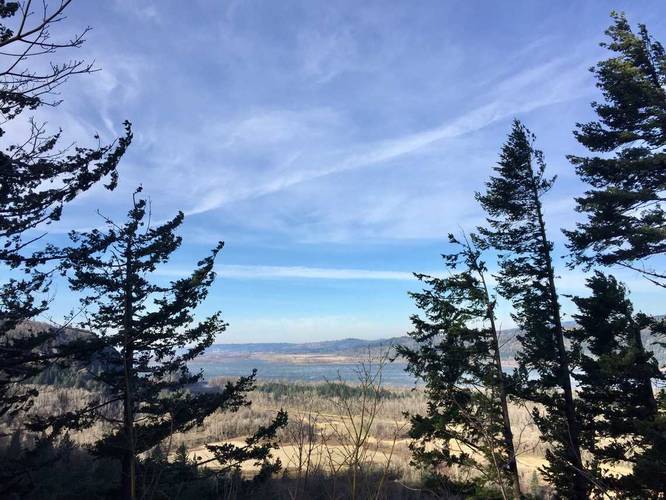
-
Latourell Falls from the bottom
45.537597, -122.217872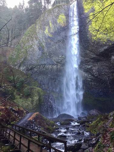
Seasons
All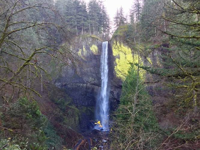
1 Trip Report


Helpful Links
Find Hiking Trails Near Me:


Before you leave...
MyHikes is an indie web platform aimed to make exploring public trails easier for everyone. The site has no investors and is owned and operated by one person, Dave Miller (Founder & Admin). As the Founder, main contributor, and doer-of-all-things for MyHikes, I share my trips with over-detailed write-ups for fun on a volunteer basis and I believe that public trail information should be available to everyone.
It takes a lot of time 🕦, money 💰, and effort (including espresso shots ☕) to run MyHikes, including hiking , mapping , writing , and publishing new trails with high-quality content... along with building new features, moderating, site maintainance, and app development for iOS and Android . I simply ask that if you find MyHikes' trail guides helpful to please consider becoming a Supporter to help keep the site, iOS, and Android apps available to everyone.
Supporters unlock website and in-app perks with a one-time payment of $25 (you renew) 😎👍. Or you can simply make a Donation of your choice without a MyHikes user account. Otherwise, telling your friends about MyHikes is the next-best thing - both quick and free 🎉
Thanks for visiting MyHikes and have a great hike!️

Dave Miller
MyHikes Founder & Admin

