Lakeside Trail
Distance:
3.3 Miles / 5.3 kmType:
LoopDifficulty:
EasyTime to Hike:
1 hour, ~39 minutesFeatures:
Surface Type:
DirtLoading...
Loading...
The Lakeside Trail at Hills Creek State Park near Wellsboro, Pennsylvania is an easy 3.3-mile loop trail that encompasses Hills Creek Lake and features views of the lake and the surrounding hills.
This recording begins at the parking lot located on Kellys Swamp Lane, just west of the intersection with Spill Way Road and heads in a clockwise direction. Starting from this parking lot, you'll find two signs; however, none are very clear about which trail is the Lakeside Trail - if you head clockwise (hiking towards Spill Way Road first), the trail follows Kellys Swamp Lane, then follows Spill Way Road until reaching the picnic area. Once you reach the picnic area, hike along the picnic area until you reach the corner of the lot where yellow blazes lead you down a set of stairs that end behind the dam.
Behind the dam, you can sometimes find large birds of prey nesting in the nearby trees or power lines. At this point, you'll be following both the Mid State Trail and Lakeside Trail until you reach the northern section of the loop. The trail follows the backside of the dam before heading up a series of stairs that lead to the top of the dam - hike up the stairs and continue heading southwest towards the entrance to the park along Hills Creek Lake Road.
Just before reaching the intersection with Hills Creek Lake Road, the trail will head into a coniferous forest and follows the shore of Hills Creek Lake. The trail will have a few lookout points along with a couple of parking lots, mainly for boat launches, along the west side of the trail.
Hiking further up the west side of the lake, you'll eventually reach the northern section where the trail diverges from the lake a bit. This section of the trail is the most difficult, but is moderate at best. The trail will run north and then south again to reach the lake once more (on the eastern shore) and here there will be a small spur trail that leads out to another lookout point along the lake. Just after this short spur trail is a fork in the trail - stay right to hike along the lake. If you stay left, you'll end up following the Mid State Trail.
After staying along the lake at the Mid State Trail / Lakeside Trail junction, you'll hike through more coniferous forests before reaching Kellys Swamp Lane again. Follow Kellys Swamp Lane down the street until you find another sign for the Tauschers Trail - head back into the woods at this sign and then take the immediate right-hand turn in the fork as this is the continuation for the Lakeside Trail.
Once again, the trail will end up back on the road to follow the road for about 0.25-miles or so before there's one last section of trail that passes through the woods and ends at the parking lot to complete the loop.
Pets: Dogs are allowed if leashed and their waste must be carried out by the hiker.
Parking: Parking can be found in multiple places around the edge of the lake at Hills Creek State Park; however, we started this hike from the parking lot located on Kellys Swamp Lane, just 100-feet from the intersection with Spill Way Road.
Blaze colors: The main blaze color for this trail is yellow; however, along the western and northern sections of this loop, you'll be following yellow and orange blazes - the orange blazes mark the Mid State Trail.
-
Parking
41.805538, -77.191334 -
Main Trailhead
41.805566, -77.191051 -
Viewing bench
41.803417, -77.196153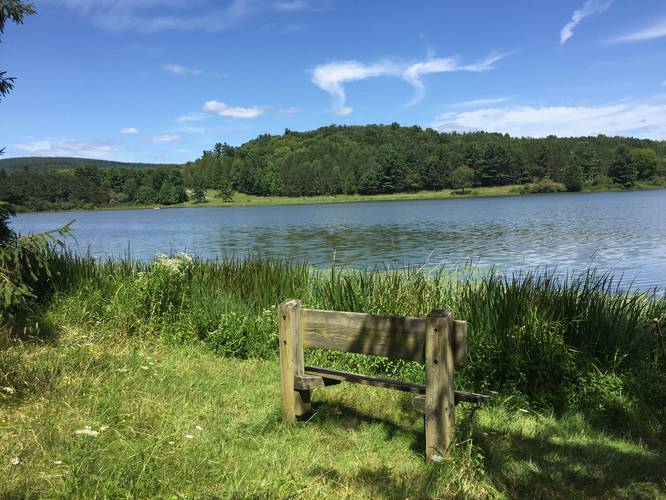
-
Vista from the spur trail on eastern shore
41.815025, -77.203003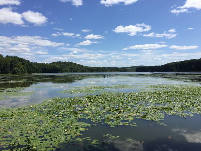
-
Maple sugar shack equipment
41.808767, -77.1948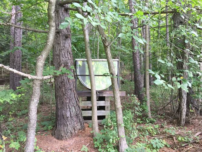
Hazards
Seasons
AllBlaze Color
_20221115030811UTC_small.jpg)

4 Trip Reports


Helpful Links
Find Hiking Trails Near Me:


Before you leave...
MyHikes is an indie web platform aimed to make exploring public trails easier for everyone. The site has no investors and is owned and operated by one person, Dave Miller (Founder & Admin). As the Founder, main contributor, and doer-of-all-things for MyHikes, I share my trips with over-detailed write-ups for fun on a volunteer basis and I believe that public trail information should be available to everyone.
It takes a lot of time 🕦, money 💰, and effort (including espresso shots ☕) to run MyHikes, including hiking , mapping , writing , and publishing new trails with high-quality content... along with building new features, moderating, site maintainance, and app development for iOS and Android . I simply ask that if you find MyHikes' trail guides helpful to please consider becoming a Supporter to help keep the site, iOS, and Android apps available to everyone.
Supporters unlock website and in-app perks with a one-time payment of $25 (you renew) 😎👍. Or you can simply make a Donation of your choice without a MyHikes user account. Otherwise, telling your friends about MyHikes is the next-best thing - both quick and free 🎉
Thanks for visiting MyHikes and have a great hike!️

Dave Miller
MyHikes Founder & Admin

