Lake Carolyn Spillway
Distance:
0.1 Miles / 0.2 kmType:
Out-and-BackDifficulty:
EasyTime to Hike:
~5 minutesFeatures:
Surface Type:
DirtLoading...
Loading...
The Lake Carolyn Spillway in York, Maine is an easy 0.1-mile out-and-back walk that leads along the dam/spillway at Lake Carolyn.
Note that this is not a hike but rather a short walk along a rock wall / dam that runs along the south side of the lake, providing visitors with views of the water. Note that the Town of York owns very small slices of land that encompass Lake Carolyn, but most of the plots of land are dispersed and don't connect. As of June 2023 (and years earlier) there are no defined trails to explore here. At the far end of the dam is a small 2-foot tall spillway that acts as a human-made waterfall when the lake's water levels are high enough.
Parking
Visitors will find a small parking turnout at the coordinates provided. The lot is large enough to fit a few vehicles at most.
Pets
Dogs are allowed only if leashed and must be cleaned up after.
Hazards
Seasons
All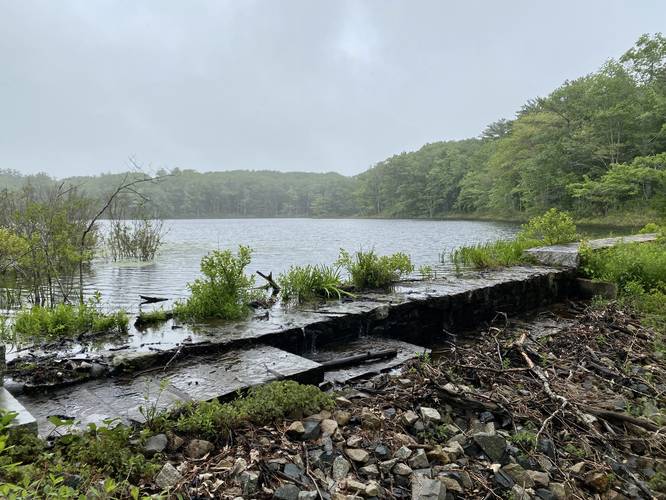
2 Trip Reports


Helpful Links
Find Hiking Trails Near Me:


Before you leave...
MyHikes is an indie web platform aimed to make exploring public trails easier for everyone. The site has no investors and is owned and operated by one person, Dave Miller (Founder & Admin). As the Founder, main contributor, and doer-of-all-things for MyHikes, I share my trips with over-detailed write-ups for fun on a volunteer basis and I believe that public trail information should be available to everyone.
It takes a lot of time 🕦, money 💰, and effort (including espresso shots ☕) to run MyHikes, including hiking , mapping , writing , and publishing new trails with high-quality content... along with building new features, moderating, site maintainance, and app development for iOS and Android . I simply ask that if you find MyHikes' trail guides helpful to please consider becoming a Supporter to help keep the site, iOS, and Android apps available to everyone.
Supporters unlock website and in-app perks with a one-time payment of $25 (you renew) 😎👍. Or you can simply make a Donation of your choice without a MyHikes user account. Otherwise, telling your friends about MyHikes is the next-best thing - both quick and free 🎉
Thanks for visiting MyHikes and have a great hike!️

Dave Miller
MyHikes Founder & Admin

