Kenyon Hill Loop
Distance:
1.4 Miles / 2.3 kmType:
LoopDifficulty:
EasyTime to Hike:
~42 minutesFeatures:
Surface Type:
DirtLoading...
Loading...
The Kenyon Hill Loop at Kenyon Hill Preserve in South Berwick, Maine is an easy 1.4-mile loop trail that features large rock outcroppings that offer rock scrambling and a nice hike through the woods.
Trails
This hike follows one named trail with apparently two names: "Ledge Trail" (blue blazes) - named on the park's PDF; "Blue Square Trail" (blue blazes) - named on the trail map at the trailhead - likely a typo.
Nikkiseeseverything's Review
This mile long loop trail was a nice little walk in the woods. I originally came here for the many blueberry bushes along the trail, but I was a few weeks too late to pick them. There are a few interesting rocky areas, but this is mostly just a nice hike if you're looking to spend a little time in the woods.
Admin's Edits
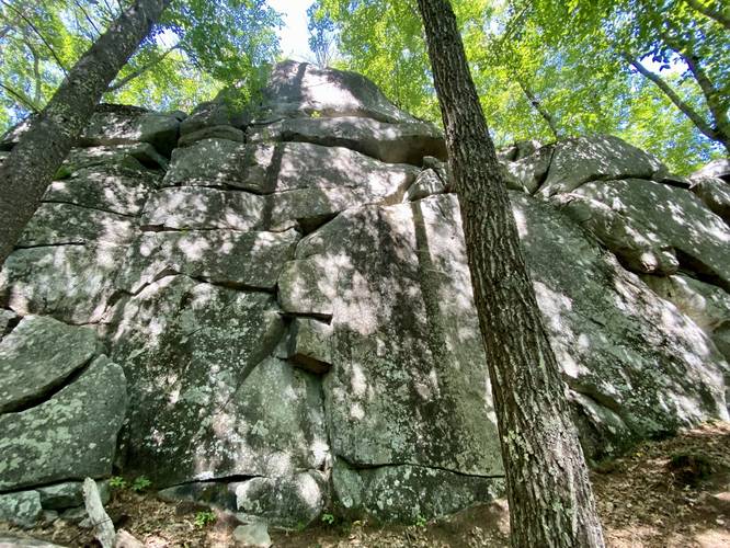
After exploring this in early September 2022, I was glad I came here to explore the boulders. I updated the main map to include a bit more to explore than the original write-up from Nikkiseeseverything. We hiked this loop counter-clockwise, starting with the ledges and boulders first. This section was really neat because it allows hikers to explore slightly differently - by light bouldering and non-technical climbing along easy routes up to the top of ledges. Some routes may be technical climbing routes, but it's unclear if the land trust allows it. We found a "rock face" in one of the large boulders before the official "ledges" area and also hiked to the top of the tallest ledges, which were about 40-feet tall. Note that if you hike to the top of the ledges, there's an unofficial deer trail that connects back to the main Ledges Trail - either connecting back to parking or to close the loop, depending on which way you hike (counter/non-counter clockwise). If you wish to follow the blue blazes in full and accidentally hiked back, head back down the ledges to find a hairpin turn with blue blazes. Note that as of September 2022, this turn does not include 2 blazes on the tree, but one, which makes it seem like the trail leads up the ledges instead of the turn.
Length: The Ledges Trail is approximately 1.1-miles long as a loop, without hiking or scrambling on any of the ledges. This track is about 1.4-miles long which includes a hike to the top of the tallest ledge.
Bugs: I recommend wearing bug-spray because the mosquitoes were everywhere.
Hours: The park is open from dawn to dusk daily.
Pets: Dogs are allowed if leashed and their waste must be carried out by the hiker.
Parking: The parking lot is large enough to fit 4 vehicles comfortably, with just enough space to maybe fit a couple more.
-
Parking
43.26218, -70.67874 -
Main Trailhead
43.261953, -70.678895 -
Small rock scramble
43.261069, -70.680786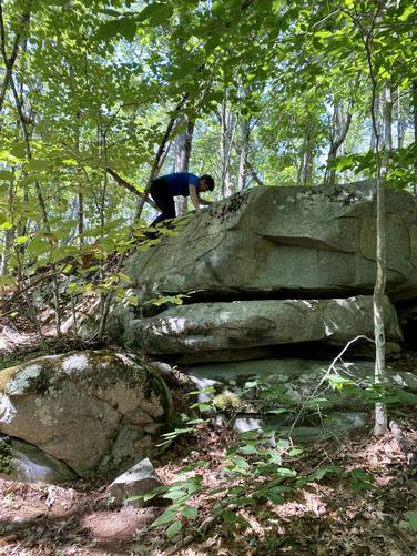
-
Face in the rock - see it?
43.260711, -70.681481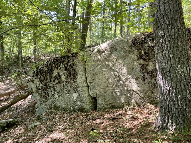
-
Light rock scramble on ledges
43.260478, -70.681581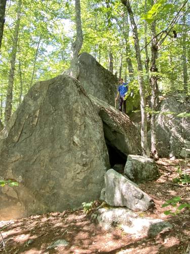
-
Ledges with crevasses
43.25985, -70.683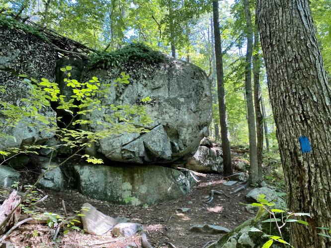
-
Junction with Blueberry Trai (cut-off trail) western terminus
43.259342, -70.681739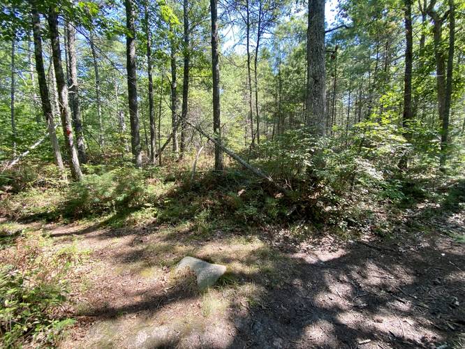
-
Large boulders
43.260239, -70.679825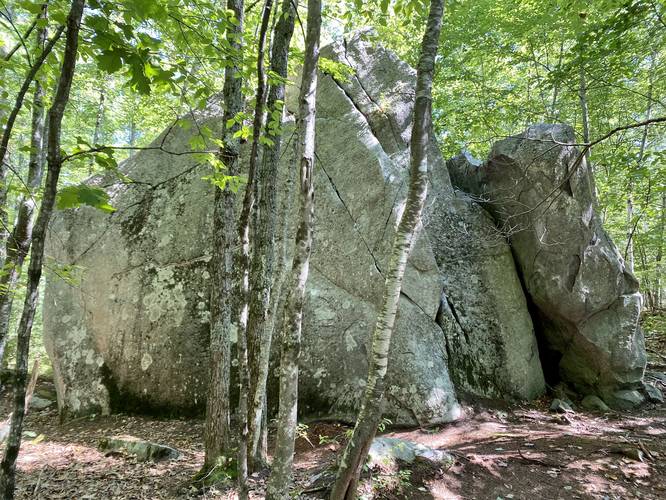
-
View Trail Map
Hiker: Admin (David Miller)Hiked on: September 04, 2022Distance: 1.5 miles / 2.4 km
Hazards
Seasons
AllBlaze Color

4 Trip Reports


Helpful Links
Find Hiking Trails Near Me:


Before you leave...
MyHikes is an indie web platform aimed to make exploring public trails easier for everyone. The site has no investors and is owned and operated by one person, Dave Miller (Founder & Admin). As the Founder, main contributor, and doer-of-all-things for MyHikes, I share my trips with over-detailed write-ups for fun on a volunteer basis and I believe that public trail information should be available to everyone.
It takes a lot of time 🕦, money 💰, and effort (including espresso shots ☕) to run MyHikes, including hiking , mapping , writing , and publishing new trails with high-quality content... along with building new features, moderating, site maintainance, and app development for iOS and Android . I simply ask that if you find MyHikes' trail guides helpful to please consider becoming a Supporter to help keep the site, iOS, and Android apps available to everyone.
Supporters unlock website and in-app perks with a one-time payment of $25 (you renew) 😎👍. Or you can simply make a Donation of your choice without a MyHikes user account. Otherwise, telling your friends about MyHikes is the next-best thing - both quick and free 🎉
Thanks for visiting MyHikes and have a great hike!️

Dave Miller
MyHikes Founder & Admin

