John Summerson Trail
Distance:
3.5 Miles / 5.6 kmType:
Out-and-BackDifficulty:
ModerateTime to Hike:
1 hour, ~45 minutesFeatures:
Surface Type:
DirtLoading...
Loading...
The John Summerson Branch Trail at Susquehannock State Forest's Hammersley Wild Area, near Cross Fork, Pennsylvania is a moderate 3.5-mile out-and-back hike. The John Summerson Branch Trail is a nice forest hike, and a beauty spot for some trout fishing. This trek leads the hiker along an 2 mile cascade of small water falls with abundant fishing holes and the possibility of over-night camping stays.
Trails
This hike follows the John Summerson Branch within the Hammersley Wild Area of north-western Clinton County.
Hike Description
This trek begins along Trout Run Road, where hikers will find a small parking turnout just before the creek crossing at Trout Run. Hikers will need to get their feet wet or come prepared with waders since the trail immediately crosses Trout Run before following a mostly-dry path that heads north along the John Summerson Branch and past, what appears to be a private camp. This section of the hike follows - what's depicted on the Hammersley Wild Area map - as yellow blazes. At least two additional creek crossings are need along the trail up the John Summerson Branch.
.2 Miles Cascade of Small Water Falls
Ideal habitat for the native PA Brook Trout. Recommend catch and release on these native fish streams. Catch and Release
is a fishing technique of conservation. Once caught, the fish is immediately returned unharmed. For Fishing License purchase fishing rules, and fishing regulations please visit Pennsylvania Fish & Wildlife or visit local sporting goods stores to learn more.
After reaching the mouth of Van Oak Hollow, this trek ends and heads back to the parking area for a 3.5-mile out-and-back hike.
Additional hiking on this trail is available beyond the Van Oak Hollow to reach the John Summerson Branch summit at the junction of the Trout Run Ridge trail. This longer trek is published under the "Summerson - Trout Ridge - Lock Branch Loop".
Parking
Hikers will find a small parking area at the coordinates provided.
Pets
Dogs are allowed if leashed; however, depending on the size of your dog and the time of year, it might be best to leave your furry friend at home because of several creek crossings and the need to scale across a number of difficult blowdowns during of the hike.
Camping and Backpacking
Backpackers will find a couple of well-established campsites near the trailhead parking area.
Additional, dispersed camping spots can be found further along this hike, mostly in the areas where the tributary creeks of Lock Branch and Van Oak Hollow feed into the John Summerson Branch. Please follow all dispersed / primitive / backcountry camping rules and regulations that the state forest has in place.
Difficulty
This trail is not all that difficult in terms of elevation gain; however, there are sections of the John Summerson Branch Trail that will not be easy to hike.
Blowdowns:
The difficulty mostly lies within areas of blowdowns on the narrower paths cutting along the steep side hills. Maneuvering through or around the windthrows can be challenging on the steeper terrain. Be careful with footing especially on the descent part when walking around the blowdowns, or when stepping over or bending under the blowdowns on the steep hillsides of the John Summerson Branch Trail.
Creek crossings:
The creek crossings were not too difficult. However without the proper foot gear, the unprepared hiker will be left with not only wet feet but also water-laden footwear. One technique for dealing with creek crossings is to stow along a pair of light-wieght, knee-high waders, to change into during the creek crossings. When hiking on the dry portions of the trail change back into the more-supportive hiking boots necessary for rough terrain walking on the hillside trails.
Another technique is to come with a set of small stream fishing-waders, and trout fish the streams, avoiding the steep side-hill paths and the blowdowns.
Warnings
Rattlesnakes: The Timber Rattlesnake tends to come down to creeks to cool down or hunt between the end of April through the end of September. Watch your step and give any rattlesnake you see some space.
Creek crossings: This trek requires the hiker to cross creeks several times. Come prepared with the proper footwear and gear for when crossing Trout Run and John Summerson Branch especially during the Spring.
Blowdowns: Some trail problems of concern to hikers including blowdowns on the narrow trail paths on steep slope hillsides.
Wild Plant of Interest
Horse Hoof's Fungus: This fungus makes a good tinder for flint and steel sparks. Used as a tinder to catch sparks and to carry a smoldering fire since at least 3200 BC. Once ignited a dry Horse’s Hoof Fungus can smolder for a considerable period of time.
-
Parking
41.446281, -77.932241 -
Main Trailhead
41.44635, -77.932095 -
Creek Crossing at John Summerson Branch
41.455836, -77.930132
-
Alien Face on Mossy Rock
41.463298, -77.928444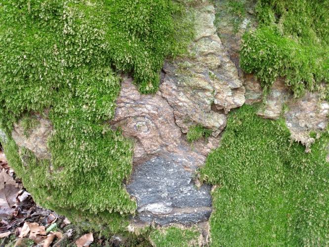
-
Cascade of Water Falls
41.467532, -77.928512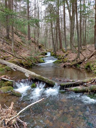
-
Hemlock Rock
41.45687, -77.929199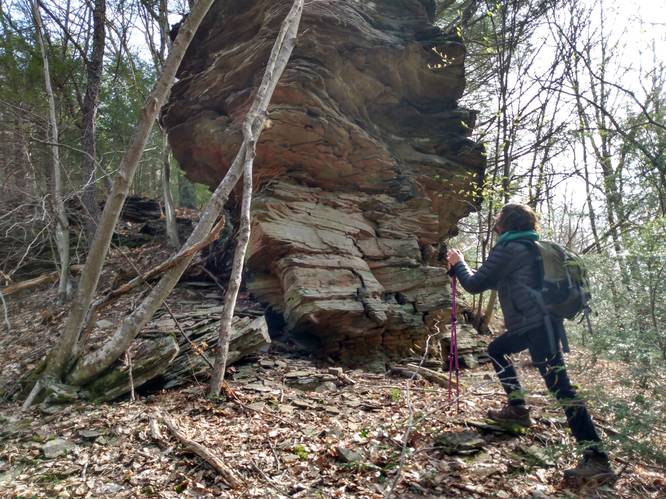
-
Standing Rock Falls
41.471211, -77.926977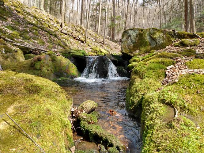
-
Lock Branch Trail Vista
41.457295, -77.919282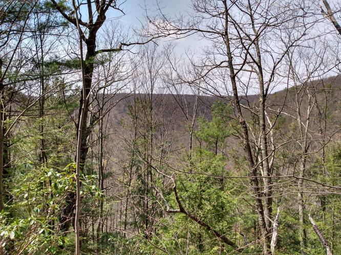
-
Fishing Spot on Trout Run
41.446731, -77.932664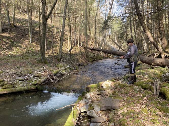
-
View Trail Map
Hiker: OliverPhineasHiked on: April 27, 2021Distance: 0.0 miles / 0.0 km
Hazards
Seasons
AllBlaze Color

3 Trip Reports


Helpful Links
Find Hiking Trails Near Me:


")


Before you leave...
MyHikes is an indie web platform aimed to make exploring public trails easier for everyone. The site has no investors and is owned and operated by one person, Dave Miller (Founder & Admin). As the Founder, main contributor, and doer-of-all-things for MyHikes, I share my trips with over-detailed write-ups for fun on a volunteer basis and I believe that public trail information should be available to everyone.
It takes a lot of time 🕦, money 💰, and effort (including espresso shots ☕) to run MyHikes, including hiking , mapping , writing , and publishing new trails with high-quality content... along with building new features, moderating, site maintainance, and app development for iOS and Android . I simply ask that if you find MyHikes' trail guides helpful to please consider becoming a Supporter to help keep the site, iOS, and Android apps available to everyone.
Supporters unlock website and in-app perks with a one-time payment of $25 (you renew) 😎👍. Or you can simply make a Donation of your choice without a MyHikes user account. Otherwise, telling your friends about MyHikes is the next-best thing - both quick and free 🎉
Thanks for visiting MyHikes and have a great hike!️

Dave Miller
MyHikes Founder & Admin

