Ice Break Trail
Distance:
1.5 Miles / 2.4 kmType:
Out-and-BackDifficulty:
EasyTime to Hike:
~45 minutesFeatures:
Surface Type:
DirtLoading...
Loading...
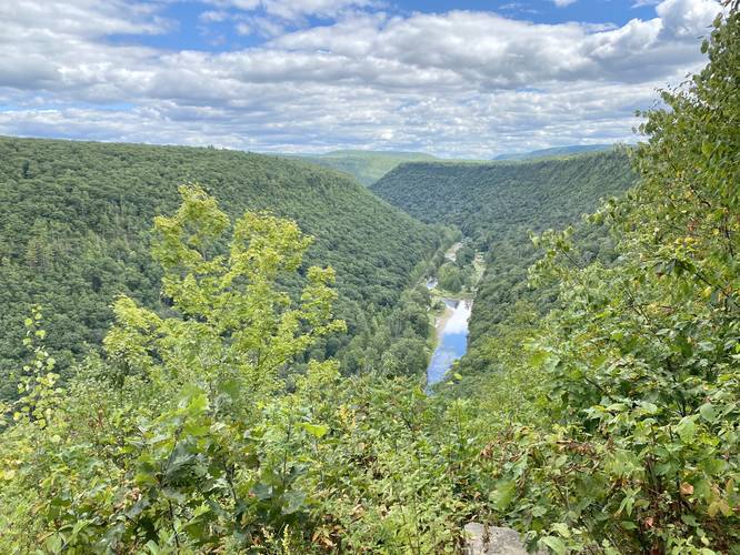
The Ice Break Trail at Tioga State Forest near Gaines, Pennsylvania is an easy 1.5-mile out-and-back trail that leads from Painter-Leetonia Road out to the West Rim Trail to a nice vista point above Pine Creek at Pine Creek Gorge (PA Grand Canyon).
This trail does not have much to note other than it's a nice peaceful mostly-flat hike. At the end of the trail is the vista point and a campsite along the West Rim Trail, along with a trail registry box.
Parking
Hikers will find a tiny parking turnout next to the trailhead. This parking turnout can fit about 2 vehicles max. Do not block the road or park down the road if parking is full.
Backpacking and Camping
Backpackers will find a campsite at the end of this trail. There are also plenty of flat spots off-trail where you can likely setup a tent or hammock as well. Please follow all state forest rules and regulations for dispersed / backcountry / primitive camping.
Pets
Dogs are allowed if leashed.
Blaze Color
This trail follows yellow blazes.
Winter Maintenance
The state forest does not maintain this road during the winter. Do not attempt to drive this road without the proper equipment.
-
Parking
41.65569, -77.482521 -
Main Trailhead
41.655671, -77.48266 -
Vista along West Rim Trail
41.658181, -77.471436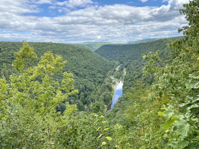
-
Campsite along West Rim Trail
41.658161, -77.471367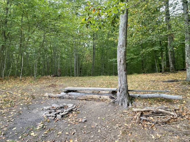
Hazards
Seasons
AllBlaze Color
3 Trip Reports


Before you leave...
MyHikes is an indie web platform aimed to make exploring public trails easier for everyone. The site has no investors and is owned and operated by one person, Dave Miller (Founder & Admin). As the Founder, main contributor, and doer-of-all-things for MyHikes, I share my trips with over-detailed write-ups for fun on a volunteer basis and I believe that public trail information should be available to everyone.
It takes a lot of time 🕦, money 💰, and effort (including espresso shots ☕) to run MyHikes, including hiking , mapping , writing , and publishing new trails with high-quality content... along with building new features, moderating, site maintainance, and app development for iOS and Android . I simply ask that if you find MyHikes' trail guides helpful to please consider becoming a Supporter to help keep the site, iOS, and Android apps available to everyone.
Supporters unlock website and in-app perks with a one-time payment of $25 (you renew) 😎👍. Or you can simply make a Donation of your choice without a MyHikes user account. Otherwise, telling your friends about MyHikes is the next-best thing - both quick and free 🎉
Thanks for visiting MyHikes and have a great hike!️

Dave Miller
MyHikes Founder & Admin

