Hood Mountain & Gunsight Rock
Distance:
6.8 Miles / 10.9 kmType:
Out-and-BackDifficulty:
HardTime to Hike:
3 hours, ~24 minutesFeatures:
Surface Type:
Semi-PavedLoading...
Loading...
The Hood Mountain & Gunsight Rock hike at the Hood Mountain Regional Park in Santa Rosa, California is a difficult 6.8-mile out-and-back trail that leads to the peak of Hood Mountain and the lookout point, Gunsight Rock.
This hike starts out by following the Lower Johnson Ridge Trail. The trail crosses and follows the paved road for short distances - hikers can easily follow the signs for the Lower Johnson Ridge Trail to continue along the proper path.
There are plenty of trail junctions along the way, but hikers should be on the lookout for signs pointing the way to the Hood Mountain summit. This hike eventually reaches the Panoramic Ranch Trail, which leads to the Hood Mountain Trail. Once on the Hood Mountain Trail, hikers will head south toward the Hood Mountain summit.
At Hood Mountain summit, there are no views, but not too far down the trail is Gunsight Rock, which is the main destination of this hike. Hikers can follow signs for Gunsight Rock to find their way, but it's only about 0.4-miles one-way from the Hood Mountain summit.
At Gunsight Rock hikers will find beautiful views and two tall rocks that overlook the valley. The vista point gives hikers views of San Francisco Bay to the left and Santa Rosa to the right.
Heading back down the mountain, hikers can choose to hike the same way out; however, this recording takes a small detour. The hike down takes a left-hand turn where the Pond Trail meets the Panoramic Ranch Trail at the three-way junction. This route will bring hikers past the Blue Heron Pond, Merganser Pond, and another vista point.
After reaching the junction with the Lower Johnson Ridge Trail, hikers will take this trail back to parking to complete the hike for a 6.8-mile trek.
Parking
The coordinates provided will bring hikers to the Pythian Road trailhead.
Fee
There is a small parking fee collected to support maintaining the park.
Pets
Dogs are allowed if leashed and their waste must be carried out by the hiker.
For more details, check out the Norcalhiker blog post on this trip.
-
Parking
38.451822, -122.574139 -
Main Trailhead
38.451977, -122.574246 -
Gunsight Rock vista
38.456424, -122.556755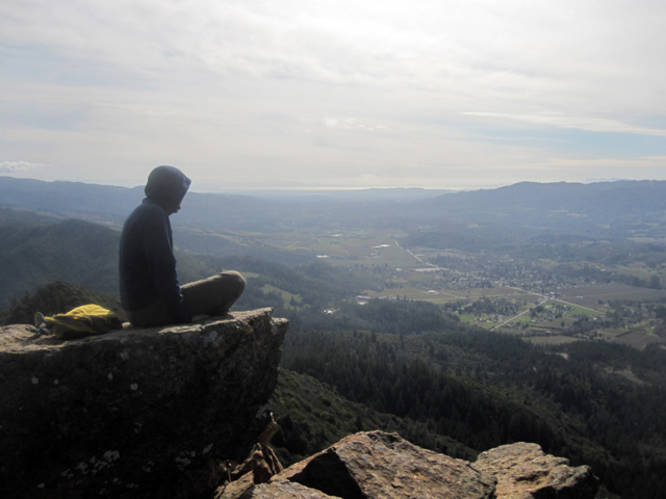
-
Vista point
38.45598, -122.569153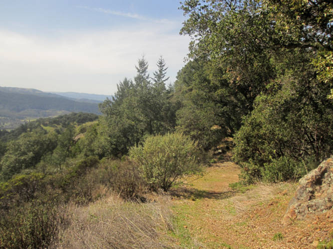
-
Hood Mountain summit
38.459983, -122.553573
Hazards
Season
Spring
1 Trip Report


Helpful Links
Find Hiking Trails Near Me:


")


Before you leave...
MyHikes is an indie web platform aimed to make exploring public trails easier for everyone. The site has no investors and is owned and operated by one person, Dave Miller (Founder & Admin). As the Founder, main contributor, and doer-of-all-things for MyHikes, I share my trips with over-detailed write-ups for fun on a volunteer basis and I believe that public trail information should be available to everyone.
It takes a lot of time 🕦, money 💰, and effort (including espresso shots ☕) to run MyHikes, including hiking , mapping , writing , and publishing new trails with high-quality content... along with building new features, moderating, site maintainance, and app development for iOS and Android . I simply ask that if you find MyHikes' trail guides helpful to please consider becoming a Supporter to help keep the site, iOS, and Android apps available to everyone.
Supporters unlock website and in-app perks with a one-time payment of $25 (you renew) 😎👍. Or you can simply make a Donation of your choice without a MyHikes user account. Otherwise, telling your friends about MyHikes is the next-best thing - both quick and free 🎉
Thanks for visiting MyHikes and have a great hike!️

Dave Miller
MyHikes Founder & Admin

