Holland Glen Section 10 Vista
Distance:
1.5 Miles / 2.4 kmType:
Out-and-BackDifficulty:
ModerateTime to Hike:
~45 minutesFeatures:
Surface Type:
DirtLoading...
Loading...
The Holland Glen Section 10 Vista hike in Belchertown, Massachusetts is a moderate 1.5-mile out-and-back trail that leads up to a seasonal clear-cut vista, as of December 2021, and features an optional stop at Hop Brook Falls.
Trails
This hike follows the former Section 10 of the M & M Trail and a section of the Holland Glen Loop Trail (yellow blazes).
Hike Description
This trail is a part of the Holland Glen Loop Trail and part of former Section 10 of the M & M Trail.
From the parking lot hike the Holland Glen Loop Trail and keep left at the bridge near the beginning of the trail. Follow the yellow blazes for roughly 0.4 miles. There is no signage or blazes at the turn for the M & M trail since this section is technically retired. There are at least 2 trails leading off of the yellow blazes that will lead you to the white blazes of the M & M trail, be on the look out for gray as well, these are white blazes that have been covered. Once connected to the white blazes the trail is very straight forward.
The trail eventually leads to fresh clear cuts on both sides of the trail, as of December 2021. The seasonal view provides a great look at the 7 Sisters at Mount Holyoke Range State Park along with parts of Amherst and Belchertown. Note that this view will be obstructed when the leaves are on the trees, so this is a great Autumn, Winter, or early Spring hike. This land is currently owned by W.D. Cowls, and while there are areas marked no trespassing, they are generally okay with hikers, please be respectful. The new lookout is roughly a 10-minute walk from the yellow loop trail.
Hop Brook Falls
Hikers will notice the waterfall located on the map - this is Hop Brook Falls which cascades approximately 7-feet down Hop Brook within Holland Glen. Hikers can reach the waterfall by taking the optional yellow-blazed trail around mile 0.4 on the hike in, or mile 1.1 on the hike out. The additional mileage is worth the hike to see Belchertown's most popular waterfall.
Parking
Parking is located at Holland Glen along Route 9 at the parking coordinates provided. There is now fresh gravel for parking and a trail map kiosk for the loop trail (yellow blazes).
Pets
Dogs are allowed if leashed and their waste must be carried out by the hiker.
-
Parking
42.324927, -72.430484 -
Main Trailhead
42.325034, -72.430284 -
Hop Brook Falls
42.329211, -72.427803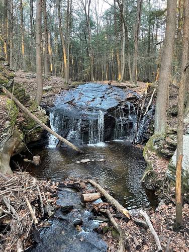
-
Clear cut vista of the Holyoke Range
42.331981, -72.432214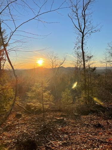
Hazards
Seasons
AllBlaze Color
1 Trip Report


Helpful Links
Find Hiking Trails Near Me:


Before you leave...
MyHikes is an indie web platform aimed to make exploring public trails easier for everyone. The site has no investors and is owned and operated by one person, Dave Miller (Founder & Admin). As the Founder, main contributor, and doer-of-all-things for MyHikes, I share my trips with over-detailed write-ups for fun on a volunteer basis and I believe that public trail information should be available to everyone.
It takes a lot of time 🕦, money 💰, and effort (including espresso shots ☕) to run MyHikes, including hiking , mapping , writing , and publishing new trails with high-quality content... along with building new features, moderating, site maintainance, and app development for iOS and Android . I simply ask that if you find MyHikes' trail guides helpful to please consider becoming a Supporter to help keep the site, iOS, and Android apps available to everyone.
Supporters unlock website and in-app perks with a one-time payment of $25 (you renew) 😎👍. Or you can simply make a Donation of your choice without a MyHikes user account. Otherwise, telling your friends about MyHikes is the next-best thing - both quick and free 🎉
Thanks for visiting MyHikes and have a great hike!️

Dave Miller
MyHikes Founder & Admin

