Hog Island (Patriots Point) Trail
Distance:
0.3 Miles / 0.5 kmType:
Out-and-BackDifficulty:
EasyTime to Hike:
~9 minutesFeatures:
Surface Type:
DirtLoading...
Loading...
The Hog Island (Patriot's Point) Trail in Mount Pleasant, South Carolina is an easy 0.3-mile out-and-back trail that features an observation deck with views of Charleston and the bay.
This is very short trail leads from the Patriots Point Links golf course (which provides public parking), following a defined path and out to the shoreline. The trailhead can be found west of the parking area and is best found by locating the silver historical "Hog Island" sign. The trail heads into the forest, passing palmetto, wild Carolina Jasmine, and other low-growing bushes before reaching an observation deck at the end of the trail. Here, you can climb the short staircase of the observation deck to get a better view of the area. The view from the top is mostly the shoreline and bay ahead of you, but to the right-hand side (west) you'll find views of Charleston, mainly around the French Quarter. After visiting the views, the walk back is short and leads back to parking for a 0.3-mile out-and-back jaunt.
Parking
Walkers will find a large parking lot at the coordinates provided, located at the end of Club House Road in Mount Pleasant, SC. The lot is large enough to fit many dozens of vehicles. Parking for the trailhead is easiest if you park on the west side of the lot.
Pets
Dogs are allowed only if leashed and must be cleaned up after.
-
Parking
32.788017, -79.900565 -
Main Trailhead
32.787604, -79.900984 -
View from the Hog Island Observation Deck
32.786583, -79.899689
Hazards
Seasons
All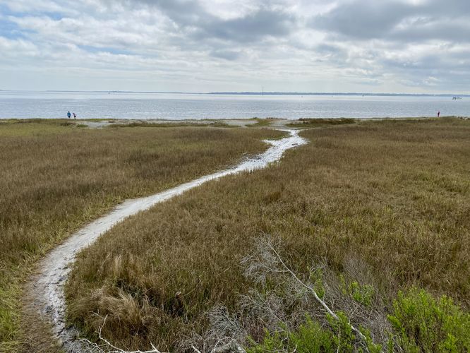
1 Trip Report


Helpful Links
Find Hiking Trails Near Me:


Before you leave...
MyHikes is an indie web platform aimed to make exploring public trails easier for everyone. The site has no investors and is owned and operated by one person, Dave Miller (Founder & Admin). As the Founder, main contributor, and doer-of-all-things for MyHikes, I share my trips with over-detailed write-ups for fun on a volunteer basis and I believe that public trail information should be available to everyone.
It takes a lot of time 🕦, money 💰, and effort (including espresso shots ☕) to run MyHikes, including hiking , mapping , writing , and publishing new trails with high-quality content... along with building new features, moderating, site maintainance, and app development for iOS and Android . I simply ask that if you find MyHikes' trail guides helpful to please consider becoming a Supporter to help keep the site, iOS, and Android apps available to everyone.
Supporters unlock website and in-app perks with a one-time payment of $25 (you renew) 😎👍. Or you can simply make a Donation of your choice without a MyHikes user account. Otherwise, telling your friends about MyHikes is the next-best thing - both quick and free 🎉
Thanks for visiting MyHikes and have a great hike!️

Dave Miller
MyHikes Founder & Admin

