Purple Loop
Distance:
2.3 Miles / 3.7 kmType:
LoopDifficulty:
ModerateTime to Hike:
1 hour, ~9 minutesFeatures:
Surface Type:
DirtPark:
Hartwood Acres ParkLoading...
Loading...
The Purple Loop Trail at Hartwood Acres Park in Indiana Township, Pennsylvania is a moderate and really nice 2.3-mile trail through the southeast section of the park with a lookout point.
The trailhead can be found in two locations along Hartwood Acres Drive - both visible from the road next to the parking area. Head to the western trailhead to follow the trail in the same direction of this trek.
Lookout Point: Just after hiking the switchbacks during the first 1.5 miles of the hike, you'll reach a lookout point at the top of the natural gas line around mile 1.7 (while following the same route here). This lookout point faces southeast from Hartwood Acres Park looking down toward Saxonburg Blvd and the surrounding neighborhoods.
When you get to the southeastern part of the loop (in this GPS data), you can keep right or keep left to avoid looping depending on which direction you're traveling. That section was a bit confusing on the trail.
Parking: You can find parking at the main lot for the Hartwood Acres Mansion.
-
Parking
40.568451, -79.909292 -
Main Trailhead
40.568098, -79.91024 -
Hartwood Acres lookout point - Purple Loop
40.563672, -79.912919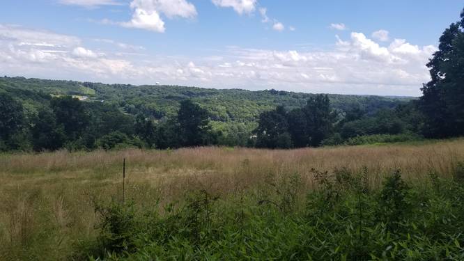
-
Views through the trees on the switchbacks
40.563575, -79.913964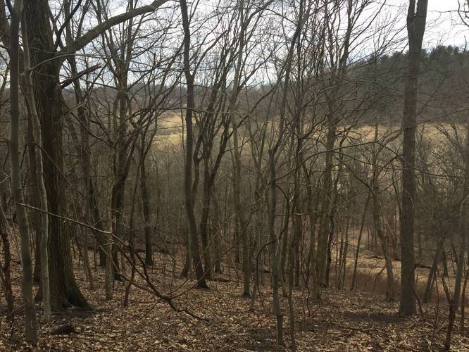
Hazards
Season
WinterBlaze Color


10 Trip Reports


Helpful Links
Find Hiking Trails Near Me:


Before you leave...
MyHikes is an indie web platform aimed to make exploring public trails easier for everyone. The site has no investors and is owned and operated by one person, Dave Miller (Founder & Admin). As the Founder, main contributor, and doer-of-all-things for MyHikes, I share my trips with over-detailed write-ups for fun on a volunteer basis and I believe that public trail information should be available to everyone.
It takes a lot of time 🕦, money 💰, and effort (including espresso shots ☕) to run MyHikes, including hiking , mapping , writing , and publishing new trails with high-quality content... along with building new features, moderating, site maintainance, and app development for iOS and Android . I simply ask that if you find MyHikes' trail guides helpful to please consider becoming a Supporter to help keep the site, iOS, and Android apps available to everyone.
Supporters unlock website and in-app perks with a one-time payment of $25 (you renew) 😎👍. Or you can simply make a Donation of your choice without a MyHikes user account. Otherwise, telling your friends about MyHikes is the next-best thing - both quick and free 🎉
Thanks for visiting MyHikes and have a great hike!️

Dave Miller
MyHikes Founder & Admin

