Hamilton Falls
Distance:
0.2 Miles / 0.3 kmType:
One-WayDifficulty:
HardTime to Hike:
~6 minutesFeatures:
Surface Type:
DirtLoading...
Loading...
Hamilton Falls is located on Hamilton Falls Rd in Jamaica, VT and is an easy 0.2-mile one-way trail that leads to one of Vermont's tallest waterfalls - Hamilton Falls. Parking is available on the road.
There are a couple ways of accessing Hamilton Falls. The shortest seems to be from Hamilton Falls Rd, since it is roughly a 0.25 mile hike down to the bottom. However, this trail should be considered difficult or 'hard' for all skill levels. The trail is very steep and is almost straight down over roots and open rock face, with some low hanging branches. During the fall there are lots of leaves on the ground providing many opportunities to slip and get seriously injured, so hike at your own risk. There appears to be another trail leading down to the falls nearby but I did not locate it.
Hamilton Falls is one of Vermont's largest waterfalls, cascading down about 125 feet and has several tiers or levels to it. One tier of the falls has a large pool and
ladder access. When the falls are not raging this area is safe for
swimming but proceed with caution and always watch the weather to avoid flash flooding.
You may also approach from Ball Mountain State Park by the dam - there is a trail that leads to Hamilton Falls there and one from below the dam as well. Both of these routes are roughly 2.5 miles.
-
View Trail Map
Hiker: TocraHiked on: October 15, 2019Distance: 0.2 miles / 0.3 km
Hazards
Seasons
All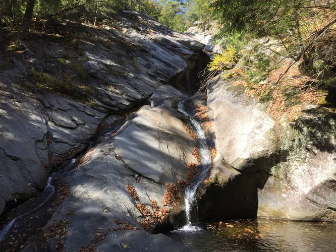


Helpful Links
Find Hiking Trails Near Me:


Before you leave...
MyHikes is an indie web platform aimed to make exploring public trails easier for everyone. The site has no investors and is owned and operated by one person, Dave Miller (Founder & Admin). As the Founder, main contributor, and doer-of-all-things for MyHikes, I share my trips with over-detailed write-ups for fun on a volunteer basis and I believe that public trail information should be available to everyone.
It takes a lot of time 🕦, money 💰, and effort (including espresso shots ☕) to run MyHikes, including hiking , mapping , writing , and publishing new trails with high-quality content... along with building new features, moderating, site maintainance, and app development for iOS and Android . I simply ask that if you find MyHikes' trail guides helpful to please consider becoming a Supporter to help keep the site, iOS, and Android apps available to everyone.
Supporters unlock website and in-app perks with a one-time payment of $25 (you renew) 😎👍. Or you can simply make a Donation of your choice without a MyHikes user account. Otherwise, telling your friends about MyHikes is the next-best thing - both quick and free 🎉
Thanks for visiting MyHikes and have a great hike!️

Dave Miller
MyHikes Founder & Admin

