Greenbush Kettle Pond Trail
Distance:
0.2 Miles / 0.3 kmType:
Out-and-BackDifficulty:
ModerateTime to Hike:
~6 minutesFeatures:
Surface Type:
DirtLoading...
Loading...
The Greenbush Kettle Pond Trail at Kettle Moraine State Forest near Plymouth, Wisconsin is a moderate 0.2-mile out-and-back trail that leads to views of the glacially-formed Greenbush Kettle Pond.
Hike Description
This is less of a hike and more of a moderate walk to and from the Greenbush Kettle Pond; however, this trail does include a self-guided interactive tour along the way with some information about kettle ponds and how they're formed. At the end of this trail is a nice view of the kettle pond and the hike
back uphill is a moderate, but short, walk back to parking.
What's a kettle pond?
Thousands of years ago, when the glaciers receded from this area, large chunks of ice would break off and submerge themselves in the ground. Over time the ice would melt and leave behind a depression in the ground to where water would fill it, creating ponds. Greenbush Kettle Pond was formed exactly the same way.
Parking
Visitors will find parking at the coordinates provided. The lot is large enough to fit about a dozen vehicles.
Pets
Dogs are allowed if leashed and their waste should be carried out by the hiker.
-
Parking
43.735086, -88.096489 -
Main Trailhead
43.735028, -88.096562 -
View of the Greenbush Kettle Pond
43.735642, -88.097442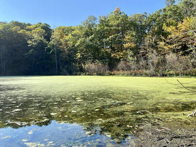
Hazards
Seasons
All
2 Trip Reports


Helpful Links
Find Hiking Trails Near Me:


Before you leave...
MyHikes is an indie web platform aimed to make exploring public trails easier for everyone. The site has no investors and is owned and operated by one person, Dave Miller (Founder & Admin). As the Founder, main contributor, and doer-of-all-things for MyHikes, I share my trips with over-detailed write-ups for fun on a volunteer basis and I believe that public trail information should be available to everyone.
It takes a lot of time 🕦, money 💰, and effort (including espresso shots ☕) to run MyHikes, including hiking , mapping , writing , and publishing new trails with high-quality content... along with building new features, moderating, site maintainance, and app development for iOS and Android . I simply ask that if you find MyHikes' trail guides helpful to please consider becoming a Supporter to help keep the site, iOS, and Android apps available to everyone.
Supporters unlock website and in-app perks with a one-time payment of $25 (you renew) 😎👍. Or you can simply make a Donation of your choice without a MyHikes user account. Otherwise, telling your friends about MyHikes is the next-best thing - both quick and free 🎉
Thanks for visiting MyHikes and have a great hike!️

Dave Miller
MyHikes Founder & Admin

