Gate 33
Distance:
3.2 Miles / 5.1 kmType:
Out-and-BackDifficulty:
EasyTime to Hike:
1 hour, ~36 minutesFeatures:
Surface Type:
Dirt
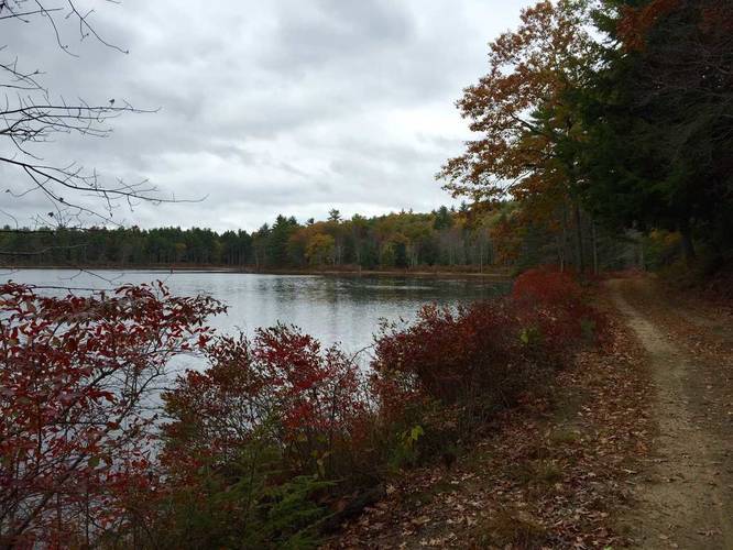
Gate 33 at Quabbin Reservoir in New Salem, Massachusetts is an easy 3.2-mile out-and-back trail to the water and back to parking.
Along the trail, you'll pass Bassett Pond to the east with Bassett Hill to the west. Just before reaching Quabbin Reservoir, you'll pass Old North Dana Road on your left -- stay to the right here to continue toward the water.
Parking
Parking can be found right at the gate on Route-122 at the coordinates provided.
Pets
Dogs are not allowed on any trails at Quabbin.
Hazards
Seasons
AllLoading...
Loading...
1 Trip Report


Helpful Links
Find Hiking Trails Near Me:


")


Before you leave...
MyHikes is an indie web platform aimed to make exploring public trails easier for everyone. The site has no investors and is owned and operated by one person, Dave Miller (Founder & Admin). As the Founder, main contributor, and doer-of-all-things for MyHikes, I share my trips with over-detailed write-ups for fun on a volunteer basis and I believe that public trail information should be available to everyone.
It takes a lot of time 🕦, money 💰, and effort (including espresso shots ☕) to run MyHikes, including hiking , mapping , writing , and publishing new trails with high-quality content... along with building new features, moderating, site maintainance, and app development for iOS and Android . I simply ask that if you find MyHikes' trail guides helpful to please consider becoming a Supporter to help keep the site, iOS, and Android apps available to everyone.
Supporters unlock website and in-app perks with a one-time payment of $25 (you renew) 😎👍. Or you can simply make a Donation of your choice without a MyHikes user account. Otherwise, telling your friends about MyHikes is the next-best thing - both quick and free 🎉
Thanks for visiting MyHikes and have a great hike!️

Dave Miller
MyHikes Founder & Admin

