Escarpment Trail to Vista
Distance:
1.9 Miles / 3.1 kmType:
Out-and-BackDifficulty:
ModerateTime to Hike:
1 hour, ~10 minutesFeatures:
Surface Type:
DirtLoading...
Loading...
The Escarpment Trail to Vista hike at Porcupine Mountains Wilderness State Park near Ontonagon, Michigan is a moderate 1.9-mile out-and-back trail that leads to several views of the Big Carp River and the Porcupine Mountains along the way in addition to a stunning vista of the Lake of the Clouds.
Hike Description
This hike begins at the Lake of the Clouds Overlook and follows the blue blazes of the Escarpment Trail east as it traverses a northern mountain ridge along the Lake of the Clouds / Big Carp River.
Off-Trail Vista - Mile 0.11
After the hiker descends the first series of stairs, they'll reach a turn in the trail. Here is a small off-trail path that leads out to a rocky ledge in the mountains and provides hikers will some nice views of the Lake of the Clouds and the Porcupine Mountain range. The vista is located around mile 0.14.
Campsite (Permit Required) - Mile 0.28
After returning to the trail, hikers will continue onward until reaching a campsite (permit required) around mile 0.28. At this point, the trail will be heading back uphill at a moderate grade.
Vistas - Mile 0.54 - 0.6
Between miles 0.54 and 0.6, hikers will find a couple of spots off-trail that provide more views of the Big Carp River and the Porcupine Mountains; however, the Lake of the Clouds will be out of view at this point.
Big Carp River Vista - Mile 0.9
Around mile 0.9, hikers will find yet another bald spot on the mountain ridge that provides some views. They aren't stunning, but provide addition views of the Big Carp River. Just after passing this vista, the trail will lead through a
pine forest before the main destination for this hike finally reveals
itself - the Lake of the Clouds Vista.
Lake of the Clouds Vista - Mile 1
At mile 1, where this recording ends, lies the stunning panoramic vista of the Lake of the Clouds and Big Carp River as it snakes its way east from the lake. This spot is a great place to hang out and relax; however, the sun exposure here is pretty bad. There are not many place to sit and enjoy the view without the sun beating down on you. Views from the rock ledges make for great pictures as well, but watch your steps.
Hiking Out
The hike out follows the opposite hike in and is not very difficult; however, considering the elevation gain, the hike should be considered moderate for most hikers. By skipping most of the off-trail vistas on the way out, the hike is also shortened slightly to just under 1-mile, making it a 1.9-mile out-and-back.
Parking & Fees
Visitors will find a very large parking lot
at the coordinates provided that can fit several dozen vehicles. As of
September 2022, there's a $10 entrance fee.
Pets
Dogs are allowed if leashed and their waste must be carried out by the hiker.
Warnings
Ledges:
For those willing to venture away from the stone wall on the eastern
side of the overlook to get a better view (away from the crowds), it's
best to stay far away from the rock ledges since falling here would
likely cause serious injury if not instant death.
No water: This trail has no water, so it's best to carry in at least 1 liter / 32oz of water per person just in case.
Camping & Backpacking
Permits are required to camp at any campsite along this trail. Please inquire at the state park office for more information on backcountry camping permits.
-
Parking
46.803787, -89.765713 -
Main Trailhead
46.803207, -89.764446 -
View of the Lake of the Clouds within the Porcupine Mountains
46.803653, -89.762572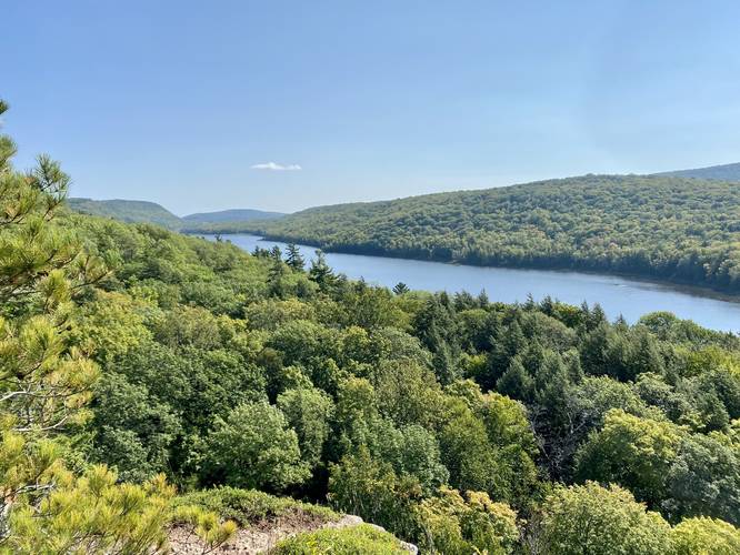
-
Campsite (permit required)
46.805169, -89.761667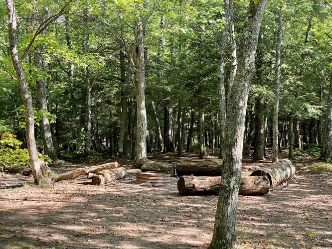
-
View of the Porcupine Mountains and Big Carp River from the Escarpment Trail
46.806483, -89.757081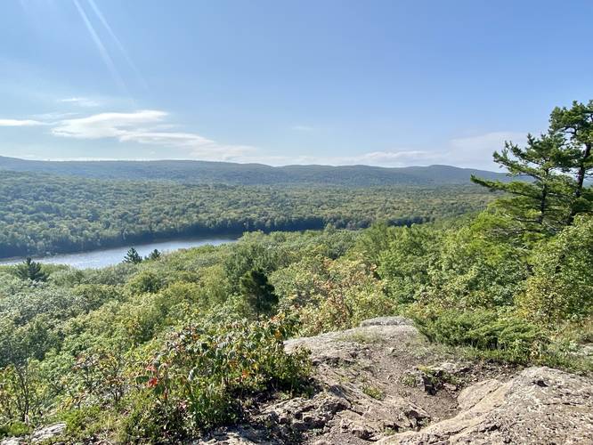
-
View of the Porcupine Mountains from the Escarpment Trail
46.806675, -89.756325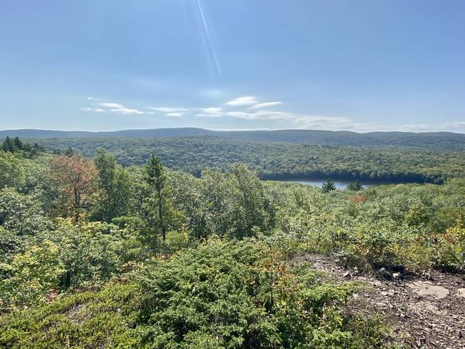
-
View of the Porcupine Mountains and Big Carp River from the Escarpment Trail
46.807586, -89.750892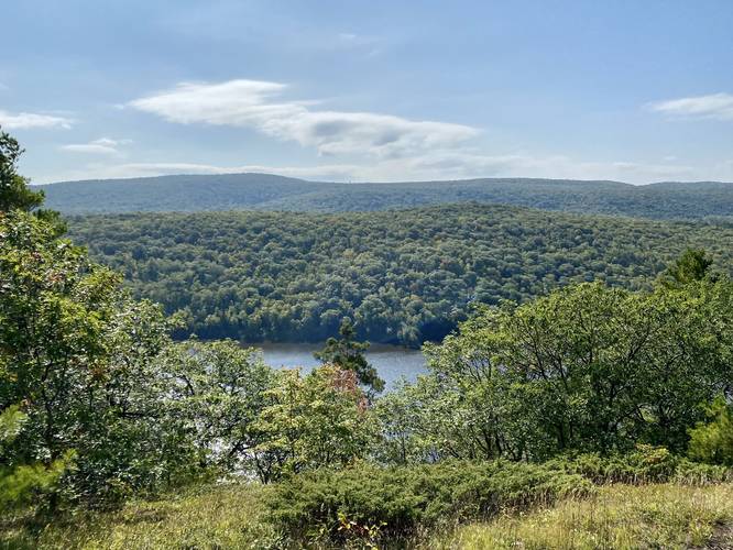
-
Lake of the Clouds vista along the Escarpment Trail
46.807819, -89.749856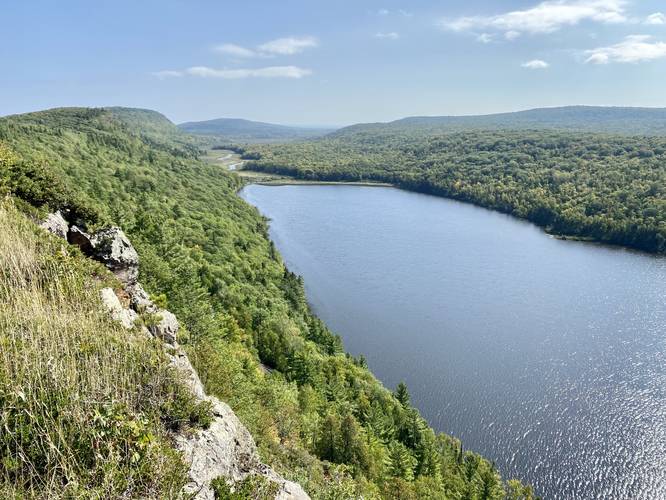
-
View facing west of the Porcupine Mountains from the Escarpment Trail
46.806586, -89.756928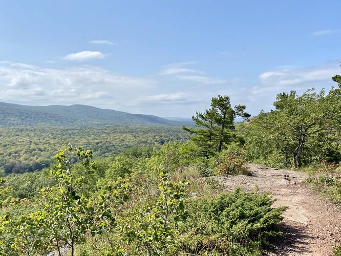
Hazards
Seasons
AllBlaze Color
2 Trip Reports


Helpful Links
Find Hiking Trails Near Me:


Before you leave...
MyHikes is an indie web platform aimed to make exploring public trails easier for everyone. The site has no investors and is owned and operated by one person, Dave Miller (Founder & Admin). As the Founder, main contributor, and doer-of-all-things for MyHikes, I share my trips with over-detailed write-ups for fun on a volunteer basis and I believe that public trail information should be available to everyone.
It takes a lot of time 🕦, money 💰, and effort (including espresso shots ☕) to run MyHikes, including hiking , mapping , writing , and publishing new trails with high-quality content... along with building new features, moderating, site maintainance, and app development for iOS and Android . I simply ask that if you find MyHikes' trail guides helpful to please consider becoming a Supporter to help keep the site, iOS, and Android apps available to everyone.
Supporters unlock website and in-app perks with a one-time payment of $25 (you renew) 😎👍. Or you can simply make a Donation of your choice without a MyHikes user account. Otherwise, telling your friends about MyHikes is the next-best thing - both quick and free 🎉
Thanks for visiting MyHikes and have a great hike!️

Dave Miller
MyHikes Founder & Admin

