Emily Dickinson Trail
Distance:
0.9 Miles / 1.4 kmType:
One-WayDifficulty:
EasyTime to Hike:
~27 minutesFeatures:
Surface Type:
DirtLoading...
Loading...
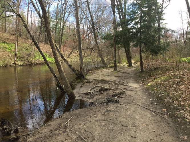
The Emily Dickinson Trail is an easy 0.9-mile one-way trail located off of Mill Lane in Amherst, Massachusetts. There are 2 trail heads, one located by the parking lot at the east end of Mill Lane by South East St, this is also a rail trail entrance as well. The other trail head is located within Groff Park in the northeast corner beyond the playground.
This trail follows along Fort River by farm fields and over small foot bridges. The trail is well maintain and each bridge is named. There are several places to stop and take a dip in the water or sit in the tall grass by a field. Sections of this trail are known to be very active locations for snakes, one bridge is even name Snake Point. There are also many turkey that frequent the area along with plenty of other bird species.
While there are sections with many roots, this trail should be considered easy.
It should be noted that there is a direction sign at roughly the 0.7-mile mark from the Groff Park trailhead. This sign appears to point you into a field, there are however, no additional trail markers once you enter the field. This sign should be ignored.
Hazards
Seasons
AllBlaze Dot
1 Trip Report


Helpful Links
Find Hiking Trails Near Me:


Before you leave...
MyHikes is an indie web platform aimed to make exploring public trails easier for everyone. The site has no investors and is owned and operated by one person, Dave Miller (Founder & Admin). As the Founder, main contributor, and doer-of-all-things for MyHikes, I share my trips with over-detailed write-ups for fun on a volunteer basis and I believe that public trail information should be available to everyone.
It takes a lot of time 🕦, money 💰, and effort (including espresso shots ☕) to run MyHikes, including hiking , mapping , writing , and publishing new trails with high-quality content... along with building new features, moderating, site maintainance, and app development for iOS and Android . I simply ask that if you find MyHikes' trail guides helpful to please consider becoming a Supporter to help keep the site, iOS, and Android apps available to everyone.
Supporters unlock website and in-app perks with a one-time payment of $25 (you renew) 😎👍. Or you can simply make a Donation of your choice without a MyHikes user account. Otherwise, telling your friends about MyHikes is the next-best thing - both quick and free 🎉
Thanks for visiting MyHikes and have a great hike!️

Dave Miller
MyHikes Founder & Admin

