Elakala Falls Trail
Distance:
0.6 Miles / 1.0 kmType:
Out-and-BackDifficulty:
EasyTime to Hike:
~18 minutesFeatures:
Surface Type:
Dirt
The Elakala Trail at Blackwater Falls State Park is a short 0.6 mile out-and-back trail that leads from the Blackwater Falls Lodge to Elakala Falls and back to Blackwater Lodge Road. The trail starts on the southern side of the parking lot next to Blackwater Lodge and heads gradually downhill to Elakala Falls.
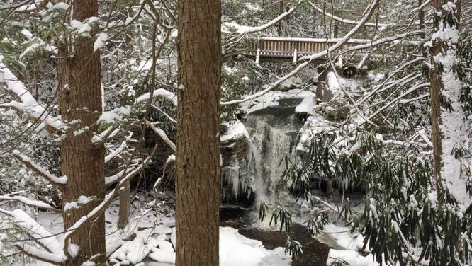
Elakala Falls is technically a series of four waterfalls; however, the
first waterfall is the only one you can see from this trail and is 35
feet tall. Elakala is the 2nd most popular waterfall in the park, thus making this a really popular trail during warmer months. The trail sits directly next to the Blackwater Lodge, so if you're staying at the lodge, this trail is a must-do.
Lookout Points: Just beyond Elakala Falls are a few lookout points into the Blackwater Canyon below; however, these lookout points aren't all that interesting. You can only see glimpses of the hills across the canyon.
Trail Length: Listed here is 0.6 miles to cover a 'true-thru hike' of the trail, but this hike can be anywhere from 0.2 miles to 0.6 really. If you just want to see Elakala Falls, you can hike down to the viewing area, and hike back up to the parking lot. If you plan to see more of the trail and take it all the way to the road, you'll end up hiking about 0.6 miles back to parking - either by road or back on the trail.
Note: The GPS for this data does not follow the Elakala Trail 100% near the end - we ended up taking a left-hand turn at the sign that says "Park Road 1/4 Mile"; however, this trail does continue on for about 0.2 to 0.3 miles beyond that sign. If you continue following the trail, to the right, it end at Blackwater Lodge Road, but slightly further west than where this ends.
-
Parking
39.10753, -79.498021 -
Main Trailhead
39.10753, -79.498021 -
On the bridge above Elakala Falls
39.107167, -79.499175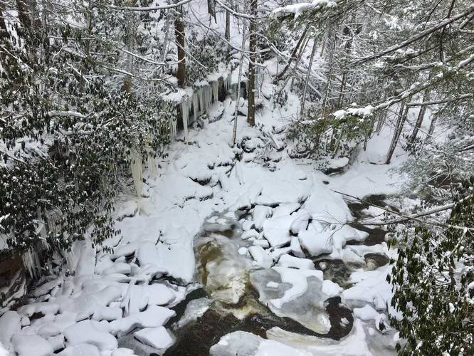
-
Elakala Falls - frozen
39.107119, -79.499572
-
Elakala Falls - frozen
39.107169, -79.499619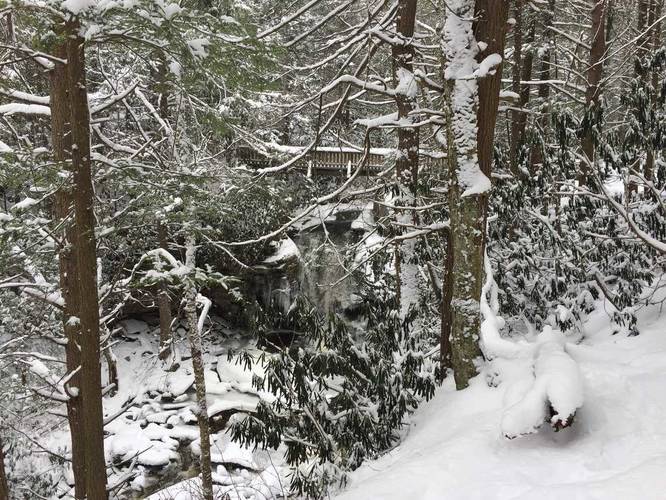
-
Elakala Falls - frozen
39.107169, -79.499619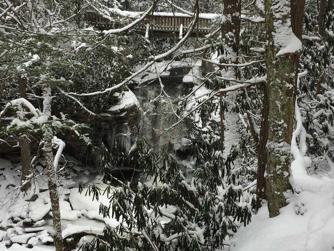
-
One of a few lookouts
39.108289, -79.500825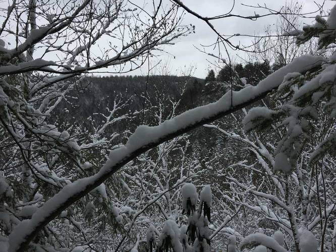
-
Take a left-hand turn to Blackwater Lodge Rd
39.108219, -79.500969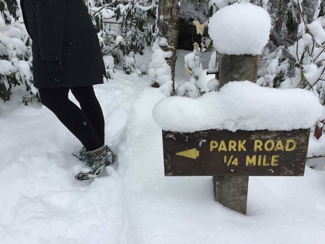
Hazards
Seasons
AllLoading...
Loading...
2 Trip Reports


Helpful Links
Find Hiking Trails Near Me:


Before you leave...
MyHikes is an indie web platform aimed to make exploring public trails easier for everyone. The site has no investors and is owned and operated by one person, Dave Miller (Founder & Admin). As the Founder, main contributor, and doer-of-all-things for MyHikes, I share my trips with over-detailed write-ups for fun on a volunteer basis and I believe that public trail information should be available to everyone.
It takes a lot of time 🕦, money 💰, and effort (including espresso shots ☕) to run MyHikes, including hiking , mapping , writing , and publishing new trails with high-quality content... along with building new features, moderating, site maintainance, and app development for iOS and Android . I simply ask that if you find MyHikes' trail guides helpful to please consider becoming a Supporter to help keep the site, iOS, and Android apps available to everyone.
Supporters unlock website and in-app perks with a one-time payment of $25 (you renew) 😎👍. Or you can simply make a Donation of your choice without a MyHikes user account. Otherwise, telling your friends about MyHikes is the next-best thing - both quick and free 🎉
Thanks for visiting MyHikes and have a great hike!️

Dave Miller
MyHikes Founder & Admin

