El Camino Del Mar Trail
Distance:
1.3 Miles / 2.1 kmType:
One-WayDifficulty:
EasyTime to Hike:
~39 minutesFeatures:
Surface Type:
Semi-PavedLoading...
Loading...
The El Camino Del Mar Trail at Lands End in San Francisco, California is an easy 1.3 mile one-way trail that runs parallel to the California Coastal Trail and is lightly-trafficked.
This trail technically runs along El Camino Del Mar Rd for about half of its length, but it's a good trail to use to get back to the parking area after hiking the California Coastal Trail at Lands End.
The trailhead can be found in one of a few different places - the trailhead listed here is on the eastern side, but you can also pick up the trail at the Lands End Overlook parking area or the USS Francisco parking area.
To find the unpaved section of the trail, simply follow the road west - all the way to the dead end. You'll pass through a parking lot before finding a yellow gate at the end of the road.
Lookout Points: Along the northwestern side of the trail, you'll get views of the ocean from high up on the cliffs, but the eastern side is mostly just woods.
-
Parking
37.780272, -122.511292 -
Main Trailhead
37.786354, -122.494054 -
Above Lands End Lookout
37.783914, -122.509086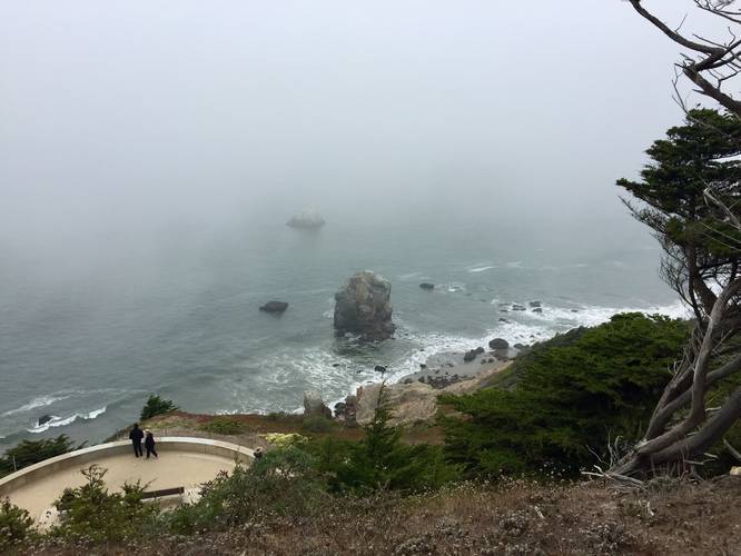
-
Trail sign just after dead end
37.784006, -122.504203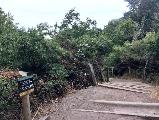
Hazards
Seasons
All
1 Trip Report


Helpful Links
Find Hiking Trails Near Me:


")
Before you leave...
MyHikes is an indie web platform aimed to make exploring public trails easier for everyone. The site has no investors and is owned and operated by one person, Dave Miller (Founder & Admin). As the Founder, main contributor, and doer-of-all-things for MyHikes, I share my trips with over-detailed write-ups for fun on a volunteer basis and I believe that public trail information should be available to everyone.
It takes a lot of time 🕦, money 💰, and effort (including espresso shots ☕) to run MyHikes, including hiking , mapping , writing , and publishing new trails with high-quality content... along with building new features, moderating, site maintainance, and app development for iOS and Android . I simply ask that if you find MyHikes' trail guides helpful to please consider becoming a Supporter to help keep the site, iOS, and Android apps available to everyone.
Supporters unlock website and in-app perks with a one-time payment of $25 (you renew) 😎👍. Or you can simply make a Donation of your choice without a MyHikes user account. Otherwise, telling your friends about MyHikes is the next-best thing - both quick and free 🎉
Thanks for visiting MyHikes and have a great hike!️

Dave Miller
MyHikes Founder & Admin

