Double Drainage Falls
Distance:
2.9 Miles / 4.7 kmType:
Out-and-BackDifficulty:
ModerateTime to Hike:
1 hour, ~27 minutesFeatures:
Surface Type:
DirtLoading...
Loading...
Double Drainage Falls at Tioga State Forest near Wellsboro, Pennsylvania is a moderate 2.9-mile out-and-back hike that features hillside scrambles to reach two off-trail waterfalls, unofficially named Double Drainage Falls North and Double Drainage Falls South.
Trails
This hike follows the Pine Creek Trail for most of the mileage.
Hike Description
This hike begins at the Darling Run parking area for the Pine Creek Trail. The trailhead listed is located further south from the parking lot, at a very small turnout, located near a yellow gate - starting here reduces the mileage a bit.
The GPS track leads down the Pine Creek Trail for approximately 1.25-miles before reaching Double Drainage Falls, which are located off-trail and up the steep hillsides of the Pine Creek Gorge (Pennsylvania Grand Canyon).
Double Drainage Falls North - Mile 1.25
At mile 1.25, hikers will find the seasonal drainage creek spilling down the mountain - during this trip it was totally frozen! The hillside scramble to reach the bottom of this waterfall is not very long, approximately 60-feet. The GPS recording heads up the waterfall's small cascades within this drainage creek for about 50-feet or so before turning back. During this trip, my crampons did not feel safe enough to continue up the steep hillside waterfall on slick ice.
Double Drainage Falls South - Mile 1.4 to 1.5
Located about 100-feet south of the first waterfall, around mile 1.4 (including the climb to Double Drainage Falls North), hikers will begin their scramble uphill toward Double Drainage Falls South - a 7-foot waterfall. The scramble uphill is not easy - using your hands to keep yourself steady - but is do-able nonetheless. Just as you approach the main cascade, hikers will find an old logging grade (what appears to be a trail) that runs just below the waterfall. This old log slide was a unique find after scrambling 200-feet up the hillside. Around mile 1.5, hikers will find Double Drainage Falls South cascading over a rock ledge that protrudes out from the hillside at about 10-feet wide and 7-feet tall.
Hiking Out
Be careful hiking down from each waterfall as the hillside elevation grade is very steep. It's recommended to bring trekking poles any time of the year, but include ice spikes, crampons, and potentially an ice axe for colder months.
Waterfalls
This hike leads to two off-trail seasonal waterfalls that cascade down the canyon's slopes nicknamed Double Drainage Falls - North and South. The waterfall to the north (Double Drainage Falls North) can be found approximately 60-feet uphill from the Pine Creek Trail and is at least 60 to 80-feet tall as it cascades down the canyon in a multitude of very small waterfalls ranging between 2 to 6-feet tall. The waterfall to the south (Double Drainage Falls South) is located much further up the hillside (about 200-feet) along a much steeper scramble. Double Drainage Falls South is about 7-feet tall and no more than 10-feet wide.
Pets
Dogs are allowed if leashed and their waste should be carried out by the hiker.
Hazards
Steep hillsides, potential ice (in colder months), and Timber Rattlesnakes during the warmer months are all hazards hikers should be aware of before hiking this.
Parking
Hikers will find parking at the Darling Run parking area for the Pine Creek Trail at the coordinates provided.
-
Parking
41.736452, -77.428688 -
Main Trailhead
41.733757, -77.428266 -
Double Drainage Falls North - approx. 80-feet. Frozen in Jan 2022
41.719733, -77.441681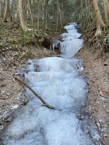
-
Double Drainage Falls South - approx. 7-feet tall
41.719097, -77.441497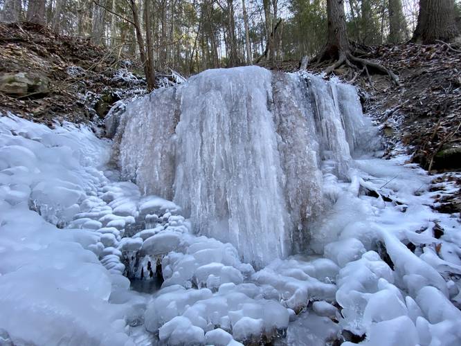
-
Waterfall
41.719706, -77.441628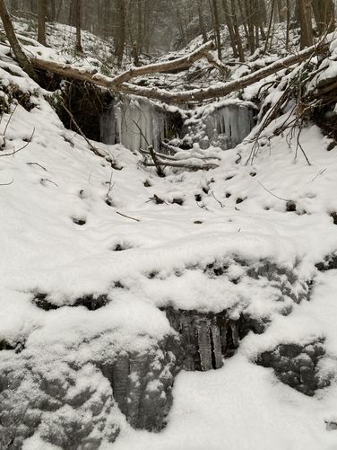
-
Waterfall
41.719383, -77.441194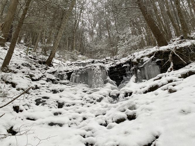
-
Waterfall
41.719356, -77.441117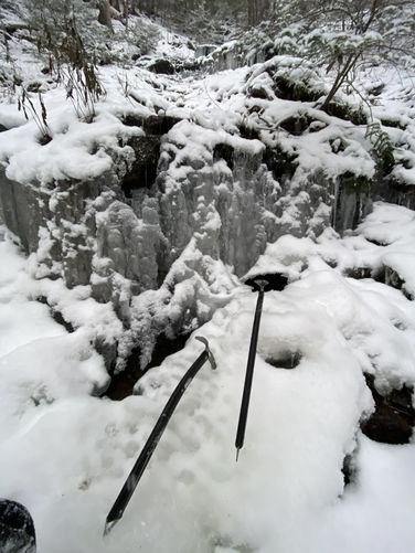
-
Waterfall
41.719283, -77.441064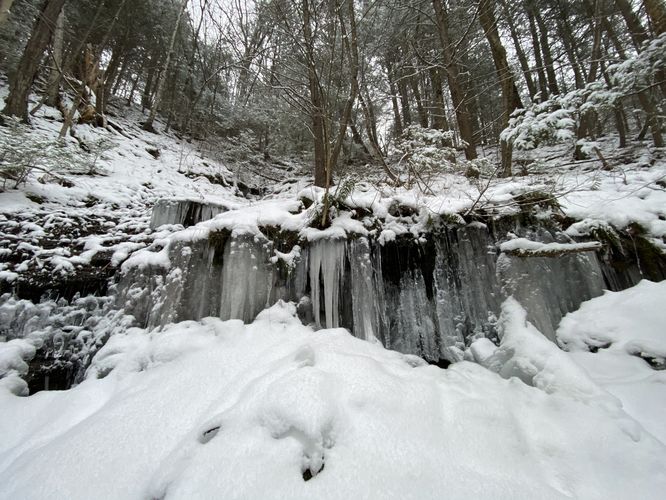
-
View Trail Map
Hiker: Admin (David Miller)Hiked on: January 19, 2024Distance: 2.8 miles / 4.5 km
Hazards
Seasons
All

2 Trip Reports


Helpful Links
Find Hiking Trails Near Me:


")

Before you leave...
MyHikes is an indie web platform aimed to make exploring public trails easier for everyone. The site has no investors and is owned and operated by one person, Dave Miller (Founder & Admin). As the Founder, main contributor, and doer-of-all-things for MyHikes, I share my trips with over-detailed write-ups for fun on a volunteer basis and I believe that public trail information should be available to everyone.
It takes a lot of time 🕦, money 💰, and effort (including espresso shots ☕) to run MyHikes, including hiking , mapping , writing , and publishing new trails with high-quality content... along with building new features, moderating, site maintainance, and app development for iOS and Android . I simply ask that if you find MyHikes' trail guides helpful to please consider becoming a Supporter to help keep the site, iOS, and Android apps available to everyone.
Supporters unlock website and in-app perks with a one-time payment of $25 (you renew) 😎👍. Or you can simply make a Donation of your choice without a MyHikes user account. Otherwise, telling your friends about MyHikes is the next-best thing - both quick and free 🎉
Thanks for visiting MyHikes and have a great hike!️

Dave Miller
MyHikes Founder & Admin

