Dolly Sods Scenic Lookout
Distance:
0.2 Miles / 0.3 kmType:
Out-and-BackDifficulty:
EasyTime to Hike:
~6 minutesFeatures:
Surface Type:
DirtLoading...
Loading...
This short lookout trail at the Dolly Sods Scenic Area is an easy 0.2 mile out-and-back walk to a quiet lookout point along FR-75, south of the Red Creek Campground.
The trail leads out to the edge of the Allegheny Plateau, called the Allegheny Front. The Allegheny Front is a ridge that stretches from New York to Tennessee, which influences water flow and climate.
From the end of the trail you'll find a lookout point where the trail ends with views of North Fork Mountain straight ahead. You can continue on the boulders to get a better view.
While this trail and lookout is not as popular as the Bear Rocks Preservation Trail, there tend to be a lot less people.
Parking: Parking can be found along FR-75 south of the Red
Creek Campground and north of FR-19. Look for a brown sign with a
lookout symbol.
Warning: Dolly Sods was used for military bombing training during
WWII and there are still unexploded ordinances in the ground out in the
wilderness. Most of these trails and the surrounding area have been
combed and searched, but not everything has been found. If you find any
strange metal objects, especially bomb-shaped, do not tamper with them.
Make a note of where you found it and alert the proper authorities. More
information can be found at the wilderness trailheads.
Dolly Sods trail map PDF
Hazards
Seasons
All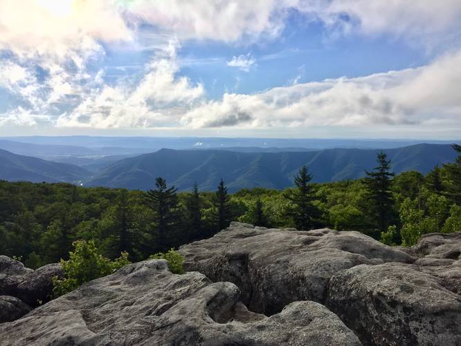

2 Trip Reports


Before you leave...
MyHikes is an indie web platform aimed to make exploring public trails easier for everyone. The site has no investors and is owned and operated by one person, Dave Miller (Founder & Admin). As the Founder, main contributor, and doer-of-all-things for MyHikes, I share my trips with over-detailed write-ups for fun on a volunteer basis and I believe that public trail information should be available to everyone.
It takes a lot of time 🕦, money 💰, and effort (including espresso shots ☕) to run MyHikes, including hiking , mapping , writing , and publishing new trails with high-quality content... along with building new features, moderating, site maintainance, and app development for iOS and Android . I simply ask that if you find MyHikes' trail guides helpful to please consider becoming a Supporter to help keep the site, iOS, and Android apps available to everyone.
Supporters unlock website and in-app perks with a one-time payment of $25 (you renew) 😎👍. Or you can simply make a Donation of your choice without a MyHikes user account. Otherwise, telling your friends about MyHikes is the next-best thing - both quick and free 🎉
Thanks for visiting MyHikes and have a great hike!️

Dave Miller
MyHikes Founder & Admin

