Dolly Sods Loop
Distance:
7.0 Miles / 11.3 kmType:
LoopDifficulty:
ModerateTime to Hike:
3 hours, ~30 minutesFeatures:
Surface Type:
DirtLoading...
Loading...
This moderate 7 mile loop trail brings you through the Dolly Sods Wilderness on 3 different trails: Bear Rocks Trail (TR522), Dobbin Grade Trail (TR526), and Raven Ridge Trail (TR521).
The trip starts off along the Bear Rocks Trail which heads downhill from the parking lot. Shortly after you reach the bottom of the hill, the trail heads back uphill and then back down again to the trail junction with the Dobbin Grade Trail (TR526). From here you have two options - either follow the Dobbin Grade Trail south towards Red Creek or continue along the Bear Rocks Trail and head west. The GPS track provided heads south first, but you'll find more filterable water along the Dobbin Grade Trail than you will along the Raven Ridge or western portion of the Bear Rocks Trail. If you continue along the Bear Rocks Trail, Red Creek passes through a popular camping area just beyond the first trail junction; however, the campsites are close together.
If you head south along the Dobbin Grade Trail, you'll find plenty of campsites tucked away in conifer groves directly on the trail. Eventually the trail opens up to large open fields - this is where Red Creek tends to flood and this area can be very wet during rainy seasons. After you cross Red Creek (southern tip of the GPS data provided), you'll hike west and hit the Raven Ridge Trail after about 0.1 or 0.2 miles.
Upon reaching the Raven Ridge Trail, there will be more campsites along the northern hill - follow the GPS data to a hidden campsite tucked away further from the rest.
Hiking north on the Raven Ridge Trail is a bit more moderate as it's mostly uphill from where you leave Red Creek. There are more campsites along Raven Ridge as well. You'll eventually come to a trail junction with the Bear Rocks Trail - take this right-hand turn to head back to parking.
Views/Scenery: You'll be amazed by the scenery and views of Dolly Sods, even on the flat parts of the trail. It's one of the most unique places on the east coast and often resembles the landscapes of Yellowstone. Dolly Sods also provides some of the darkest night skies on the east coast, so it makes for a great place to shoot the Milky Way.
Camping: There are numerous predefined campsites along all of the trails here, so camping is made easy; however, beware that hillsides may look like they're camp-able, but really aren't. You'll often notice a 'nice spot' on a hill that you want to camp on and assume the hill is covered in grass - this is usually not the case.
Note: in the southern section of the GPS data where the Raven Ridge Trail heads north, we hiked beyond the trail in search of a campsite, which can be found on the map via picture markers. There's technically no trail that leads up to this campsite. In the southeastern section of the GPS data is a spur trail that heads up a hill - this is not any predefined trail, this was a venture to see if the hillside was camp-able. It was not.
Hazards: Dolly Sods was used as a bombing training ground during WWII and people have discovered live rounds. If you see any, do not touch or temper with them. Make note of where you found it and alert authorities when you're back in civilization. Chances are you won't come across any of these.
Dolly Sods Trail Map PDF
-
Parking
39.063972, -79.302917 -
Main Trailhead
39.063726, -79.303091 -
Looking north along the Raven Ridge Trail
39.059075, -79.33787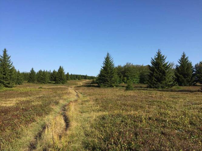
-
View / Overlook / Vista
39.064281, -79.331644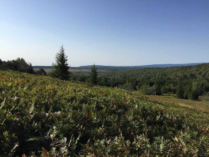
-
View looking east along the Dobbin Grade Trail
39.046622, -79.336508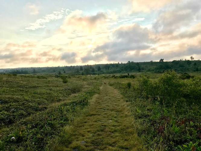
-
Red Creek crossing and water source
39.046875, -79.335206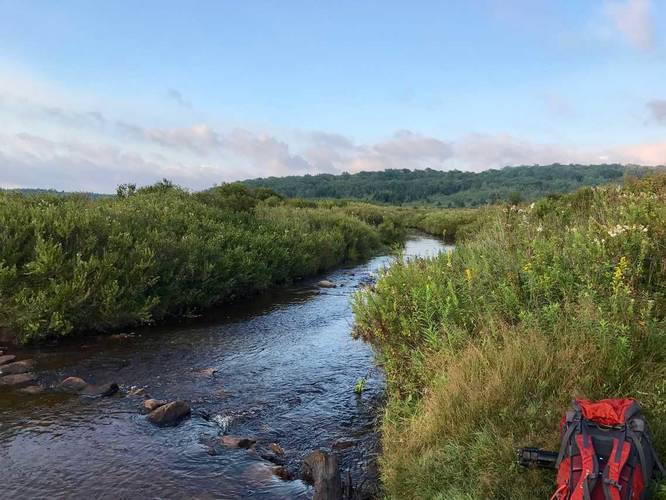
-
View of Red Creek
39.058431, -79.320525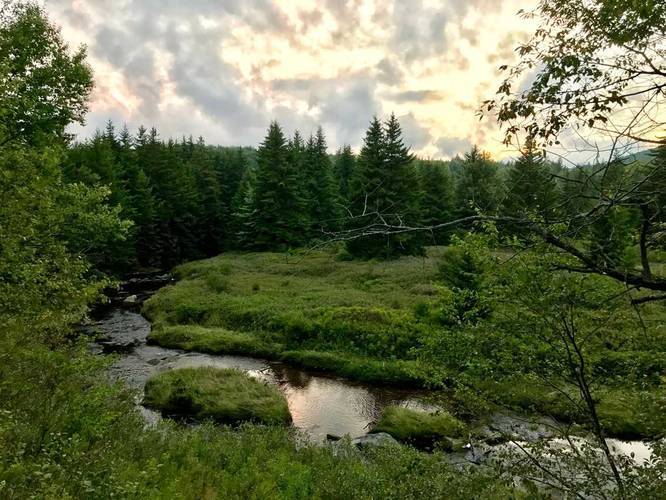
-
Campsite
39.048897, -79.337111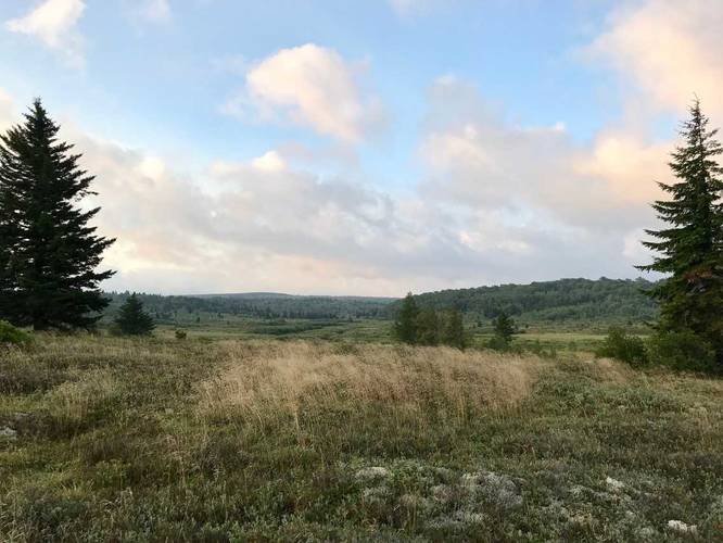
-
Campsite
39.050522, -79.337875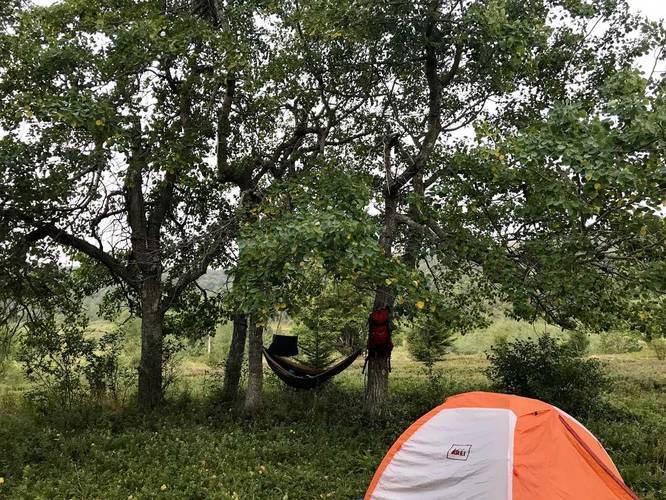
Hazards
Seasons
All


2 Trip Reports


")


Before you leave...
MyHikes is an indie web platform aimed to make exploring public trails easier for everyone. The site has no investors and is owned and operated by one person, Dave Miller (Founder & Admin). As the Founder, main contributor, and doer-of-all-things for MyHikes, I share my trips with over-detailed write-ups for fun on a volunteer basis and I believe that public trail information should be available to everyone.
It takes a lot of time 🕦, money 💰, and effort (including espresso shots ☕) to run MyHikes, including hiking , mapping , writing , and publishing new trails with high-quality content... along with building new features, moderating, site maintainance, and app development for iOS and Android . I simply ask that if you find MyHikes' trail guides helpful to please consider becoming a Supporter to help keep the site, iOS, and Android apps available to everyone.
Supporters unlock website and in-app perks with a one-time payment of $25 (you renew) 😎👍. Or you can simply make a Donation of your choice without a MyHikes user account. Otherwise, telling your friends about MyHikes is the next-best thing - both quick and free 🎉
Thanks for visiting MyHikes and have a great hike!️

Dave Miller
MyHikes Founder & Admin

