DOC Trail
Distance:
1.0 Mile / 1.6 kmType:
Out-and-BackDifficulty:
EasyTime to Hike:
~30 minutesFeatures:
Surface Type:
DirtLoading...
Loading...
The DOC Trail at the Mount Tom State Reservation in Holyoke, Massachusetts is an easy 1-mile one-way trail that features a quiet walk through the forest near Whiting Peak.
This trailhead is located along the Tote Road Trail, just south of the summit of Whiting Peak on the the southern portion of the range. The DOC Trail heads up the mountain at a gradual elevation grade before continuing northeast, heading down the mountain, when it reaches the Metacomet-Monadnock Trail (M & M Trail) near Whiting Peak.
The DOC Trail connects easily to the Middle Loop Trail near the southern trailhead and in the northeast it meets up with the Quarry Trail and Keystone Trail.
Pets
Dogs are allowed if leashed and their waste must be carried out by the hiker.
Parking
Please
note that the parking coordinates will bring hikers to the entrance to
the southeastern section to the Mount Tom State Reservation. Depending
on the time of year, this road can be closed up to a certain point to
motorized vehicles. Hikers will find parking down this road, but how far
is unpredictable - so plan on hiking down Mt Tom Ski Road until you
reach the end of this trek to hike in the opposite direction.
-
Parking
42.24205, -72.629948 -
Main Trailhead
42.255457, -72.640751 -
Vista point - not on the DOC Trail but leads up to it
42.25285, -72.635772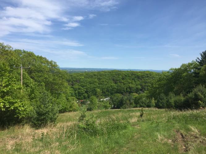
-
Vista point - not on the DOC Trail but leads up to it
42.252183, -72.63465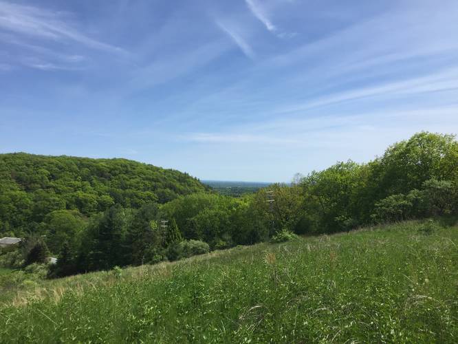
Hazards
Seasons
AllBlaze Dot
1 Trip Report


Helpful Links
Find Hiking Trails Near Me:


Before you leave...
MyHikes is an indie web platform aimed to make exploring public trails easier for everyone. The site has no investors and is owned and operated by one person, Dave Miller (Founder & Admin). As the Founder, main contributor, and doer-of-all-things for MyHikes, I share my trips with over-detailed write-ups for fun on a volunteer basis and I believe that public trail information should be available to everyone.
It takes a lot of time 🕦, money 💰, and effort (including espresso shots ☕) to run MyHikes, including hiking , mapping , writing , and publishing new trails with high-quality content... along with building new features, moderating, site maintainance, and app development for iOS and Android . I simply ask that if you find MyHikes' trail guides helpful to please consider becoming a Supporter to help keep the site, iOS, and Android apps available to everyone.
Supporters unlock website and in-app perks with a one-time payment of $25 (you renew) 😎👍. Or you can simply make a Donation of your choice without a MyHikes user account. Otherwise, telling your friends about MyHikes is the next-best thing - both quick and free 🎉
Thanks for visiting MyHikes and have a great hike!️

Dave Miller
MyHikes Founder & Admin

