Deadman Trail
Distance:
2.7 Miles / 4.3 kmType:
Out-and-BackDifficulty:
EasyTime to Hike:
1 hour, ~21 minutesFeatures:
Surface Type:
DirtLoading...
Loading...
The Deadman Trail at Tioga State Forest in Shippen Township is an easy 2.7-mile out-and-back trail that runs adjacent to the Deadman Hollow Run Trail and along the mountainside. This trail does not have much to see, but during the colder months when no leaves are on the trees, hikers will get glimpses of the surrounding mountain ranges.
The trail begins at the yellow and black service gate and follows the wide trail, mostly heading downhill the whole time, through the forest and along the mountainside. The trail has several sections of overgrowth that have not yet been chopped down - these are mostly smaller coniferous trees that often make it look like the trail ends. Hikers can push past these small trees to continue on the trail.
Several sections of the hike include large areas of evergreens, but most of the trail follows a mixed forest of deciduous trees and conifers.
Hikers will essentially reach the "end" of this trail when they reach the larger clear-cut area, located about 1.2 to 1.3-miles from the parking lot. The trail technically continues on from here, as does this GPS track, but it's not clear where the trail truly ends or if it connects with any of the neighboring trails.
The hike back to parking is more difficult than the hike to the clear-cut area, but it's still an easy hike because of the gradual elevation grade.
Parking
Parking can be found at the coordinates provided. The turnout is large enough for a few cars. Do not block the yellow access gate. Hikers will also find that the Deadman Hollow Run Trail leads up to this parking lot; however, that trail (blue blazes) is not easy to follow from this parking lot because of the lack of blazes.
Pets
Dogs are allowed if leashed.
Vistas
There's really no true vista point here because of the trees; however, hikers will find some obstructed views of the surrounding mountain ranges during colder months.
Winter Road Conditions
Tioga State Forest does not maintain this road during the
winter. Do not attempt driving on this road without proper equipment
including snow tires and/or chains unless the road is clear. High wind
storms may also cause trees to fall across the road, making the road
impassible. If you plan to visit during the winter, plan accordingly.
-
Parking
41.723272, -77.485503 -
Main Trailhead
41.723183, -77.486096 -
Obstructed vista point
41.737797, -77.492561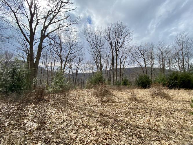
Hazards
Seasons
All
1 Trip Report


Helpful Links
Find Hiking Trails Near Me:


Before you leave...
MyHikes is an indie web platform aimed to make exploring public trails easier for everyone. The site has no investors and is owned and operated by one person, Dave Miller (Founder & Admin). As the Founder, main contributor, and doer-of-all-things for MyHikes, I share my trips with over-detailed write-ups for fun on a volunteer basis and I believe that public trail information should be available to everyone.
It takes a lot of time 🕦, money 💰, and effort (including espresso shots ☕) to run MyHikes, including hiking , mapping , writing , and publishing new trails with high-quality content... along with building new features, moderating, site maintainance, and app development for iOS and Android . I simply ask that if you find MyHikes' trail guides helpful to please consider becoming a Supporter to help keep the site, iOS, and Android apps available to everyone.
Supporters unlock website and in-app perks with a one-time payment of $25 (you renew) 😎👍. Or you can simply make a Donation of your choice without a MyHikes user account. Otherwise, telling your friends about MyHikes is the next-best thing - both quick and free 🎉
Thanks for visiting MyHikes and have a great hike!️

Dave Miller
MyHikes Founder & Admin

