Darling Run Falls
Distance:
1.7 Miles / 2.7 kmType:
Out-and-BackDifficulty:
ModerateTime to Hike:
~51 minutesFeatures:
Surface Type:
DirtLoading...
Loading...
The Darling Run Falls hike at Tioga State Forest in Wellsboro, Pennsylvania is a moderate 1.7-mile out-and-back hike that leads down Darling Run creek out to a small two-tiered waterfall, Darling Run Falls.
This hike follows a creek most of the way, so hikers must either get their feet wet, wear waders, or both in order to reach the waterfall. During the late Spring, the creek is much more shallow allowing hikers to meander up Darling Run creek to reach the waterfall without getting soaking wet.
The hike begins at the end of Forest Road next to the Darling Run parking area for the Pine Creek Trail and follows the Pine Creek Trail for approximately 0.2-miles before reaching Darling Run.
Once at Darling Run, hike down the small embankment to the creek below and begin your hike upstream. The hike upstream is moderate because of the loose and slippery rocks, which can make this trek more dangerous. This upstream hike lasts for approximately 0.5 miles while passing blowdown trees, loose and slippery rocks, and eventually a bedrock creek bottom. Along the way lies an old home foundation and a lesser-known backcountry campsite.
Old Home Foundation
Around mile 0.3, from parking, or less than 0.1-miles from the Pine Creek Trail, hikers will find an old abandoned home foundation. This old foundation is mostly visible when the leaves are off of the trees. Hikers heading upstream, in the creek, may not notice this small piece of history tucked away just off-trail, so be on the lookout.
As you hike up to Darling Run, hikers will notice a fork in the creek - look to the creek on your right-hand side and you'll find Lower Darling Run Falls cascading down this tributary creek. At Darling Run Falls, if the water level is low enough, hikers can make their way up the Lower tier of the waterfall and hike over to the Upper tier.
Darling Run Falls
This two-tiered waterfall can be found approximately 0.5-miles upstream from where hikers leave the Pine Creek Trail. The Lower Darling Run Falls is a multi-tiered waterfall that cascades down about 8-feet in total. The Upper Darling Run Falls is a single-tier waterfall that's approximately 6-feet tall. Neither waterfall is all that scenic, but it's a nice spot tucked away in the woods of Tioga State Forest that sees very little foot-traffic.
Parking
Hikers can find parking at the coordinates provided at the Pine Creek Trail Darling Run parking area. There's enough parking to fit several dozen cars.
Pets
Dogs are allowed if leashed and their waste must be carried out by the hiker.
Warnings
Rattlesnakes: While rare, the Timber Rattlesnake lives in this area and tends to come down to
creeks to cool down or hunt between the end of April through the end of
September. Watch your step and give any rattlesnake you see some space.
History - Native American Footpath
According to the Guide to the Historical Markers of Tioga County, this trail actually follows one branch of an ancient Seneca trail, Pine Creek Path, which was used by the Seneca tribe to connect Genesee River to Susquehanna River down in Jersey Shore, PA. This section of the trail used to connect Pine Creek to Babb Creek, using Darling Run as part of the route.
-
Parking
41.733714, -77.42835 -
Main Trailhead
41.733617, -77.428265 -
Campsite
41.727047, -77.423109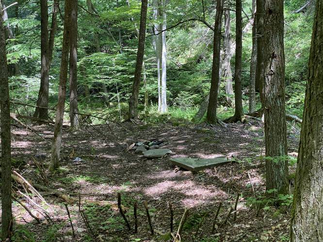
-
Lower Darling Run Falls
41.726356, -77.423103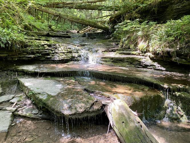
-
Upper Darling Run Falls
41.726156, -77.423356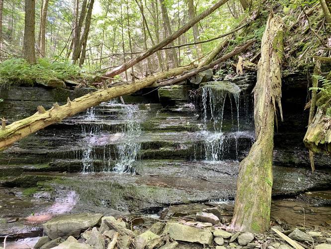
-
Old foundation
41.730042, -77.427528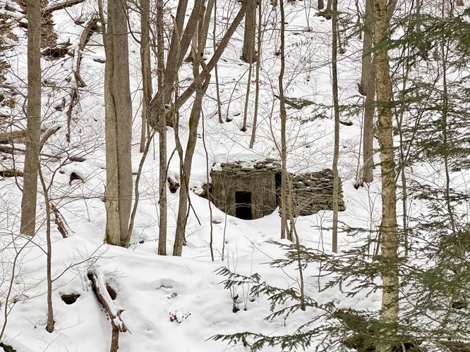
Hazards
Seasons
All

2 Trip Reports


Helpful Links
Find Hiking Trails Near Me:


Before you leave...
MyHikes is an indie web platform aimed to make exploring public trails easier for everyone. The site has no investors and is owned and operated by one person, Dave Miller (Founder & Admin). As the Founder, main contributor, and doer-of-all-things for MyHikes, I share my trips with over-detailed write-ups for fun on a volunteer basis and I believe that public trail information should be available to everyone.
It takes a lot of time 🕦, money 💰, and effort (including espresso shots ☕) to run MyHikes, including hiking , mapping , writing , and publishing new trails with high-quality content... along with building new features, moderating, site maintainance, and app development for iOS and Android . I simply ask that if you find MyHikes' trail guides helpful to please consider becoming a Supporter to help keep the site, iOS, and Android apps available to everyone.
Supporters unlock website and in-app perks with a one-time payment of $25 (you renew) 😎👍. Or you can simply make a Donation of your choice without a MyHikes user account. Otherwise, telling your friends about MyHikes is the next-best thing - both quick and free 🎉
Thanks for visiting MyHikes and have a great hike!️

Dave Miller
MyHikes Founder & Admin

