Cranesville Swamp Loop Trail
Distance:
0.4 Miles / 0.6 kmType:
LoopDifficulty:
EasyTime to Hike:
~12 minutesFeatures:
Surface Type:
BoardwalkLoading...
Loading...
The Loop Trail at the Cranesville Swamp Natural Area in Terra Alta, West Virginia is an easy 0.4 mile hike that leads into the wetlands of the park with awesome views surrounding you. This is likely one of the best trails in the park since the trail lies within a large valley, so you get views of the hills around you, but you also get a variety of plant life too.
The trail is fairly unique in that half of it is a boardwalk that runs above the wetland and half runs along the dirt outside of the wetland area. Back on the dirt portion of the trail, you'll pass through a grove of coniferous trees before heading back into the deciduous forest.
In order to get to this trail you need to hike in on the Blue Trail, Orange Trail, or White Trail (not mapped on MyHikes yet).
Note mud and water conditions: Since the trail passes through wetlands, it can be muddy in certain areas. Some areas of the boardwalk can be flooded after it rains too - which is usually an inch or to of water. You can get by the flooding with proper footwear or you can walk along the edge of the boardwalk which usually sits flush with the waterline during high water.
Dogs are allowed on this trail.
-
Parking
39.531849, -79.485613 -
Main Trailhead
39.534888, -79.483392 -
Trailhead with view of the swamp and neighboring hills
39.534931, -79.483375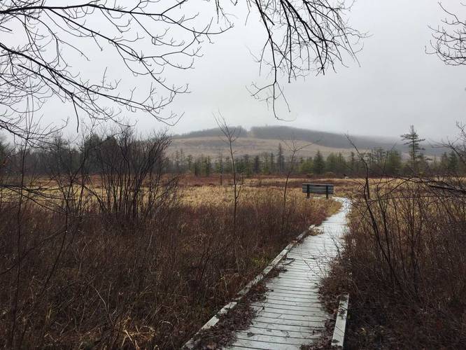
-
View of the swamp and neighboring hills
39.534919, -79.483047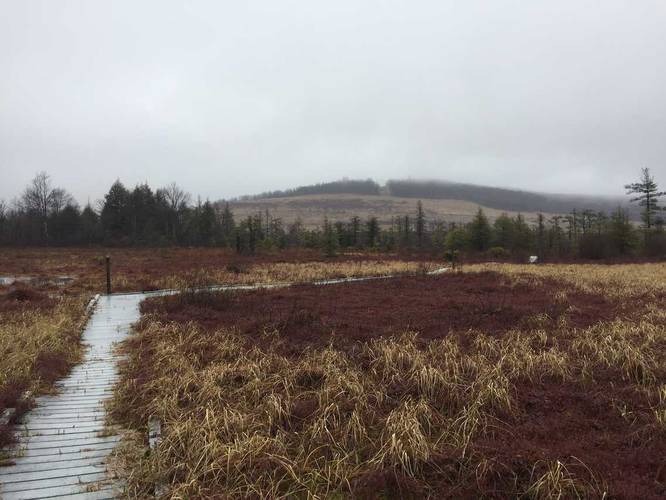
Hazards
Seasons
All
2 Trip Reports


Helpful Links
Find Hiking Trails Near Me:


Before you leave...
MyHikes is an indie web platform aimed to make exploring public trails easier for everyone. The site has no investors and is owned and operated by one person, Dave Miller (Founder & Admin). As the Founder, main contributor, and doer-of-all-things for MyHikes, I share my trips with over-detailed write-ups for fun on a volunteer basis and I believe that public trail information should be available to everyone.
It takes a lot of time 🕦, money 💰, and effort (including espresso shots ☕) to run MyHikes, including hiking , mapping , writing , and publishing new trails with high-quality content... along with building new features, moderating, site maintainance, and app development for iOS and Android . I simply ask that if you find MyHikes' trail guides helpful to please consider becoming a Supporter to help keep the site, iOS, and Android apps available to everyone.
Supporters unlock website and in-app perks with a one-time payment of $25 (you renew) 😎👍. Or you can simply make a Donation of your choice without a MyHikes user account. Otherwise, telling your friends about MyHikes is the next-best thing - both quick and free 🎉
Thanks for visiting MyHikes and have a great hike!️

Dave Miller
MyHikes Founder & Admin

