Connecting Channel Overlook
Distance:
0.1 Miles / 0.2 kmType:
Out-and-BackDifficulty:
EasyTime to Hike:
~5 minutesFeatures:
Surface Type:
Paved
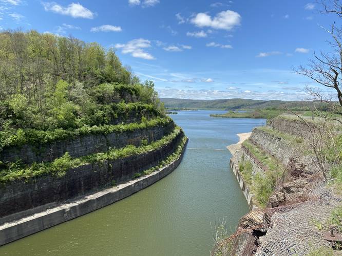
The Connecting Channel Overlook at Tioga-Hammond Lakes Recreation Area in Tioga, Pennsylvania is an easy 0.1-mile out-and-back paved path that leads to an overlook high above the Tioga Lake water channel with views of both Tioga Lake and Hammond Lake.
These two lakes, technically reservoirs, are connected by this channel to keep clean water flowing into Tioga Lake from Hammond Lake. Since Tioga Lakes receives its water from various upstream acid drains from old mines, Hammond Lakes' channel provides a way to mix in cleaner water to help promote better aquatic life in both the reservoir and downstream rivers.
Parking
Visitors can find parking at the coordinates provided.
Accommodations
Restrooms can be found at the parking lot.
Pets
Dogs are allowed if leashed and their waste must be carried out by the hiker.
-
Parking
41.89708, -77.141647 -
Main Trailhead
41.896986, -77.141453 -
Tioga Lake and channel
41.896397, -77.141359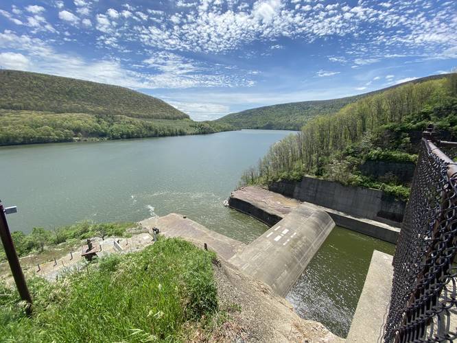
Hazards
Seasons
AllLoading...
Loading...
2 Trip Reports


Before you leave...
MyHikes is an indie web platform aimed to make exploring public trails easier for everyone. The site has no investors and is owned and operated by one person, Dave Miller (Founder & Admin). As the Founder, main contributor, and doer-of-all-things for MyHikes, I share my trips with over-detailed write-ups for fun on a volunteer basis and I believe that public trail information should be available to everyone.
It takes a lot of time 🕦, money 💰, and effort (including espresso shots ☕) to run MyHikes, including hiking , mapping , writing , and publishing new trails with high-quality content... along with building new features, moderating, site maintainance, and app development for iOS and Android . I simply ask that if you find MyHikes' trail guides helpful to please consider becoming a Supporter to help keep the site, iOS, and Android apps available to everyone.
Supporters unlock website and in-app perks with a one-time payment of $25 (you renew) 😎👍. Or you can simply make a Donation of your choice without a MyHikes user account. Otherwise, telling your friends about MyHikes is the next-best thing - both quick and free 🎉
Thanks for visiting MyHikes and have a great hike!️

Dave Miller
MyHikes Founder & Admin

