Cliff Trail
Distance:
0.8 Miles / 1.3 kmType:
Out-and-BackDifficulty:
EasyTime to Hike:
~24 minutesFeatures:
Surface Type:
DirtLoading...
Loading...
The Cliff Trail at Dick & Nancy Eales Preserve at Moosic Mountain near Jessup, Pennsylvania is an easy 0.8-mile out-and-back trail that leads to a rocky cliff view point.
This trail sits on the south side of the nature preserve and gives hikers access to the Heath Barrens Trail which sits about half-way between the parking lot and the cliff . The trail is mostly flat and follows a well-beaten path along mountain laurel and other low-growing shrubs.
Parking
Hikers will find a large parking lot at the coordinates provided. The lot is large enough to fit about a dozen vehicles as of May 2021.
Pets
Dogs are allowed if leashed and their waste must be carried out by the hiker.
Blaze Color
This trail follows purple blazes as of May 2021.
About the Heath Barrens
The Moosic Mountain heath barrens
are made up of stunted pine and oak forests that are dominated by
low-growing shrubs like blueberry, huckleberry, rhodora, and others
species that affect an entire ecosystem of wildlife including birds,
butterflies, deer, bear, and other native animals to Pennsylvania.
Additionally, the globally-rare swallow moth and barrens buckmoth call
this area home.
In 2001, The Nature Conservancy purchased 1,200
acres in the center of Moosic Mountain that were previously designated
for development. With this purchase, TNC was able to protect this rare
natural ecosystem.
In 2009, TNC named the preserve after Dick and
Nancy Eales, whose generosity has allowed the expansion of the
preserve, which today encompasses around 2,250 acres.
-
Parking
41.430312, -75.527066 -
Main Trailhead
41.430113, -75.526818 -
View along Cliff Trail
41.427167, -75.531836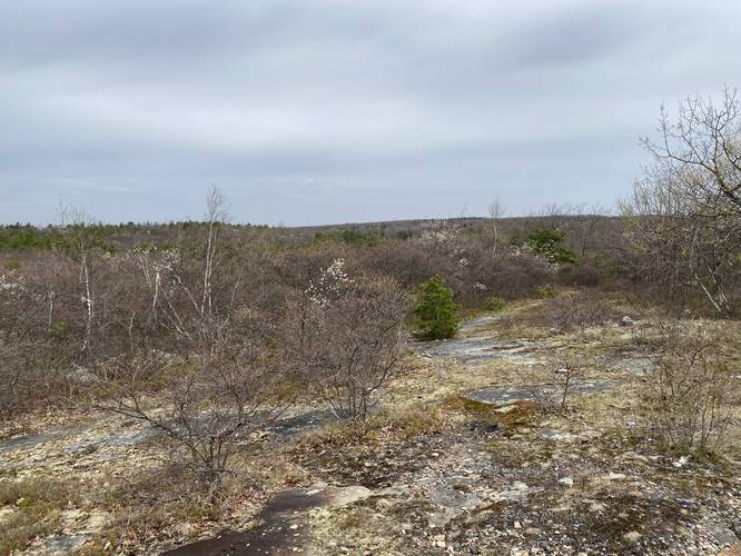
Hazards
Seasons
AllBlaze Color
1 Trip Report


Before you leave...
MyHikes is an indie web platform aimed to make exploring public trails easier for everyone. The site has no investors and is owned and operated by one person, Dave Miller (Founder & Admin). As the Founder, main contributor, and doer-of-all-things for MyHikes, I share my trips with over-detailed write-ups for fun on a volunteer basis and I believe that public trail information should be available to everyone.
It takes a lot of time 🕦, money 💰, and effort (including espresso shots ☕) to run MyHikes, including hiking , mapping , writing , and publishing new trails with high-quality content... along with building new features, moderating, site maintainance, and app development for iOS and Android . I simply ask that if you find MyHikes' trail guides helpful to please consider becoming a Supporter to help keep the site, iOS, and Android apps available to everyone.
Supporters unlock website and in-app perks with a one-time payment of $25 (you renew) 😎👍. Or you can simply make a Donation of your choice without a MyHikes user account. Otherwise, telling your friends about MyHikes is the next-best thing - both quick and free 🎉
Thanks for visiting MyHikes and have a great hike!️

Dave Miller
MyHikes Founder & Admin

