Chimney Rock View
Distance:
0.4 Miles / 0.6 kmType:
Out-and-BackDifficulty:
EasyTime to Hike:
~12 minutesFeatures:
Surface Type:
DirtLoading...
Loading...
The Chimney Rock View at Capitol Reef National Park near Fruita, Utah is an easy 0.4-mile out-and-back hike that leads to an off-trail viewpoint of Chimney Rock.
Trails
This hike follows the Chimney Rock Trail.
Hike Description
This very short hike begins at the main parking lot for Capitol Reef National Park's Chimney Rock Trail and follows the trail in for approximately 0.15-miles. Along the way are nice views of the surrounding area as the trail slowly ascends small hills as it makes its way northeast to reach larger uphill climbs. This hike doesn't hit any difficult ascents and instead veers off-trail around mile 0.15 to then hike up a small reef (rock barrier) to reach a beautiful view of Chimney Rock. From the top of this dirt mount / reef, hikers will get a nice view of Chimney Rock without simply just stepping outside of your car. This view, arguably, is much nicer at sunrise when the light is shining behind Chimney Rock.
Parking
Hikers will find a medium-sized parking lot at the coordinates provided, which is large enough to fit less than a dozen vehicles. There's some overflow parking for hikers along the dirt portions of the parking lot.
Pets
Dogs are not allowed on this trail.
-
Parking
38.315559, -111.304142 -
Main Trailhead
38.315634, -111.304068 -
View of Chimney Rock at Capitol Reef National Park
38.317203, -111.302147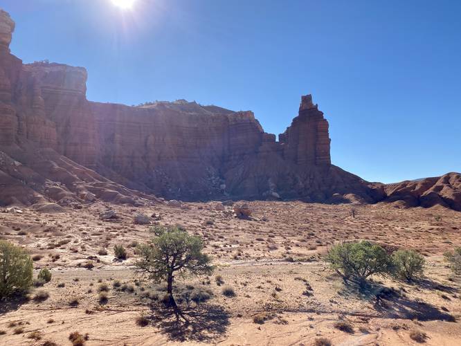
-
View of Chimney Rock at Capitol Reef National Park (from road)
38.312564, -111.301033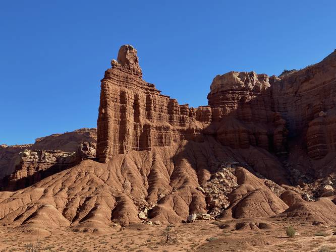
Hazards
Seasons
All
1 Trip Report


Helpful Links
Find Hiking Trails Near Me:


Before you leave...
MyHikes is an indie web platform aimed to make exploring public trails easier for everyone. The site has no investors and is owned and operated by one person, Dave Miller (Founder & Admin). As the Founder, main contributor, and doer-of-all-things for MyHikes, I share my trips with over-detailed write-ups for fun on a volunteer basis and I believe that public trail information should be available to everyone.
It takes a lot of time 🕦, money 💰, and effort (including espresso shots ☕) to run MyHikes, including hiking , mapping , writing , and publishing new trails with high-quality content... along with building new features, moderating, site maintainance, and app development for iOS and Android . I simply ask that if you find MyHikes' trail guides helpful to please consider becoming a Supporter to help keep the site, iOS, and Android apps available to everyone.
Supporters unlock website and in-app perks with a one-time payment of $25 (you renew) 😎👍. Or you can simply make a Donation of your choice without a MyHikes user account. Otherwise, telling your friends about MyHikes is the next-best thing - both quick and free 🎉
Thanks for visiting MyHikes and have a great hike!️

Dave Miller
MyHikes Founder & Admin

