Capitol Reef Petroglyphs
Distance:
0.3 Miles / 0.5 kmType:
Out-and-BackDifficulty:
EasyTime to Hike:
~9 minutesSurface Type:
Universal AccessLoading...
Loading...
The Capitol Reef Petroglyphs at Capitol Reef National Park in Fruita, Utah is an easy 0.3-mile universally-accessible out-and-back trail that features two sets of ancient Native American petroglyphs.
Walk Description
This is not a hike but rather a short walk along a universally-accessible boardwalk trail that leads to two different sets of petroglyphs. First, hikers will head along the shortest path which leads north from the parking lot and ends within 150-feet or so where they'll find petroglyphs located high on the rock wall above their heads. After exploring the norther-most petroglyphs, hikers can head east along the paved pathway and over to the eastern boardwalk. From the eastern boardwalk, hikers can head to the end of the trail where they'll find more ancient petroglyphs in addition to some newer illegal graffiti that was carved into the rock.
Parking
Hikers will find a large paved parking lot at the coordinates provided.
Pets
Dogs are not allowed on this trail.
Warning
Falling rock: Despite the trail being far from the cliff's edge, sometimes rockfalls can happen along these sheer rock ledges. Rockfalls are rare.
-
Parking
38.288049, -111.242435 -
Main Trailhead
38.288137, -111.242446 -
Capitol Reef Petroglyphs
38.288433, -111.242394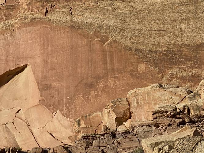
-
Capitol Reef Petroglyphs
38.287856, -111.239926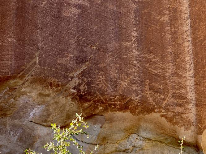
-
Capitol Reef Petroglyphs
38.28785, -111.240033
Hazards
Seasons
All
2 Trip Reports


Helpful Links
Find Hiking Trails Near Me:


Before you leave...
MyHikes is an indie web platform aimed to make exploring public trails easier for everyone. The site has no investors and is owned and operated by one person, Dave Miller (Founder & Admin). As the Founder, main contributor, and doer-of-all-things for MyHikes, I share my trips with over-detailed write-ups for fun on a volunteer basis and I believe that public trail information should be available to everyone.
It takes a lot of time 🕦, money 💰, and effort (including espresso shots ☕) to run MyHikes, including hiking , mapping , writing , and publishing new trails with high-quality content... along with building new features, moderating, site maintainance, and app development for iOS and Android . I simply ask that if you find MyHikes' trail guides helpful to please consider becoming a Supporter to help keep the site, iOS, and Android apps available to everyone.
Supporters unlock website and in-app perks with a one-time payment of $25 (you renew) 😎👍. Or you can simply make a Donation of your choice without a MyHikes user account. Otherwise, telling your friends about MyHikes is the next-best thing - both quick and free 🎉
Thanks for visiting MyHikes and have a great hike!️

Dave Miller
MyHikes Founder & Admin

