Butternut Road to Fire Pond
Distance:
0.4 Miles / 0.6 kmType:
One-WayDifficulty:
EasyTime to Hike:
~12 minutesFeatures:
Surface Type:
DirtLoading...
Loading...
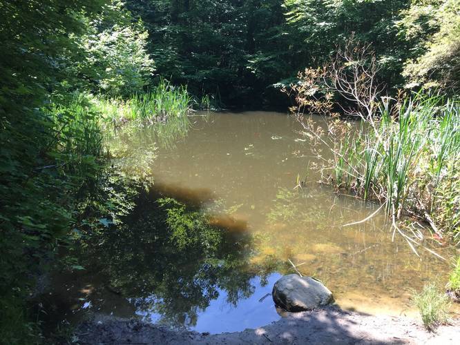
The Butternut Road to Fire Pond Trail at Peaked Mountain Park in Monson, Massachusetts is an easy 0.4-mile one-way trail that follows Butternut Road up to Fire Pond.
This short trail is connected at both ends to the Roslyn's Turnpike Trail, which is part of the Peaked Mountain Summit Loop Trail. The lower entrance to the trail is located just beyond the field by the parking lot and ends at the Fire Pond.
Parking: Parking can be found at the main lot at the coordinates provided. The lot is fairly large, but can fill up quickly by noon on weekends.
Pets: Dogs are allowed if leashed and their waste must be carried out.
Hazards
Seasons
AllBlaze Dot
1 Trip Report


Helpful Links
Find Hiking Trails Near Me:


Before you leave...
MyHikes is an indie web platform aimed to make exploring public trails easier for everyone. The site has no investors and is owned and operated by one person, Dave Miller (Founder & Admin). As the Founder, main contributor, and doer-of-all-things for MyHikes, I share my trips with over-detailed write-ups for fun on a volunteer basis and I believe that public trail information should be available to everyone.
It takes a lot of time 🕦, money 💰, and effort (including espresso shots ☕) to run MyHikes, including hiking , mapping , writing , and publishing new trails with high-quality content... along with building new features, moderating, site maintainance, and app development for iOS and Android . I simply ask that if you find MyHikes' trail guides helpful to please consider becoming a Supporter to help keep the site, iOS, and Android apps available to everyone.
Supporters unlock website and in-app perks with a one-time payment of $25 (you renew) 😎👍. Or you can simply make a Donation of your choice without a MyHikes user account. Otherwise, telling your friends about MyHikes is the next-best thing - both quick and free 🎉
Thanks for visiting MyHikes and have a great hike!️

Dave Miller
MyHikes Founder & Admin

