Boundary Trail and Summit Trail
Distance:
3.5 Miles / 5.6 kmType:
LoopDifficulty:
EasyTime to Hike:
1 hour, ~45 minutesFeatures:
Surface Type:
DirtLoading...
Loading...
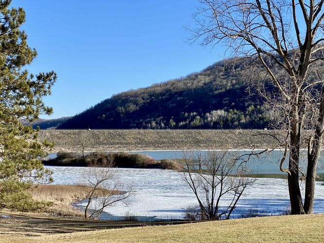
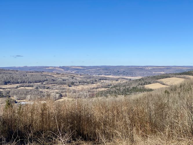
The Boundary Trail and Summit Trail at Oak Hill Conservation Land in Littleton, Massachusetts is an easy 3.5-mile loop hike that runs along Tophet Chasm and features a vista point.
Location: Oak Hill Tophet Chasm Littleton Conservation Land, Oak Hill Road, Littleton Massachusetts
Trail name(s): Summit Trail and Boundary Trail
Allowed activities: Picnicking, hiking, cross country skiing, snowshoeing, mountain biking, overnight camping with written permission from the Conservation Commission
Prohibited activities: No motorized vehicles, No fires, No hunting, No horseback riding, No defacement of plants, rocks, signs, walls, No littering, No cutting trees.
Hours: Oak Hill is open for activities from 30 minutes before dawn to 30 minutes after dusk.
Parking: There is limited street side and limited lot parking near the trailhead on Oak Hill Road. There is another parking area on Harvard Road with parking for 10 vehicles.
Pets: Dogs are allowed on the trails as long as they are leashed and waste is carried out with the hiker.
Accessibility: The trails are not wheelchair accessible. Hikers should have the ability to go up and down some hilly or uneven terrain. Trip hazards, such as roots, rocks, and mud are possible along every trail.
Sanitation: There are no restrooms or trash receptacles. Please carry out all trash.
Trail information: There is an information Kiosk near the parking area that has a map posted of the trails at Oak Hill. The trail blaze on Boundary trail is a Yellow rectangle. The blaze on the Summit Trail is a Red Rectangle. Hikers can print a map before heading out by going to the link below, downloading the pdf and printing the Oak Hill map found on page 58 of the trail guide.
https://littletonconservationtrust.org/Trail_Guide.pdf
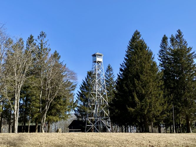
Length and features: This hike is an easy 3.5 mile trail that loops. This loop trail begins a short uphill distance from the main entrance. Hikers will need to follow the Summit Trail marked with red blaze rectangles for a short distance to reach the intersection of the Boundary Trail which has a yellow rectangle blaze. There are roughly 220 acres of land and seven miles of hiking trails available at Oak Hill. There is a water tower near the top of the hill and also a telecommunication tower next to the water tower. There are several fun, easy to find and well maintained geocaches within the property boundary.
In the middle to late spring, Oak hill has a stunning annual bloom of mountain laurel. There is a variety of woodland habitats here, producing lots of different kind’s ferns, mushrooms and fungi throughout the season. There are groves of Birch and Hemlock and of course Oak trees. Occasionally, Beech and Ash trees can also be found. Be on the lookout for the four erratic boulders that can be found on the trail, as their location and size are always a surprise.
The Boundary trail is one of the longest in the Reservation. Several of the trails at Oak Hill connect to each other thus affording visitors the opportunity to create multiple combinations of hikes that can be enjoyed as either “looping” or “out and back“ hikes. Oak Hill Conservation Land is tucked within a charming residential setting, and on several sections of the trail, private homes closely border the Boundary Trail. Please be respectful of personal property as some of the homes are very close, one lovely home features a fun gargoyle that keeps a close eye on passersby.
The trail travels along the edge of Tophet Chasm, which has some narrow sections that are very close to the edge of the chasm. There are the typical forests footing hazards to be aware of. Pay attention to your steps along the Chasm section of the trail, especially if you are visiting during spring or winter when the trail can be slippery. Ironically, the word “Tophet” is an old term meaning “hell” or “place of fire”; however the chasm was formed by the forces of water and ice. Tophet Chasm is result of an ancient glacial event that caused rushing waters to carve out this beautiful ravine. Geologists have reported that there was once an active waterfall here that rivaled the height of Niagara Falls. Sadly there is no longer a waterfall in this area, but there is Tophet Swamp. Visitors who wish to take the rocky steep trail down into the chasm will be able to view the rocky cliff walls, search for a geocache, find mushrooms or just admire the flora and fauna found there. The side trip to the chasm swamp is a delightful detour. Passing Tophet Chasm, the trail follows along an old stage coach road. Back in the early 1800’s there were two stagecoach lines that crossed Oak Hill. Evidence of the former coach activity can been seen in the grooves in boulders and ledges that show the marks left by the repeated rubbing of the carriage wheels, worn down over time.
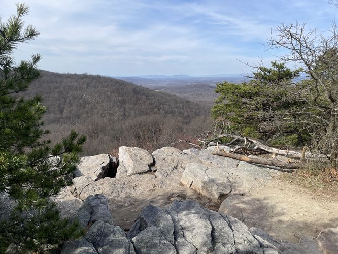
The Boundary trial continues along the outside of Oak Hill perimeter to Lookout Rock. Lookout Rock is a 475 feet high rock that gives visitors an awesome view towards the south and southeast. On a clear day visitors can see the John Hancock and Prudential Tower buildings in Boston on the distant horizon. Lookout Rock is a great spot to pause, take seat, enjoy the view and rest before heading back down the trail following the red and yellow blaze markers to the junction of the Summit Trail and Boundary trail. To stay on the Boundary Trail, follow the yellow blaze markers back to the gravel section of the trail where the Summit and Boundary Trails intersect again, at this intersection head down hill on the Summit trail with red markers to the parking area on Oak Hill Road.
Explore 45 trails near Littleton, MAHazards
Seasons
AllBlaze Color
Blaze Dot
1 Trip Report
Before you leave...
MyHikes is an indie web platform aimed to make exploring public trails easier for everyone. The site has no investors and is owned and operated by one person, Dave Miller (Founder & Admin). As the Founder, main contributor, and doer-of-all-things for MyHikes, I share my trips with over-detailed write-ups for fun on a volunteer basis and I believe that public trail information should be available to everyone.
It takes a lot of time 🕦, money 💰, and effort (including espresso shots ☕) to run MyHikes, including hiking , mapping , writing , and publishing new trails with high-quality content... along with building new features, moderating, site maintainance, and app development for iOS and Android . I simply ask that if you find MyHikes' trail guides helpful to please consider becoming a Supporter to help keep the site, iOS, and Android apps available to everyone.
Supporters unlock website and in-app perks with a one-time payment of $25 (you renew) 😎👍. Or you can simply make a Donation of your choice without a MyHikes user account. Otherwise, telling your friends about MyHikes is the next-best thing - both quick and free 🎉
Thanks for visiting MyHikes and have a great hike!️
Dave Miller
MyHikes Founder & Admin


