Blackrock Summit
Distance:
1.2 Miles / 1.9 kmType:
LoopDifficulty:
ModerateTime to Hike:
~36 minutesFeatures:
Surface Type:
DirtLoading...
Loading...
The Blackrock Summit Trail at Shenandoah National Park in Crozet, Virginia is an easy 1.2 mile loop hike that leads out to Blackrock Summit and features stunning views of the Shenandoah mountain range.
The trail starts off along the Appalachian Trail (white blazes) to the summit, which is only about 0.5 - 0.6 miles one-way. The summit gives you an almost-360 degree view of the southern Shenandoah area and a large rock scramble to climb if you want to take in panoramic views.
Continue on the trail and take a left at the sign post just beyond the summit area to return to the parking lot. The final hike out follows the blue blaze trail (Trayfoot Mountain Trail).
Pets
Dogs are allowed if leashed and their waste must be carried out by the hiker.
Camping
Camping is allowed on this trail - there were small areas along the Appalachian Trail along this route where thru-hikers can setup camp.
Difficulty
This hike should be considered easy to moderate, at worst.
-
Parking
38.222576, -78.733135 -
Main Trailhead
38.222962, -78.733375 -
View / Overlook / Vista
38.220062, -78.739942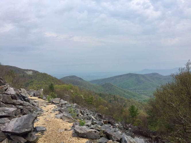
-
View / Overlook / Vista
38.220174, -78.740074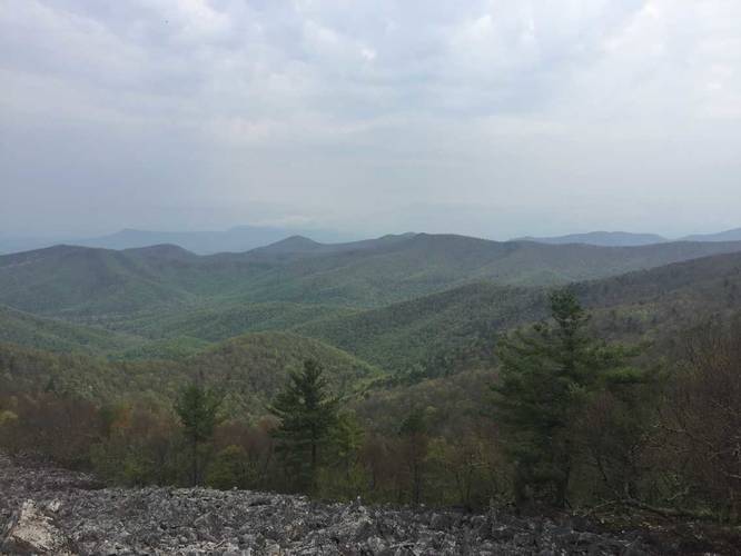
-
View from the top of Blackrock Summit
38.219836, -78.740247
-
Left-hand turn leads back to parking
38.21932, -78.739422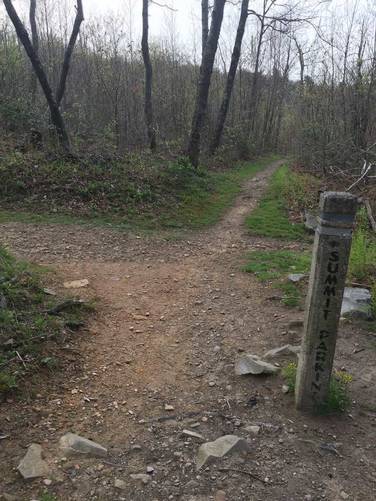
Hazards
Season
SpringBlaze Color
2 Trip Reports


Helpful Links
Find Hiking Trails Near Me:


")
Before you leave...
MyHikes is an indie web platform aimed to make exploring public trails easier for everyone. The site has no investors and is owned and operated by one person, Dave Miller (Founder & Admin). As the Founder, main contributor, and doer-of-all-things for MyHikes, I share my trips with over-detailed write-ups for fun on a volunteer basis and I believe that public trail information should be available to everyone.
It takes a lot of time 🕦, money 💰, and effort (including espresso shots ☕) to run MyHikes, including hiking , mapping , writing , and publishing new trails with high-quality content... along with building new features, moderating, site maintainance, and app development for iOS and Android . I simply ask that if you find MyHikes' trail guides helpful to please consider becoming a Supporter to help keep the site, iOS, and Android apps available to everyone.
Supporters unlock website and in-app perks with a one-time payment of $25 (you renew) 😎👍. Or you can simply make a Donation of your choice without a MyHikes user account. Otherwise, telling your friends about MyHikes is the next-best thing - both quick and free 🎉
Thanks for visiting MyHikes and have a great hike!️

Dave Miller
MyHikes Founder & Admin

