Black Pot & Hanalei Beach
Distance:
0.7 Miles / 1.1 kmType:
Out-and-BackDifficulty:
EasyTime to Hike:
~21 minutesFeatures:
Surface Type:
DirtLoading...
Loading...
Black Pot & Hanalei Beach in Hanalei, Hawaii (Kauai) is an easy 0.7-mile out-and-back beach access walk that leads to both Black Pot Beach and Hanalei Beach and features stunning views of Hanalei Bay and its surrounding mountain ranges.
This is not a hike, but rather a beach walk that follows the shoreline for approximately 0.35-miles one-way. Hikers, visitors, and beach-goers can setup shop on the beach to chill out or swim or choose to walk the lengthy Hanalei Beach, which can be several miles out-and-back if you wish. Views from Black Pot and Hanalei Beaches include docked boats in the bay, the surrounding mountain ranges with lush rainforests, a massive 2,800-foot waterfall that cascades down one of these mountains, and usually some paddleboarders cruising around the bay.
Parking
Visitors will find parking at the Black Pot Beach Park
parking lot at the coordinates provided. There are two main lots which
both hold a couple dozen vehicles each; however, parking fills up
quickly, so show up early to claim a spot. There are other parking lots for Hanalei Beach which can be found along Weke Rd in Hanalei.
Respecting the Land
Hawaiian land is considered sacred to native Hawaiians and many locals, so please stay on-trail, take nothing but photos, and leave nothing but footprints. Respect the locals - don't stay for long and have a backup hike planned in case the parking lot is full.
Seasons
All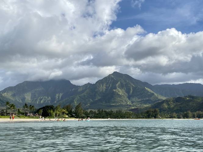
2 Trip Reports


Helpful Links
Find Hiking Trails Near Me:


Before you leave...
MyHikes is an indie web platform aimed to make exploring public trails easier for everyone. The site has no investors and is owned and operated by one person, Dave Miller (Founder & Admin). As the Founder, main contributor, and doer-of-all-things for MyHikes, I share my trips with over-detailed write-ups for fun on a volunteer basis and I believe that public trail information should be available to everyone.
It takes a lot of time 🕦, money 💰, and effort (including espresso shots ☕) to run MyHikes, including hiking , mapping , writing , and publishing new trails with high-quality content... along with building new features, moderating, site maintainance, and app development for iOS and Android . I simply ask that if you find MyHikes' trail guides helpful to please consider becoming a Supporter to help keep the site, iOS, and Android apps available to everyone.
Supporters unlock website and in-app perks with a one-time payment of $25 (you renew) 😎👍. Or you can simply make a Donation of your choice without a MyHikes user account. Otherwise, telling your friends about MyHikes is the next-best thing - both quick and free 🎉
Thanks for visiting MyHikes and have a great hike!️

Dave Miller
MyHikes Founder & Admin

