Black Forest Trail - Southwest Loop
Distance:
10.7 Miles / 17.2 kmType:
LoopDifficulty:
EasyTime to Hike:
5 hours, ~21 minutesFeatures:
Surface Type:
DirtLoading...
Loading...
The Black Forest Trail - Southwest Loop at Tiadaghton State Forest near Slate Run, Pennsylvania is an easy 10.7-mile loop hike that follows part of the Black Forest Trail (BFT) in the southwestern corner of the BFT trail system. This hike features beautiful views facing southwest and west along the BFT as well as an overlook near the parking area along the Old Grade Trail. This hike is also a great short backpacking loop for those who want to experience an easier section of the Black Forest Trail (BFT) without committing to the entire 42-mile loop.
Trails
This hike follows several named trails: Black Forest Trail, Blackberry Trail, George Will Ski Trail, Laurel Path, Old Grade Trail.
Trail Description
Hikers and backpackers will begin at the parking lot near the coordinates provided. The trail here is a bit tricky to find since the blazes, as of September 2020, were not visible from the parking area. Across the street, hikers will notice a small numbered sign that leads into a private camp; however, the Black Forest Trail trailhead can be found just to the left of this grassy driveway. The Black Forest Trail runs for about 30 feet before following this driveway for about 300-feet. At the junction, take a right-hand turn to continue along the BFT instead of hiking into this private camp.
After passing the private camp, hikers will start to head downhill into a hollow that leads to the Baldwin Branch creek. Near the bottom of the steepest section, a campsite can be found around mile 0.86.
After passing the first campsite, hikers will slowly make their way back uphill, but not before passing a second campsite around mile 1.1. There's not much to note on the way back uphill, but this section of trail has an easy elevation grade as it ascends.
Around mile 1.85, hikers will pass the South Link Trail which appears to be an overgrown bushwhack of a trail. Not long after passing the South Link Trail, the Black Forest Trail will dip downhill about 10 feet to a stone shelter around mile 2.4. This stone shelter (which is my best guess) looks like an old CCC furnace that appears to be used as a backpacking shelter to get out of the rain. The inside of this shelter is all dirt and is not a comfortable-looking place to sleep unless it's down-pouring outside.
After passing the shelter, hikers will pass several more campsites along the trail. After passing these campsites, the trail will reach the top of the mountain and run mostly-flat for quite a while as it passes several other connecting trails like the George B Will Ski Trail.
1st Vista / Overlook
Around mile 3.9, hikers will reach the first overlook in this loop hike. The views face mostly south. There's not much to note here except the communications tower on the mountain directly across the way. While this tower exists, cell reception (Verizon) is still extremely limited here.
Continuing onward, hikers will pass several more open areas with views and a less-than-ideal campsite around mile 4.15. These views are not labeled on the state forest map, but they're still nice to stop for.
2nd Vista / Overlook
Around mile 5.1, hikers will reach the second vista, which is the better of the two overlooks. This view faces mostly west and southwest. The mountain range slopes down toward creek beds facing southwest, which gives the best views.
From here, hikers will descend slightly as the trail heads toward a main campsite which is often full. This campsite is located around mile 6 and is labeled on the state forest map, which means this site has more expecting campers. For backpackers, it's good to note this in order to plan to sleep at one of the earlier campsites. After passing this campsite, it's several miles to reach the next one along the BFT.
After passing the next campsite, the trail heads uphill gradually again as it leads out to open space along the mountain top. From here, the hike follows the BFT for only a short bit longer before turning off. Just before reaching the Blackberry Trail to turn off of the BFT, hikers will pass through a beautiful open field and swamp area (off to the side) that's worth noting - this is around mile 6.6.
Turn to Blackberry Trail
Around mile 6.9, hikers will reach the Blackberry Trail - where this track leaves the Black Forest Trail and heads toward the parking area along less-populated trails. Hikers will follow the Blackberry Trail almost all the way to PA Route 44. Just before the highway, approximately 200-feet before the road, the Blackberry Trail will reach another junction with the George B Will Trail. Here, take a right-hand turn to head south.
Hikers will follow the George B Will Trail for 0.5-miles before the trail reaches PA Route 44. Here, hike across the street and stay to the left of the road across the street. Hikers should be able to find the blue blazes for the George B Will Trail to the left of the dirt road off of PA Route 44. Follow the blue blazes along this trail for about 1.4-miles until the trail heads west to reach PA Route 44 once again. Here, take a left-hand turn at the Laurel Path Trail to continue south.
Once the Laurel Path Trail ends, the next trail is the Old Grade Trail located across from the terminus trailhead for the Laurel Path Trail. Follow the Old Grade Trail for about 0.6-miles to reach the parking lot and to wrap up the hike.
Difficulty
This trail is rated as "easy" since the elevation gain, despite being over 1,000-feet, is spread over the course of almost 11 miles. The elevation grade is easy and even inexperienced hikers or backpackers would likely not rate it any more difficult than "moderate" at worst.
Parking
Hikers will find parking at the coordinates provided. The lot is large enough to fit about 10 vehicles.
Pets
Dogs are allowed if leashed.
Camping and Backpacking
Backpackers will find plenty of smaller campsites along this trail. All backpackers must follow the state forest primitive / dispersed / backcountry camping rules and regulations.
Water Sources
On this exact route, the only water source is the tributary that leads into Baldwin Branch creek. Additionally Baldwin Branch has water, but the trail does not run directly next to Baldwin Branch. Water usually flows regularly here in the Spring up until mid-June when the water tends to dry up.
Blaze Colors
Black Forest Trail follows orange blazes. Blackberry Trail follows yellow blazes. George B Will Ski Trail follows blue blazes. Laurel Path Trail and Old Grade Trail follow yellow blazes.
Foliage
During Autumn, this trail has amazing foliage despite the popularity. Here is a 360-pano foliage picture from the trail.
Rattlesnake Warning
Timber Rattlesnakes are a popular sight along the Black Forest Trail, especially between April and the end of September. During this trip (Sept 25, 2020) we found one rattlensake in the brush along the trail because the weather had been warmer than usual for several days. The rattlesnake was found close to the 1st vista, which is not surprising since rattlesnakes will sun themselves at rocky overlooks.
-
Parking
41.46173, -77.57241 -
Main Trailhead
41.461685, -77.572532 -
Campsite
41.459769, -77.586769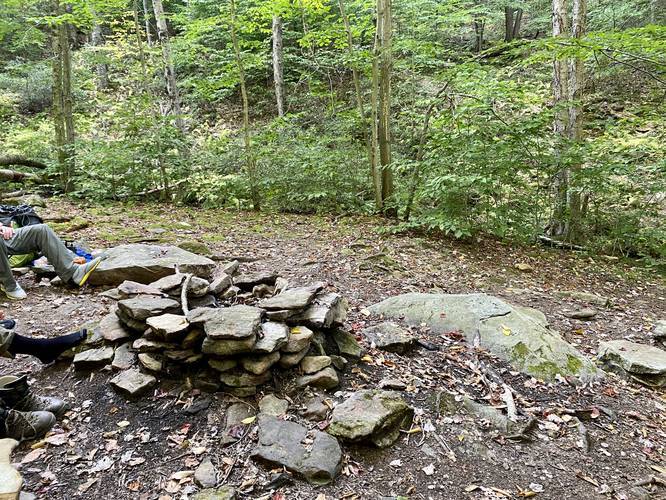
-
Campsite
41.462558, -77.586844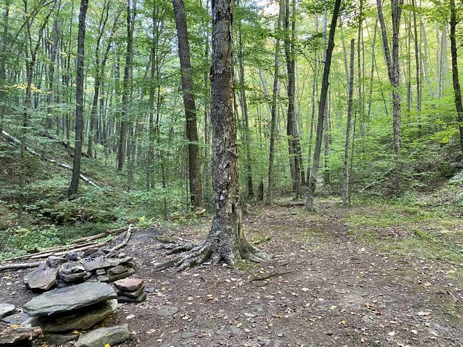
-
South Link Trail junction
41.468661, -77.582161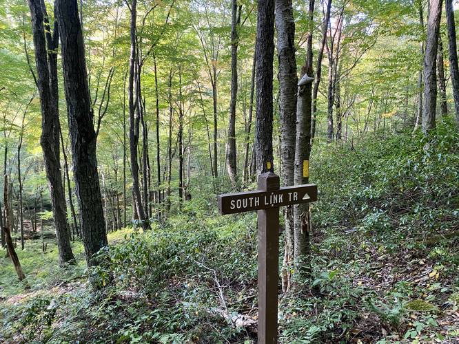
-
Stone shelter camp
41.473025, -77.575264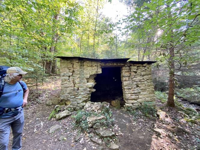
-
Campsite
41.475303, -77.574317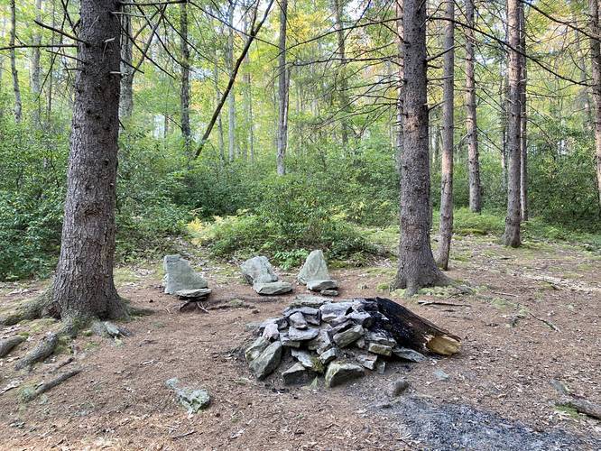
-
Campsite
41.475594, -77.573958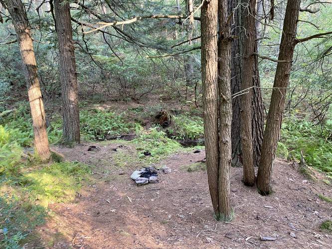
-
1st vista / overlook
41.469617, -77.592247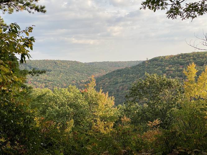
-
Iffy campsite
41.471594, -77.5943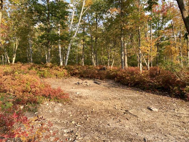
-
Campsite
41.475206, -77.604361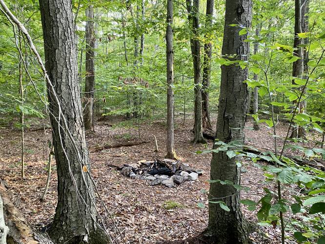
-
2nd vista / overlook
41.475242, -77.605858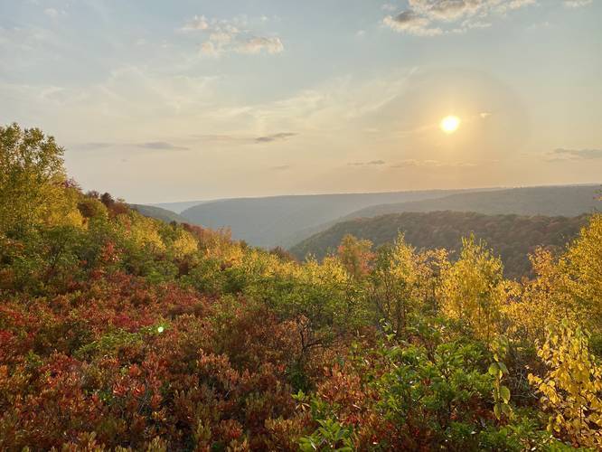
-
Obstructed view with foliage
41.475903, -77.605331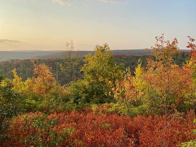
-
Campsite
41.484528, -77.599486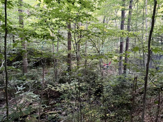
-
Beautiful open field with swamp area
41.487839, -77.595336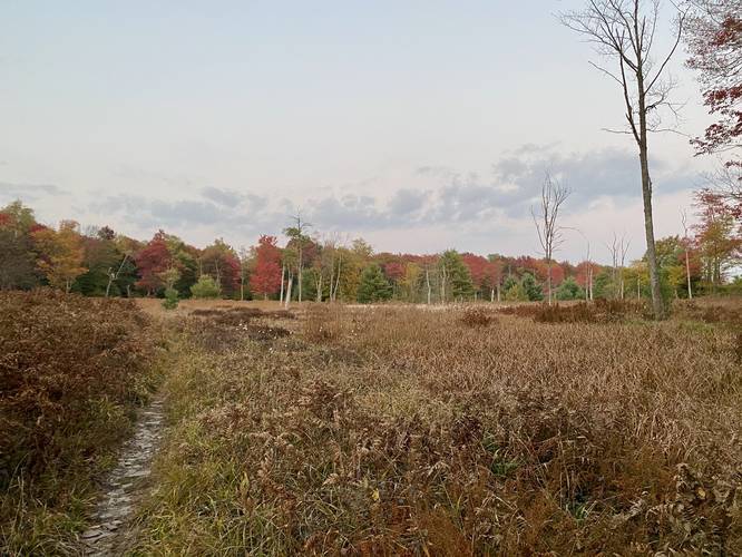
-
Turn at Blackberry Trail junction
41.489569, -77.593156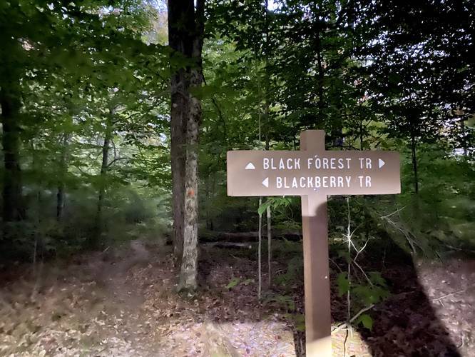
-
Straight east on George B Will Trail
41.490367, -77.586036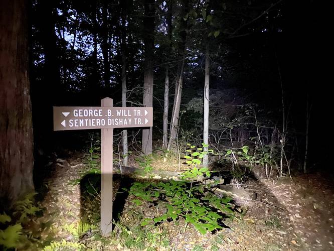
-
Turn on Old Grade Trail
41.468706, -77.565369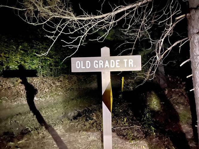
-
Old Grade Trail vista
41.463678, -77.568292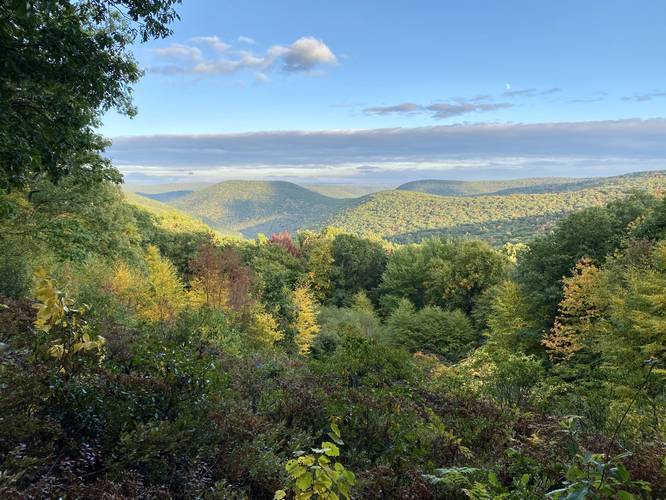
-
Laurel Path trail turn
41.473136, -77.566864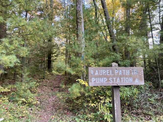
Hazards
Seasons
AllBlaze Color
2 Trip Reports


Helpful Links
Find Hiking Trails Near Me:


Before you leave...
MyHikes is an indie web platform aimed to make exploring public trails easier for everyone. The site has no investors and is owned and operated by one person, Dave Miller (Founder & Admin). As the Founder, main contributor, and doer-of-all-things for MyHikes, I share my trips with over-detailed write-ups for fun on a volunteer basis and I believe that public trail information should be available to everyone.
It takes a lot of time 🕦, money 💰, and effort (including espresso shots ☕) to run MyHikes, including hiking , mapping , writing , and publishing new trails with high-quality content... along with building new features, moderating, site maintainance, and app development for iOS and Android . I simply ask that if you find MyHikes' trail guides helpful to please consider becoming a Supporter to help keep the site, iOS, and Android apps available to everyone.
Supporters unlock website and in-app perks with a one-time payment of $25 (you renew) 😎👍. Or you can simply make a Donation of your choice without a MyHikes user account. Otherwise, telling your friends about MyHikes is the next-best thing - both quick and free 🎉
Thanks for visiting MyHikes and have a great hike!️

Dave Miller
MyHikes Founder & Admin

