Beaver Haven Nature Trail
Distance:
1.4 Miles / 2.3 kmType:
LoopDifficulty:
EasyTime to Hike:
~42 minutesFeatures:
Surface Type:
DirtLoading...
Loading...
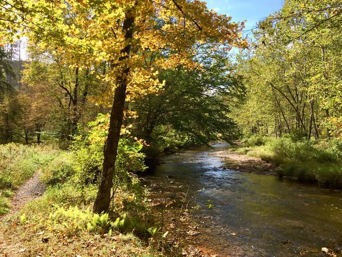
The Beaver Haven Nature Trail at Ole Bull State Park in Cross Fork, Pennsylvania is an easy 1.4-mile loop trail that features beautiful views of Kettle Creek.
This recording begins at the northern-most terminus near the Ole Bull memorial and follows the trail counter-clockwise, following Kettle Creek first. The trail is well-maintained and follows the yellow/blue blazes for almost the entire hike.
The section of trail that runs adjacent to Kettle Creek is easy to follow. Hikers will find a few access trails that lead onto the main path, but if you keep hiking along the water, you'll find your way. Eventually, the trail will cross a wooden bridge where Kettle Creek heads off at a 45-degree angle from the trail - here, the park map shows the trail taking a left-hand turn to complete the loop; however, it seems the park no longer maintains this section. Hikers should continue along the yellow/blue blazes, into the evergreen grove, where the trail will continue the loop. This section of the hike is referred to, on the park's trail map, as the "extension" section of the trail.
While hiking through this evergreen grove, be on the lookout for snapping turtles. We were able to find two large snapping turtles along the trail, in late September.
After hiking through the evergreen grove, the trail will head towards PA Route-144 before making a left-hand turn to head north and back towards parking. This section of the hike is a bit confusing as there are multiple options for hikers to go with no clear path to where the trail leads. The main idea is to follow the blue/yellow blazes until you reach the campground - hikers will find tents and RVs setup.
At the campground, hike along the western side of the campground road until you reach the entry-way for the campground. Hikers should continue walking along the woods, until they reach the parking lot and nothern trailhead where the hike began. Please note that there are no blaze markers between the campground and the trailhead, so the trail can be a bit confusing in this section.
Parking
Hikers can find parking at the coordinates provided - next to the bridge that crosses Kettle Creek.
Biking
Mountain biking is permitted along the entire trail.
Pets
Dogs are allowed if leashed and their waste must be carried out by the hiker.
Fishing
This trail is popular for fishing and there are plenty of points along the trail that fishermen can use to access Kettle Creek.
Blaze Colors
This trail follows a blue and yellow blaze marker.
Hazards
Seasons
AllBlaze Color
Blaze Dot
2 Trip Reports


Helpful Links
Find Hiking Trails Near Me:


Before you leave...
MyHikes is an indie web platform aimed to make exploring public trails easier for everyone. The site has no investors and is owned and operated by one person, Dave Miller (Founder & Admin). As the Founder, main contributor, and doer-of-all-things for MyHikes, I share my trips with over-detailed write-ups for fun on a volunteer basis and I believe that public trail information should be available to everyone.
It takes a lot of time 🕦, money 💰, and effort (including espresso shots ☕) to run MyHikes, including hiking , mapping , writing , and publishing new trails with high-quality content... along with building new features, moderating, site maintainance, and app development for iOS and Android . I simply ask that if you find MyHikes' trail guides helpful to please consider becoming a Supporter to help keep the site, iOS, and Android apps available to everyone.
Supporters unlock website and in-app perks with a one-time payment of $25 (you renew) 😎👍. Or you can simply make a Donation of your choice without a MyHikes user account. Otherwise, telling your friends about MyHikes is the next-best thing - both quick and free 🎉
Thanks for visiting MyHikes and have a great hike!️

Dave Miller
MyHikes Founder & Admin

