Beall Connector Trail
Distance:
0.2 Miles / 0.3 kmType:
One-WayDifficulty:
EasyTime to Hike:
~6 minutesFeatures:
Surface Type:
DirtLoading...
Loading...
The Beall Connector Trail at Canaan Valley National Wildlife Refuge in Cortland, West Virginia is an easy 0.2 mile one-way trail that bisects the Beall Loop Trail. This trail can be used to hike back to the parking lot from the Beall Loop Trail to Blackwater View Trail.
The trail is mostly flat, but has nice views of the open fields of Canaan Valley. Some parts of the trail have views of the surrounding West Virginian hills as well.
Biking is not allowed on this trail. Dogs are allowed on this trail.
Hazards
Seasons
All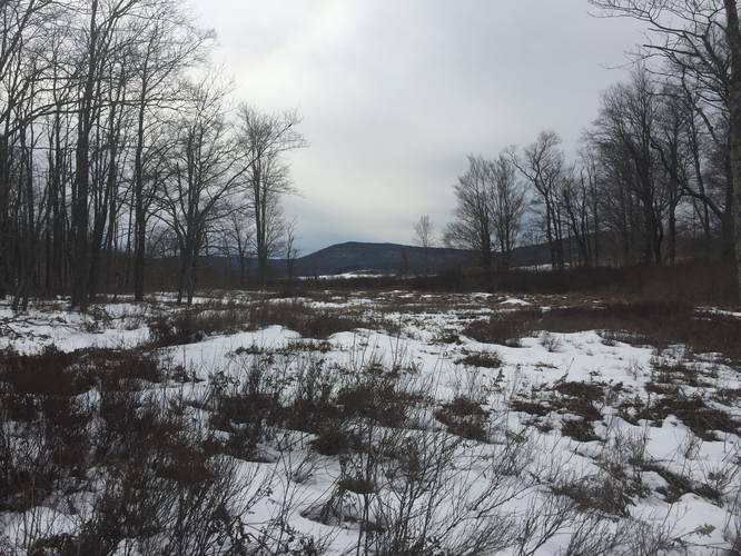
2 Trip Reports


Helpful Links
Find Hiking Trails Near Me:


Before you leave...
MyHikes is an indie web platform aimed to make exploring public trails easier for everyone. The site has no investors and is owned and operated by one person, Dave Miller (Founder & Admin). As the Founder, main contributor, and doer-of-all-things for MyHikes, I share my trips with over-detailed write-ups for fun on a volunteer basis and I believe that public trail information should be available to everyone.
It takes a lot of time 🕦, money 💰, and effort (including espresso shots ☕) to run MyHikes, including hiking , mapping , writing , and publishing new trails with high-quality content... along with building new features, moderating, site maintainance, and app development for iOS and Android . I simply ask that if you find MyHikes' trail guides helpful to please consider becoming a Supporter to help keep the site, iOS, and Android apps available to everyone.
Supporters unlock website and in-app perks with a one-time payment of $25 (you renew) 😎👍. Or you can simply make a Donation of your choice without a MyHikes user account. Otherwise, telling your friends about MyHikes is the next-best thing - both quick and free 🎉
Thanks for visiting MyHikes and have a great hike!️

Dave Miller
MyHikes Founder & Admin

