Bark Shanty CCC Camp Trail
Distance:
1.4 Miles / 2.3 kmType:
Out-and-BackDifficulty:
EasyTime to Hike:
~42 minutesFeatures:
Surface Type:
DirtLoading...
Loading...
This Bark Shanty CCC camp trail spurs off of the Jacob Run and Stuckey Hollow Loop Trail that begins and ends next to the Austin Dam Memorial Park. This spur trail lies within Susquehannock State Forest and is an easy 2.2-mile out-and-back hike.
This trail descends and ascends approximately 200' on the Gas Well road to the location of the Bark Shanty CCC Camp near the intersection of Gas Well Road and Bark Shanty Road, where only the concrete
foundation ruins of the Bark Shanty CCC camp remain today. S-146, Bark Shanty, PA was established in July of 1935. The
camp closed near the end of 1941. Work projects completed by the company include the
Gas Well Road, leading from the lower boundaries of the camp site westward to
the hard-surface highway 607 connecting Austin and Keating Summit, and Jones Run, a road
leading from the upper part of the camp site eastward to highway 872; and Bark Shanty (formally known as Trout Run), a connection
between Pennsylvania highways 872 and 607 was also serviced by
this camp.
Trails
This track follows a mix of forest trails and state forest roads. Hikers can explore around the old Bark Shanty CCC Camp location using the short forest trails at that location or use the Gas Well Road to connect to additional hiking trails. The Gas Well Road was constructed during the Great Depression by the Civilian Conservation Corps.
Private Land
The Bark Shanty CCC camp location adjoins private land to the east. Please respect the land owners and stay on the trails within the state forest lands at all times.
Parking
Hikers can find parking at the coordinates provided, next to the trailhead, along Gas Well Road and Bark Shanty Road.
Pets
Dogs are allowed if leashed.
-
Parking
41.684023, -78.113779 -
Main Trailhead
41.677745, -78.112816 -
Bark Shanty CCC Camp Foundation
41.684483, -78.111463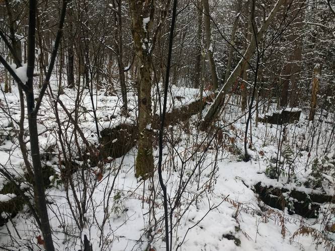
-
Old Dynamite Shed
41.678954, -78.111602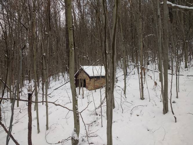
-
View Trail Map
Hiker: OliverPhineasHiked on: February 13, 2023Distance: 2.3 miles / 3.7 km
Hazards
Seasons
All
2 Trip Reports


Before you leave...
MyHikes is an indie web platform aimed to make exploring public trails easier for everyone. The site has no investors and is owned and operated by one person, Dave Miller (Founder & Admin). As the Founder, main contributor, and doer-of-all-things for MyHikes, I share my trips with over-detailed write-ups for fun on a volunteer basis and I believe that public trail information should be available to everyone.
It takes a lot of time 🕦, money 💰, and effort (including espresso shots ☕) to run MyHikes, including hiking , mapping , writing , and publishing new trails with high-quality content... along with building new features, moderating, site maintainance, and app development for iOS and Android . I simply ask that if you find MyHikes' trail guides helpful to please consider becoming a Supporter to help keep the site, iOS, and Android apps available to everyone.
Supporters unlock website and in-app perks with a one-time payment of $25 (you renew) 😎👍. Or you can simply make a Donation of your choice without a MyHikes user account. Otherwise, telling your friends about MyHikes is the next-best thing - both quick and free 🎉
Thanks for visiting MyHikes and have a great hike!️

Dave Miller
MyHikes Founder & Admin

