Almond Lake Overlook
Distance:
0.1 Miles / 0.2 kmType:
Out-and-BackDifficulty:
EasyTime to Hike:
~5 minutesFeatures:
Surface Type:
DirtLoading...
Loading...
The Almond Lake Overlook at Kanakadea Park in Hornell, New York is an easy 0.1-mile out-and-back walk that leads to an observation deck on the banks of Almond Lake.
This is not a hike but rather a very short walk from the parking area out to the observation deck. From the overlook, visitors will find scenic views of Almond Lake, the Almond Lake Dam, and surrounding hills like Bald Hill to the North and the hills that define Canacadea State Forest (i.e. the Almond-Hornell Overlook), located to the South.
Parking
Visitors will find a very-large parking lot near the coordinates provided, located on the eastern end of the park.
Pets
Dogs are allowed if leashed and must be cleaned up after.
-
Parking
42.349781, -77.71041 -
Main Trailhead
42.3495, -77.710324 -
View of Almond Lake
42.349097, -77.710044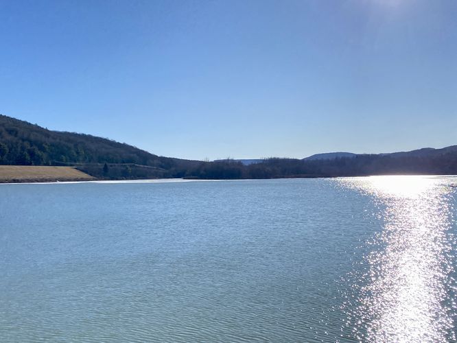
-
View of the Almond Lake Dam
42.349097, -77.710031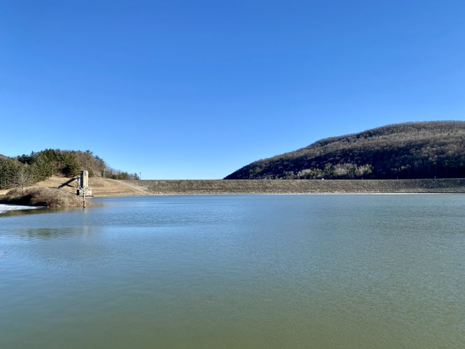
-
View of Bald Hill and Almond Lake
42.349247, -77.710197
Hazards
Seasons
All
2 Trip Reports


Before you leave...
MyHikes is an indie web platform aimed to make exploring public trails easier for everyone. The site has no investors and is owned and operated by one person, Dave Miller (Founder & Admin). As the Founder, main contributor, and doer-of-all-things for MyHikes, I share my trips with over-detailed write-ups for fun on a volunteer basis and I believe that public trail information should be available to everyone.
It takes a lot of time 🕦, money 💰, and effort (including espresso shots ☕) to run MyHikes, including hiking , mapping , writing , and publishing new trails with high-quality content... along with building new features, moderating, site maintainance, and app development for iOS and Android . I simply ask that if you find MyHikes' trail guides helpful to please consider becoming a Supporter to help keep the site, iOS, and Android apps available to everyone.
Supporters unlock website and in-app perks with a one-time payment of $25 (you renew) 😎👍. Or you can simply make a Donation of your choice without a MyHikes user account. Otherwise, telling your friends about MyHikes is the next-best thing - both quick and free 🎉
Thanks for visiting MyHikes and have a great hike!️

Dave Miller
MyHikes Founder & Admin

