Aldrich Lake Loop Trail
Distance:
1.3 Miles / 2.1 kmType:
LoopDifficulty:
EasyTime to Hike:
~39 minutesFeatures:
Surface Type:
DirtLoading...
Loading...
The Aldrich Lake Loop Trail at Mount Holyoke Range State Park in Granby, Massachusetts is an easy 1.3 mile loop trail that runs around Aldrich Lake. Parking is available on Amherst st along the road by the trail head. This trail has more side trails down to the water and in different directions than I could count. The trail is wide and well maintained. It ends on Aldrich St by an old Mill, you can turn back here or continue along a road that does not seem to have much traffic at all. The mill is a hidden gem with some great views of the dam falls and the river. Follow Aldrich St back to Amherst St to complete the loop. Amherst St is very popular but its a very short walk back to the parking area.
Explore 204 trails near Granby, MAHazards
Seasons
All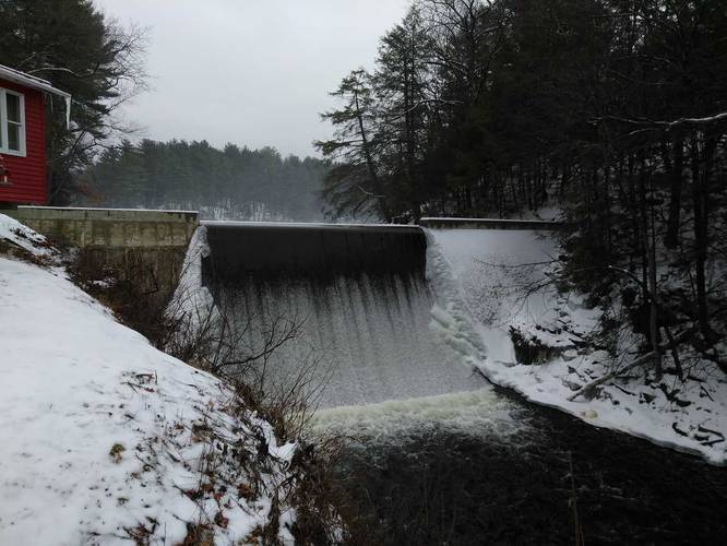
1 Trip Report


Helpful Links
Find Hiking Trails Near Me:


Before you leave...
MyHikes is an indie web platform aimed to make exploring public trails easier for everyone. The site has no investors and is owned and operated by one person, Dave Miller (Founder & Admin). As the Founder, main contributor, and doer-of-all-things for MyHikes, I share my trips with over-detailed write-ups for fun on a volunteer basis and I believe that public trail information should be available to everyone.
It takes a lot of time 🕦, money 💰, and effort (including espresso shots ☕) to run MyHikes, including hiking , mapping , writing , and publishing new trails with high-quality content... along with building new features, moderating, site maintainance, and app development for iOS and Android . I simply ask that if you find MyHikes' trail guides helpful to please consider becoming a Supporter to help keep the site, iOS, and Android apps available to everyone.
Supporters unlock website and in-app perks with a one-time payment of $25 (you renew) 😎👍. Or you can simply make a Donation of your choice without a MyHikes user account. Otherwise, telling your friends about MyHikes is the next-best thing - both quick and free 🎉
Thanks for visiting MyHikes and have a great hike!️

Dave Miller
MyHikes Founder & Admin

